 |
|
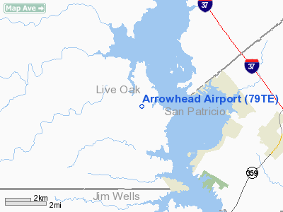
Location & QuickFacts
| FAA Information Effective: | 2008-09-25 |
| Airport Identifier: | 79TE |
| Airport Status: | Operational |
| Longitude/Latitude: | 097-55-51.0020W/28-06-56.0370N
-97.930834/28.115566 (Estimated) |
| Elevation: | 165 ft / 50.29 m (Estimated) |
| Land: | 19 acres |
| From nearest city: | 0 nautical miles S of Lagarto, TX |
| Location: | Live Oak County, TX |
| Magnetic Variation: | 07E (1985) |
Owner & Manager
| Ownership: | Privately owned |
| Owner: | Lakaero Vista Corp |
| Address: | 520 Ranger Dr
Sandia, TX 78383 |
| Phone number: | 361-547-0306 |
| Manager: | Mike Purdy/mollie Barton |
| Address: | 520 Ranger Dr
Sandia, TX 78383 |
| Phone number: | 361-547-0306 |
Airport Operations and Facilities
| Airport Use: | Private |
| Wind indicator: | Yes |
| Segmented Circle: | Yes |
| Control Tower: | No |
| Lighting Schedule: | RDO-CTL
ACTVT LIRL RY 13/31 - 122.85. |
| Landing fee charge: | No |
| Sectional chart: | San Antonio |
| Region: | ASW - Southwest |
| Boundary ARTCC: | ZHU - Houston |
| Tie-in FSS: | SJT - San Angelo |
| FSS on Airport: | No |
| FSS Toll Free: | 1-800-WX-BRIEF |
Airport Services
| Airframe Repair: | NONE |
| Power Plant Repair: | NONE |
Runway Information
Runway 13/31
| Dimension: | 3400 x 100 ft / 1036.3 x 30.5 m |
| Surface: | TURF, Good Condition |
| Edge Lights: | Low |
| |
Runway 13 |
Runway 31 |
| Traffic Pattern: | Right | Left |
| Obstruction: | 15 ft pline, 160.0 ft from runway, 125 ft left of centerline, 10:1 slope to clear | 15 ft road, 40.0 ft from runway, 4:1 slope to clear |
|
Radio Navigation Aids
| ID |
Type |
Name |
Ch |
Freq |
Var |
Dist |
| BEA | NDB | Beeville | | 284.00 | 07E | 16.8 nm |
| TKB | NDB | Kleberg County | | 347.00 | 06E | 31.7 nm |
| MNO | NDB | Mellon Ranch | | 375.00 | 06E | 39.7 nm |
| RKP | NDB | Rockport | | 391.00 | 06E | 46.9 nm |
| NOG | TACAN | Orange Grove | 063X | | 09E | 14.5 nm |
| NQI | TACAN | Kingsville | 125X | | 09E | 37.6 nm |
| ALI | VOR | Alice | | 114.50 | 06E | 23.1 nm |
| THX | VORTAC | Three Rivers | 051X | 111.40 | 08E | 26.1 nm |
| CRP | VORTAC | Corpus Christi | 102X | 115.50 | 09E | 28.8 nm |
| NGP | VORTAC | Truax | 087X | 114.00 | 06E | 42.5 nm |
Remarks
- TREES & BLDG PENT PRIM SFC & TRSN ZONE.
Images and information placed above are from
http://www.airport-data.com/airport/79TE/
We thank them for the data!
| General Info
|
| Country |
United States
|
| State |
TEXAS
|
| FAA ID |
79TE
|
| Latitude |
28-06-56.037N
|
| Longitude |
097-55-51.002W
|
| Elevation |
165 feet
|
| Near City |
LAGARTO
|
We don't guarantee the information is fresh and accurate. The data may
be wrong or outdated.
For more up-to-date information please refer to other sources.
|
|


