 |
|
Location & QuickFacts
| FAA Information Effective: | 2008-09-25 |
| Airport Identifier: | TE26 |
| Airport Status: | Operational |
| Longitude/Latitude: | 098-19-09.0410W/28-47-00.9290N
-98.319178/28.783591 (Estimated) |
| Elevation: | 275 ft / 83.82 m (Estimated) |
| Land: | 0 acres |
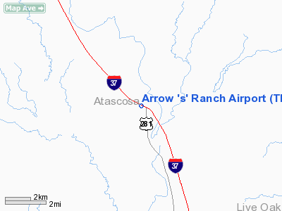
| From nearest city: | 3 nautical miles NW of Cambellton, TX |
| Location: | Atascosa County, TX |
| Magnetic Variation: | 07E (1985) |
Owner & Manager
| Ownership: | Privately owned |
| Owner: | Harrison Interests, Ltd. |
| Address: | Tx Cmce Bk Bldg, 707 Travis
Houston, TX 77002-3299
SUITE 1900. |
| Phone number: | 713-961-3900 |
| Address: |
|
Airport Operations and Facilities
| Airport Use: | Private |
| Segmented Circle: | No |
| Control Tower: | No |
| Sectional chart: | San Antonio |
| Region: | ASW - Southwest |
| Boundary ARTCC: | ZHU - Houston |
| Tie-in FSS: | SJT - San Angelo |
| FSS Toll Free: | 1-800-WX-BRIEF |
Runway Information
Runway 12/30
| Dimension: | 5500 x 50 ft / 1676.4 x 15.2 m |
| Surface: | ASPH, |
| |
Runway 12 |
Runway 30 |
| Traffic Pattern: | Left | Left |
| Obstruction: | | 75 ft plines, 300.0 ft from runway |
|
Radio Navigation Aids
| ID |
Type |
Name |
Ch |
Freq |
Var |
Dist |
| PEZ | NDB | Pleasanton | | 275.00 | 07E | 14.7 nm |
| BEA | NDB | Beeville | | 284.00 | 07E | 37.2 nm |
| HHH | NDB | Devine | | 359.00 | 07E | 39.0 nm |
| CVB | NDB | Castroville | | 338.00 | 08E | 43.8 nm |
| KSY | TACAN | Kelly | 057X | | 07E | 39.0 nm |
| DHK | TACAN | Randolph | 036X | | 09E | 45.4 nm |
| SSF | VOR | Stinson | | 108.40 | 09E | 29.3 nm |
| THX | VORTAC | Three Rivers | 051X | 111.40 | 08E | 19.0 nm |
| RND | VORTAC | Randolph | 70X | 112.30 | 09E | 44.3 nm |
| COT | VORTAC | Cotulla | 105X | 115.80 | 09E | 46.4 nm |
| SAT | VOT | San Antonio Intl | | 110.40 | | 45.8 nm |
Images and information placed above are from
http://www.airport-data.com/airport/TE26/
We thank them for the data!
| General Info
|
| Country |
United States
|
| State |
TEXAS
|
| FAA ID |
TE26
|
| Latitude |
28-47-00.929N
|
| Longitude |
098-19-09.041W
|
| Elevation |
275 feet
|
| Near City |
CAMBELLTON
|
We don't guarantee the information is fresh and accurate. The data may
be wrong or outdated.
For more up-to-date information please refer to other sources.
|
|


