 |
|
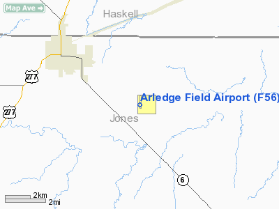
Location & QuickFacts
| FAA Information Effective: | 2008-09-25 |
| Airport Identifier: | F56 |
| Airport Status: | Operational |
| Longitude/Latitude: | 099-44-09.5788W/32-54-32.9175N
-99.735994/32.909144 (Estimated) |
| Elevation: | 1561 ft / 475.79 m (Surveyed) |
| Land: | 120 acres |
| From nearest city: | 4 nautical miles SE of Stamford, TX |
| Location: | Jones County, TX |
| Magnetic Variation: | 10E (1985) |
Owner & Manager
| Ownership: | Publicly owned |
| Owner: | City Of Stamford |
| Address: | Po Box 191
Stamford, TX 79553 |
| Phone number: | 325-773-2591 |
| Manager: | Bobby Faulks
CITY MANAGER. |
| Address: | Po Box 191
Stamford, TX 79553 |
| Phone number: | 325-773-2591 |
Airport Operations and Facilities
| Airport Use: | Open to public |
| Wind indicator: | Yes |
| Segmented Circle: | Yes |
| Control Tower: | No |
| Lighting Schedule: | DUSK-DAWN
ACTVT MIRL RY 17/35 - CTAF. |
| Beacon Color: | Clear-Green (lighted land airport) |
| Landing fee charge: | No |
| Sectional chart: | Dallas-ft Worth |
| Region: | ASW - Southwest |
| Boundary ARTCC: | ZFW - Fort Worth |
| Tie-in FSS: | FTW - Fort Worth |
| FSS on Airport: | No |
| FSS Phone: | 817-541-3474 |
| FSS Toll Free: | 1-800-WX-BRIEF |
| NOTAMs Facility: | FTW (NOTAM-d service avaliable) |
| Federal Agreements: | NGRY |
Airport Communications
| CTAF: | 122.800 |
| Unicom: | 122.800 |
Airport Services
| Airframe Repair: | MAJOR |
| Power Plant Repair: | MAJOR |
| Bottled Oxygen: | NONE |
| Bulk Oxygen: | NONE |
Runway Information
Runway 08/26
| Dimension: | 2140 x 100 ft / 652.3 x 30.5 m |
| Surface: | TURFRVL, Good Condition |
| |
Runway 08 |
Runway 26 |
| Traffic Pattern: | Left | Left |
| Obstruction: | 15 ft road, 700.0 ft from runway, 46:1 slope to clear | , 50:1 slope to clear |
|
Runway 13/31
| Dimension: | 1700 x 80 ft / 518.2 x 24.4 m |
| Surface: | TURFRVL, Good Condition |
| |
Runway 13 |
Runway 31 |
| Traffic Pattern: | Left | Left |
|
Runway 17/35
| Dimension: | 3705 x 60 ft / 1129.3 x 18.3 m |
| Surface: | ASPH, Good Condition |
| Weight Limit: | Single wheel: 4000 lbs. |
| Edge Lights: | Medium |
| |
Runway 17 |
Runway 35 |
| Longitude: | 099-44-09.4269W | 099-44-09.7306W |
| Latitude: | 32-54-51.2451N | 32-54-14.5898N |
| Elevation: | 1560.00 ft | 1554.00 ft |
| Alignment: | 127 | 0 |
| Traffic Pattern: | Left | Left |
| Markings: | Non-precision instrument, Good Condition | Non-precision instrument, Good Condition |
| Obstruction: | 15 ft road, 900.0 ft from runway, 46:1 slope to clear | , 50:1 slope to clear |
|
Radio Navigation Aids
| ID |
Type |
Name |
Ch |
Freq |
Var |
Dist |
| TMV | NDB | Stamford | | 290.00 | 08E | 2.4 nm |
| AKL | NDB | Haskell | | 407.00 | 08E | 17.0 nm |
| BKD | NDB | Breckenridge | | 245.00 | 07E | 43.8 nm |
| SWW | NDB | Sweetwater | | 275.00 | 08E | 45.7 nm |
| DYS | TACAN | Dyess | 063X | | 08E | 30.1 nm |
| TQA | VOR/DME | Tuscola | 053X | 111.60 | 10E | 40.7 nm |
| ABI | VORTAC | Abilene | 084X | 113.70 | 10E | 26.5 nm |
Images and information placed above are from
http://www.airport-data.com/airport/F56/
We thank them for the data!
| General Info
|
| Country |
United States
|
| State |
TEXAS
|
| FAA ID |
F56
|
| Latitude |
32-54-36.701N
|
| Longitude |
099-44-03.227W
|
| Elevation |
1560 feet
|
| Near City |
STAMFORD
|
We don't guarantee the information is fresh and accurate. The data may
be wrong or outdated.
For more up-to-date information please refer to other sources.
|
|


