 |
|
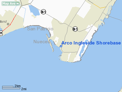
Arco Ingleside Shorebase Heliport |
Location & QuickFacts
| FAA Information Effective: | 2008-09-25 |
| Airport Identifier: | 0TA6 |
| Airport Status: | Operational |
| Longitude/Latitude: | 097-13-22.9650W/27-50-52.0940N
-97.223046/27.847804 (Estimated) |
| Elevation: | 20 ft / 6.10 m (Estimated) |
| Land: | 0 acres |
| From nearest city: | 3 nautical miles S of Ingleside, TX |
| Location: | San Patricio County, TX |
| Magnetic Variation: | 07E (1985) |
Owner & Manager
| Ownership: | Privately owned |
| Owner: | Vastar Resources Inc |
| Address: | P.o. Drawer K
Ingleside, TX 78362 |
| Phone number: | 512-289-4639 |
| Manager: | Dee Cochran |
| Address: | P.o. Drawer K
Ingleside, TX 78362 |
| Phone number: | 512-289-4639 |
Airport Operations and Facilities
| Airport Use: | Private |
| Wind indicator: | Yes |
| Segmented Circle: | No |
| Control Tower: | No |
| Lighting Schedule: | PHONE REQ
FOR PERIMETER LGTS RY H1 CALL 512-776-3538. |
| Landing fee charge: | No |
| Sectional chart: | Brownsville |
| Region: | ASW - Southwest |
| Boundary ARTCC: | ZHU - Houston |
| Tie-in FSS: | SJT - San Angelo |
| FSS on Airport: | No |
| FSS Toll Free: | 1-800-WX-BRIEF |
Airport Communications
Runway Information
Helipad H1
| Dimension: | 50 x 50 ft / 15.2 x 15.2 m |
| Surface: | CONC, |
| |
Runway H1 |
Runway |
| Traffic Pattern: | Left | Left |
|
Helipad H2
| Dimension: | 20 x 15 ft / 6.1 x 4.6 m |
| Surface: | CONC, |
| |
Runway H2 |
Runway |
| Traffic Pattern: | Left | Left |
|
Helipad H3
| Dimension: | 20 x 15 ft / 6.1 x 4.6 m |
| Surface: | CONC, |
| |
Runway H3 |
Runway |
| Traffic Pattern: | Left | Left |
|
Radio Navigation Aids
| ID |
Type |
Name |
Ch |
Freq |
Var |
Dist |
| RKP | NDB | Rockport | | 391.00 | 06E | 17.3 nm |
| MNO | NDB | Mellon Ranch | | 375.00 | 06E | 26.0 nm |
| BEA | NDB | Beeville | | 284.00 | 07E | 43.6 nm |
| TKB | NDB | Kleberg County | | 347.00 | 06E | 48.1 nm |
| NQI | TACAN | Kingsville | 125X | | 09E | 37.4 nm |
| NOG | TACAN | Orange Grove | 063X | | 09E | 43.6 nm |
| ALI | VOR | Alice | | 114.50 | 06E | 42.9 nm |
| NGP | VORTAC | Truax | 087X | 114.00 | 06E | 10.4 nm |
| CRP | VORTAC | Corpus Christi | 102X | 115.50 | 09E | 12.3 nm |
Remarks
Images and information placed above are from
http://www.airport-data.com/airport/0TA6/
We thank them for the data!
| General Info
|
| Country |
United States
|
| State |
TEXAS
|
| FAA ID |
0TA6
|
| Latitude |
27-50-52.094N
|
| Longitude |
097-13-22.965W
|
| Elevation |
20 feet
|
| Near City |
INGLESIDE
|
We don't guarantee the information is fresh and accurate. The data may
be wrong or outdated.
For more up-to-date information please refer to other sources.
|
|


