 |
|
Location & QuickFacts
| FAA Information Effective: | 2008-09-25 |
| Airport Identifier: | 4XA4 |
| Airport Status: | Operational |
| Longitude/Latitude: | 097-08-36.1600W/30-44-05.8500N
-97.143378/30.734958 (Estimated) |
| Elevation: | 410 ft / 124.97 m (Estimated) |
| Land: | 0 acres |
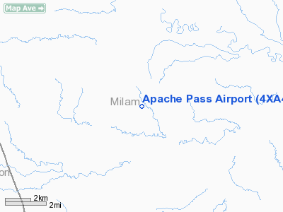
| From nearest city: | 7 nautical miles NW of Rockdale, TX |
| Location: | Milam County, TX |
| Magnetic Variation: | () |
Owner & Manager
| Ownership: | Privately owned |
| Owner: | Kit Worley |
| Address: | 1097 County Road 428
Rockdale, TX 76567 |
| Phone number: | 512-446-3211 |
| Manager: | Jim Prater |
| Address: | 9112 N. Fm 908
Rockdale, TX 76567 |
| Phone number: | 512-446-3211 |
Airport Operations and Facilities
| Airport Use: | Private |
| Wind indicator: | Yes |
| Control Tower: | No |
| Sectional chart: | Houston |
| Region: | ASW - Southwest |
| Boundary ARTCC: | ZHU - Houston |
| Tie-in FSS: | SJT - San Angelo |
| FSS Toll Free: | 1-800-WX-BRIEF |
Runway Information
Runway 01/19
| Dimension: | 3000 x 60 ft / 914.4 x 18.3 m |
| Surface: | TURF, Good Condition |
| |
Runway 01 |
Runway 19 |
| Traffic Pattern: | Left | Left |
| Obstruction: | 20 ft pline, 1000.0 ft from runway | |
|
Radio Navigation Aids
| ID |
Type |
Name |
Ch |
Freq |
Var |
Dist |
| GUO | NDB | Georgetown | | 332.00 | 06E | 27.9 nm |
| IL | NDB | Iresh | | 278.00 | 07E | 33.9 nm |
| GYB | NDB | Lee County | | 385.00 | 07E | 35.0 nm |
| HLR | NDB | Hood | | 347.00 | 07E | 37.7 nm |
| GR | NDB | Starn | | 323.00 | 07E | 46.0 nm |
| ROB | NDB | Robinson | | 400.00 | 07E | 46.4 nm |
| TPL | VOR/DME | Temple | 041X | 110.40 | 09E | 32.0 nm |
| GRK | VOR/DME | Gray | 055X | 111.80 | 07E | 38.9 nm |
| CWK | VORTAC | Centex | 075X | 112.80 | 06E | 29.3 nm |
| CLL | VORTAC | College Station | 080X | 113.30 | 08E | 38.2 nm |
Remarks
- PRVDD VFR DAYTIME AND PVTUSE AND ALL RY APCH ENDS SHALL HAVE A MIN CLEAR 20:1VISUAL APCH SLOPE.
Images and information placed above are from
http://www.airport-data.com/airport/4XA4/
We thank them for the data!
|
|


