 |
|
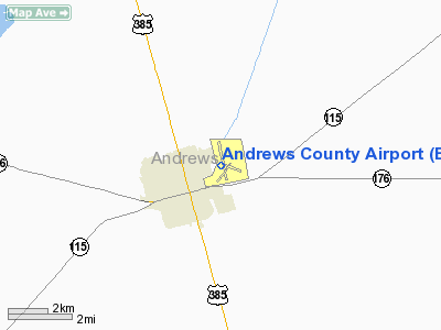
Location & QuickFacts
| FAA Information Effective: | 2008-09-25 |
| Airport Identifier: | E11 |
| Airport Status: | Operational |
| Longitude/Latitude: | 102-31-46.3000W/32-19-52.0000N
-102.529528/32.331111 (Estimated) |
| Elevation: | 3174 ft / 967.44 m (Surveyed) |
| Land: | 260 acres |
| From nearest city: | 1 nautical miles NE of Andrews, TX |
| Location: | Andrews County, TX |
| Magnetic Variation: | 09E (1990) |
Owner & Manager
| Ownership: | Publicly owned |
| Owner: | Andrews County |
| Address: | Andrews County Courthouse
Andrews, TX 79714 |
| Phone number: | 432-524-1401 |
| Manager: | Richard H. Dolgener
COUNTY JUDGE. |
| Address: | County Airport
Andrews, TX 79714 |
| Phone number: | 432-524-1447 |
Airport Operations and Facilities
| Airport Use: | Open to public |
| Wind indicator: | Yes |
| Segmented Circle: | Yes |
| Control Tower: | No |
| Lighting Schedule: | DUSK-DAWN
ACTVT MIRL RYS 02/20 & 16/34 - CTAF. VASI RYS 16 & 34, PAPI RY 20 & REIL RY 34 OPER CONT. |
| Beacon Color: | Clear-Green (lighted land airport) |
| Landing fee charge: | No |
| Sectional chart: | Albuquerque |
| Region: | ASW - Southwest |
| Boundary ARTCC: | ZFW - Fort Worth |
| Tie-in FSS: | SJT - San Angelo |
| FSS on Airport: | No |
| FSS Toll Free: | 1-800-WX-BRIEF |
| NOTAMs Facility: | SJT (NOTAM-d service avaliable) |
| Federal Agreements: | NGY |
Airport Communications
| CTAF: | 122.800 |
| Unicom: | 122.800 |
Airport Services
| Fuel available: | 100LLA |
| Bulk Oxygen: | NONE |
Runway Information
Runway 02/20
| Dimension: | 2939 x 75 ft / 895.8 x 22.9 m
HAS 940 FT BY 75 FT STOPWAY/TWY SW END.
HAS 965 FT BY 60 FT STOPWAY/TWY S END. |
| Surface: | ASPH, Good Condition |
| Weight Limit: | Single wheel: 23000 lbs. |
| Edge Lights: | Medium |
| |
Runway 02 |
Runway 20 |
| Longitude: | 102-31-52.0095W | 102-31-36.8350W |
| Latitude: | 32-19-38.7204N | 32-20-04.7923N |
| Elevation: | 3166.00 ft | 3168.00 ft |
| Alignment: | 26 | 127 |
| Traffic Pattern: | Right | Left |
| Markings: | Basic, Good Condition | Basic, Good Condition |
| Crossing Height: | 0.00 ft | 26.00 ft |
| VASI: | | 2-light PAPI on left side |
| Visual Glide Angle: | 0.00° | 3.00° |
| Obstruction: | 36 ft trees, 1500.0 ft from runway, 140 ft left of centerline, 36:1 slope to clear | 6 ft gnd, 400.0 ft from runway, 125 ft right of centerline, 33:1 slope to clear |
|
Runway 11/29
| Dimension: | 3048 x 75 ft / 929.0 x 22.9 m
HAS 940 FT BY 75 FT STOPWAY/TWY SW END.
HAS 965 FT BY 60 FT STOPWAY/TWY S END. |
| Surface: | ASPH, Good Condition |
| Weight Limit: | Single wheel: 17000 lbs. |
| |
Runway 11 |
Runway 29 |
| Longitude: | 102-31-49.9762W | 102-31-20.0277W |
| Latitude: | 32-19-51.4534N | 32-19-35.2467N |
| Elevation: | 3166.00 ft | 3158.00 ft |
| Alignment: | 123 | 127 |
| Traffic Pattern: | Left | Right |
| Markings: | Basic, Good Condition | Basic, Good Condition |
| Obstruction: | 57 ft trees, 1000.0 ft from runway, 125 ft left of centerline, 14:1 slope to clear | 10 ft road, 505.0 ft from runway, 180 ft right of centerline, 30:1 slope to clear |
|
Runway 16/34
| Dimension: | 5816 x 75 ft / 1772.7 x 22.9 m
HAS 940 FT BY 75 FT STOPWAY/TWY SW END.
HAS 965 FT BY 60 FT STOPWAY/TWY S END. |
| Surface: | ASPH, Good Condition |
| Weight Limit: | Single wheel: 23000 lbs.
Dual wheel: 37000 lbs. |
| Edge Lights: | Medium |
| |
Runway 16 |
Runway 34 |
| Longitude: | 102-32-02.1620W | 102-31-44.0191W |
| Latitude: | 32-20-24.4189N | 32-19-28.9794N |
| Elevation: | 3174.00 ft | 3168.00 ft |
| Alignment: | 127 | 127 |
| Traffic Pattern: | Left | Right |
| Markings: | Non-precision instrument, Good Condition | Non-precision instrument, Good Condition |
| Crossing Height: | 24.00 ft | 24.00 ft |
| VASI: | 2-box on left side
VASI OTS INDEFLY. | 2-box on left side
VASI OTS INDEFLY. |
| Visual Glide Angle: | 3.00° | 3.00° |
| Runway End Identifier: | Yes | Yes |
| Obstruction: | 4 ft gnd, 200.0 ft from runway, 217 ft left of centerline
+4 FT RISING GND 150-200 FT FM THLD 217 FT LEFT. | 28 ft trees, 1260.0 ft from runway, 235 ft right of centerline, 37:1 slope to clear |
|
Helipad H1
| Dimension: | 25 x 25 ft / 7.6 x 7.6 m
HAS 940 FT BY 75 FT STOPWAY/TWY SW END.
HAS 965 FT BY 60 FT STOPWAY/TWY S END. |
| Surface: | ASPH, Good Condition |
| |
Runway H1 |
Runway |
| Traffic Pattern: | Left | Left |
| Markings: | Basic, Fair Condition | , |
|
Radio Navigation Aids
| ID |
Type |
Name |
Ch |
Freq |
Var |
Dist |
| ANR | NDB | Andrews | | 245.00 | 09E | 1.1 nm |
| GNC | NDB | Gaines County | | 344.00 | 09E | 21.3 nm |
| MA | NDB | Farly | | 326.00 | 09E | 23.1 nm |
| LSA | NDB | Lamesa | | 338.00 | 09E | 40.3 nm |
| OHE | NDB | Monahans | | 214.00 | 09E | 49.2 nm |
| MAF | VORTAC | Midland | 095X | 114.80 | 11E | 25.9 nm |
| HOB | VORTAC | Hobbs | 047X | 111.00 | 11E | 41.8 nm |
| INK | VORTAC | Wink | 058X | 112.10 | 11E | 45.6 nm |
| MAF | VOT | Midland International | | 108.20 | | 28.8 nm |
Images and information placed above are from
http://www.airport-data.com/airport/E11/
We thank them for the data!
| General Info
|
| Country |
United States
|
| State |
TEXAS
|
| FAA ID |
E11
|
| Latitude |
32-19-52.000N
|
| Longitude |
102-31-46.300W
|
| Elevation |
3174 feet
|
| Near City |
ANDREWS
|
We don't guarantee the information is fresh and accurate. The data may
be wrong or outdated.
For more up-to-date information please refer to other sources.
|
|


