 |
|
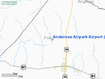
Location & QuickFacts
| FAA Information Effective: | 2008-09-25 |
| Airport Identifier: | TA43 |
| Airport Status: | Operational |
| Longitude/Latitude: | 094-51-16.0000W/31-02-51.0000N
-94.854444/31.047500 (Estimated) |
| Elevation: | 205 ft / 62.48 m (Estimated) |
| Land: | 4 acres |
| From nearest city: | 3 nautical miles NW of Corrigan, TX |
| Location: | Polk County, TX |
| Magnetic Variation: | 05E (1995) |
Owner & Manager
| Ownership: | Privately owned |
| Owner: | Alan Andersen |
| Address: | Po Box 307
Corrigan, TX 75939 |
| Phone number: | 409-398-4425 |
| Manager: | Alan Andersen |
| Address: | Po Box 307
Corrigan, TX 75939 |
| Phone number: | 409-398-4425 |
Airport Operations and Facilities
| Airport Use: | Private |
| Segmented Circle: | No |
| Control Tower: | No |
| Sectional chart: | Houston |
| Region: | ASW - Southwest |
| Boundary ARTCC: | ZHU - Houston |
| Tie-in FSS: | CXO - Montgomery County |
| FSS Toll Free: | 1-800-WX-BRIEF |
Runway Information
Runway 14/32
| Dimension: | 1650 x 80 ft / 502.9 x 24.4 m |
| Surface: | TURF, |
| |
Runway 14 |
Runway 32 |
| Traffic Pattern: | Left | Left |
| Displaced threshold: | 100.00 ft | 0.00 ft |
| Obstruction: | 35 ft pline, 100.0 ft from runway | |
|
Radio Navigation Aids
| ID |
Type |
Name |
Ch |
Freq |
Var |
Dist |
| OC | NDB | Nados | | 253.00 | 05E | 27.2 nm |
| GXD | NDB | Nacogdoches | | 391.00 | 05E | 36.9 nm |
| UTS | NDB | Huntsville | | 308.00 | 06E | 42.2 nm |
| JAS | NDB | Jasper | | 344.00 | 04E | 42.7 nm |
| LFK | VORTAC | Lufkin | 058X | 112.10 | 05E | 9.9 nm |
Images and information placed above are from
http://www.airport-data.com/airport/TA43/
We thank them for the data!
| General Info
|
| Country |
United States
|
| State |
TEXAS
|
| FAA ID |
TA43
|
| Latitude |
31-02-51.000N
|
| Longitude |
094-51-16.000W
|
| Elevation |
205 feet
|
| Near City |
CORRIGAN
|
We don't guarantee the information is fresh and accurate. The data may
be wrong or outdated.
For more up-to-date information please refer to other sources.
|
|


