 |
|
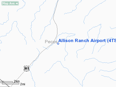
Location & QuickFacts
| FAA Information Effective: | 2008-09-25 |
| Airport Identifier: | 4TS7 |
| Airport Status: | Operational |
| Longitude/Latitude: | 102-55-35.5650W/30-27-00.6080N
-102.926546/30.450169 (Estimated) |
| Elevation: | 4572 ft / 1393.55 m (Estimated) |
| Land: | 0 acres |
| From nearest city: | 32 nautical miles SE of Fort Stockton, TX |
| Location: | Pecos County, TX |
| Magnetic Variation: | 09E (1985) |
Owner & Manager
| Ownership: | Privately owned |
| Owner: | Allison Ranch Co |
| Address: | 941 Turner
San Angelo, TX 76903 |
| Phone number: | 915-942-1602 |
| Manager: | John Allison |
| Address: | 941 Turner
San Angelo, TX 76903 |
| Phone number: | 915-942-1602 |
Airport Operations and Facilities
| Airport Use: | Private |
| Wind indicator: | Yes |
| Segmented Circle: | No |
| Control Tower: | No |
| Sectional chart: | San Antonio |
| Region: | ASW - Southwest |
| Boundary ARTCC: | ZAB - Albuquerque |
| Tie-in FSS: | SJT - San Angelo |
| FSS on Airport: | No |
| FSS Toll Free: | 1-800-WX-BRIEF |
Runway Information
Runway 16/34
| Dimension: | 4500 x 100 ft / 1371.6 x 30.5 m |
| Surface: | TURF, |
| |
Runway 16 |
Runway 34 |
| Traffic Pattern: | Left | Left |
|
Radio Navigation Aids
| ID |
Type |
Name |
Ch |
Freq |
Var |
Dist |
| IMP | NDB | Marathon | | 388.00 | 10E | 19.6 nm |
| BWR | NDB | Brewster County | | 412.00 | 09E | 37.3 nm |
| FST | VORTAC | Fort Stockton | 116X | 116.90 | 11E | 30.3 nm |
Images and information placed above are from
http://www.airport-data.com/airport/4TS7/
We thank them for the data!
| General Info
|
| Country |
United States
|
| State |
TEXAS
|
| FAA ID |
13TX
|
| Latitude |
30-31-52.661N
|
| Longitude |
100-27-05.322W
|
| Elevation |
2350 feet
|
| Near City |
SONORA
|
We don't guarantee the information is fresh and accurate. The data may
be wrong or outdated.
For more up-to-date information please refer to other sources.
|
|


