 |
|
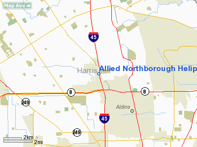
Allied Northborough Heliport |
Location & QuickFacts
| FAA Information Effective: | 2008-09-25 |
| Airport Identifier: | 84TA |
| Airport Status: | Operational |
| Longitude/Latitude: | 095-25-09.7770W/29-57-26.7990N
-95.419382/29.957444 (Estimated) |
| Elevation: | 200 ft / 60.96 m (Estimated) |
| Land: | 0 acres |
| From nearest city: | 5 nautical miles NE of Houston, TX |
| Location: | Harris County, TX |
| Magnetic Variation: | 06E (1985) |
Owner & Manager
| Ownership: | Privately owned |
| Owner: | Gene Branscome |
| Address: | Po Box 1276
Baytown, TX 77520 |
| Phone number: | 713-420-5777 |
| Manager: | R.j. Forns |
| Address: | Po Box 1276
Baytown, TX 77520 |
| Phone number: | 713-420-5777 |
Airport Operations and Facilities
| Airport Use: | Private |
| Wind indicator: | Yes |
| Segmented Circle: | No |
| Control Tower: | No |
| Landing fee charge: | No |
| Sectional chart: | Houston |
| Region: | ASW - Southwest |
| Boundary ARTCC: | ZHU - Houston |
| Tie-in FSS: | CXO - Montgomery County |
| FSS on Airport: | No |
| FSS Toll Free: | 1-800-WX-BRIEF
FOR FP FILING CALL CXO FSS 1-800-833-5602. |
Runway Information
Helipad H1
| Dimension: | 25 x 25 ft / 7.6 x 7.6 m |
| Surface: | CONC,
ROOFTOP. |
| |
Runway H1 |
Runway |
| Traffic Pattern: | Left | Left |
|
Radio Navigation Aids
| ID |
Type |
Name |
Ch |
Freq |
Var |
Dist |
| BVP | NDB | Nixin | | 326.00 | 05E | 10.9 nm |
| EYQ | NDB | Weiser | | 286.00 | 06E | 11.6 nm |
| DWH | NDB | David Hooks | | 521.00 | 05E | 12.7 nm |
| LYD | NDB | Lakeside | | 249.00 | 05E | 15.9 nm |
| SGR | NDB | Hull | | 388.00 | 05E | 23.1 nm |
| JPA | NDB | Sanjac | | 347.00 | 05E | 25.2 nm |
| SYG | NDB | Sandy Point | | 402.00 | 05E | 27.5 nm |
| CBC | NDB | Anahuac | | 413.00 | 05E | 41.0 nm |
| UTS | NDB | Huntsville | | 308.00 | 06E | 47.9 nm |
| EFD | TACAN | Ellington | 031X | | 05E | 25.1 nm |
| HUB | VOR/DME | Hobby | 118X | 117.10 | 05E | 19.6 nm |
| MHF | VOR/DME | Trinity | 083X | 113.60 | 07E | 42.9 nm |
| IAH | VORTAC | Humble | 113X | 116.60 | 05E | 3.8 nm |
| TNV | VORTAC | Navasota | 106X | 115.90 | 08E | 38.7 nm |
| DAS | VORTAC | Daisetta | 116X | 116.90 | 05E | 42.6 nm |
| HOU | VOT | Houston Wm P Hobby | | 108.40 | | 20.2 nm |
Remarks
- CONDL--PROVIDED ALLIED NORTHBOROUGH ENTERS INTO AN OPERATIONAL LETTER OF AGREEMENT WITH HOUSTON INTERCONTINENTAL TOWER.
Images and information placed above are from
http://www.airport-data.com/airport/84TA/
We thank them for the data!
| General Info
|
| Country |
United States
|
| State |
TEXAS
|
| FAA ID |
84TA
|
| Latitude |
29-57-26.799N
|
| Longitude |
095-25-09.777W
|
| Elevation |
200 feet
|
| Near City |
HOUSTON
|
We don't guarantee the information is fresh and accurate. The data may
be wrong or outdated.
For more up-to-date information please refer to other sources.
|
|


