 |
|
Location & QuickFacts
| FAA Information Effective: | 2008-09-25 |
| Airport Identifier: | 7TS2 |
| Airport Status: | Operational |
| Longitude/Latitude: | 097-53-21.0140W/29-49-52.7970N
-97.889171/29.831333 (Estimated) |
| Elevation: | 630 ft / 192.02 m (Estimated) |
| Land: | 0 acres |
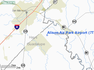
| From nearest city: | 4 nautical miles SE of San Marcos, TX |
| Location: | Guadalupe County, TX |
| Magnetic Variation: | 07E (1985) |
Owner & Manager
| Ownership: | Privately owned |
| Owner: | Ray L. Ender |
| Address: | Rt 3, Box 83a-1
San Marcos, TX 78666 |
| Phone number: | 512-353-1013 |
| Manager: | Ray L. Ender |
| Address: | Rt 3, Box 83a-1
San Marcos, TX 78666 |
| Phone number: | 512-353-1013 |
Airport Operations and Facilities
| Airport Use: | Private |
| Wind indicator: | Yes |
| Segmented Circle: | No |
| Control Tower: | No |
| Sectional chart: | San Antonio |
| Region: | ASW - Southwest |
| Boundary ARTCC: | ZHU - Houston |
| Tie-in FSS: | SJT - San Angelo |
| FSS on Airport: | No |
| FSS Toll Free: | 1-800-WX-BRIEF |
Runway Information
Runway 17/35
| Dimension: | 1300 x 26 ft / 396.2 x 7.9 m |
| Surface: | GRVL, |
| |
Runway 17 |
Runway 35 |
| Traffic Pattern: | Left | Left |
| Displaced threshold: | 300.00 ft | 0.00 ft |
| Obstruction: | 5 ft fence | |
|
Radio Navigation Aids
| ID |
Type |
Name |
Ch |
Freq |
Var |
Dist |
| MFS | NDB | Horseshoe Bay Resort | | 403.00 | 07E | 48.2 nm |
| DHK | TACAN | Randolph | 036X | | 09E | 26.5 nm |
| KSY | TACAN | Kelly | 057X | | 07E | 44.8 nm |
| SSF | VOR | Stinson | | 108.40 | 09E | 45.0 nm |
| RND | VORTAC | Randolph | 70X | 112.30 | 09E | 27.9 nm |
| SAT | VORTAC | San Antonio | 115X | 116.80 | 08E | 31.9 nm |
| CWK | VORTAC | Centex | 075X | 112.80 | 06E | 37.8 nm |
| STV | VORTAC | Stonewall | 085X | 113.80 | 08E | 48.1 nm |
| SAT | VOT | San Antonio Intl | | 110.40 | | 35.2 nm |
Remarks
- PVT USE ONLY,THRS DSPLCD TO PRVD 20:1 APCH SLOPE.
Images and information placed above are from
http://www.airport-data.com/airport/7TS2/
We thank them for the data!
| General Info
|
| Country |
United States
|
| State |
TEXAS
|
| FAA ID |
7TS2
|
| Latitude |
29-49-52.797N
|
| Longitude |
097-53-21.014W
|
| Elevation |
630 feet
|
| Near City |
SAN MARCOS
|
We don't guarantee the information is fresh and accurate. The data may
be wrong or outdated.
For more up-to-date information please refer to other sources.
|
|


