 |
|
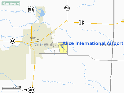
| Alice International Airport |
| IATA: ALI – ICAO: KALI |
| Summary |
| Airport type |
Public |
| Operator |
City of Alice & Jim Wells County |
| Serves |
Alice, Texas |
| Elevation AMSL |
178 ft / 54.3 m |
| Coordinates |
27°44′27″N 98°01′37″W / 27.74083°N 98.02694°W / 27.74083; -98.02694 |
| Runways |
| Direction |
Length |
Surface |
| ft |
m |
| 8/26 |
4,171 |
1,271 |
Asphalt |
| 13/31 |
5,997 |
1,828 |
Asphalt |
| 17/35 |
4,490 |
1,369 |
Asphalt |
Alice International Airport (IATA: ALI, ICAO: KALI) is a public airport located 3 miles (5 km) southeast of the city of Alice, in Jim Wells County, Texas.
Facilities
Alice International Airport covers 556 acres (2.25 km) and has three runways:
- Runway 8/26: 4,171 x 130 ft (1,271 x 40 m), Surface: Asphalt
- Runway 13/31: 5,997 x 100 ft (1,828 x 30 m), Surface: Asphalt
- Runway 17/35: 4,490 x 100 ft (1,369 x 30 m), Surface: Asphalt
The above content comes from Wikipedia and is published under free licenses – click here to read more.
Location & QuickFacts
| FAA Information Effective: | 2008-09-25 |
| Airport Identifier: | ALI |
| Airport Status: | Operational |
| Longitude/Latitude: | 098-01-37.0000W/27-44-27.2000N
-98.026944/27.740889 (Estimated) |
| Elevation: | 178 ft / 54.25 m (Surveyed) |
| Land: | 556 acres |
| From nearest city: | 3 nautical miles SE of Alice, TX |
| Location: | Jim Wells County, TX |
| Magnetic Variation: | 06E (2000) |
Owner & Manager
| Ownership: | Publicly owned |
| Owner: | City Of Alice & Jim Wells Co |
| Address: | Po Drawer 3229
Alice, TX 78333 |
| Phone number: | 361-668-7210 |
| Manager: | Charles Brazzell |
| Address: | Po Drawer 3229
Alice, TX 78333 |
| Phone number: | 361-460-1367 |
Airport Operations and Facilities
| Airport Use: | Open to public |
| Wind indicator: | Yes |
| Segmented Circle: | Yes |
| Control Tower: | No |
| Lighting Schedule: | DUSK-DAWN
ACTVT MALS RY 31 & PAPI RY 31 - CTAF. MIRL RYS 13/31 & 17/35 PRESET LOW INTST DUSK-2300; TO INCR INTST ACTVT - CTAF. AFT 2300 ACTVT - CTAF. |
| Beacon Color: | Clear-Green (lighted land airport) |
| Landing fee charge: | No |
| Sectional chart: | Brownsville |
| Region: | ASW - Southwest |
| Boundary ARTCC: | ZHU - Houston |
| Tie-in FSS: | SJT - San Angelo |
| FSS on Airport: | No |
| FSS Toll Free: | 1-800-WX-BRIEF |
| NOTAMs Facility: | ALI (NOTAM-d service avaliable) |
| Federal Agreements: | NGY3 |
Airport Communications
| CTAF: | 123.000 |
| Unicom: | 123.000 |
Airport Services
| Fuel available: | 100LLA |
| Airframe Repair: | MAJOR |
| Power Plant Repair: | MAJOR |
Runway Information
Runway 13/31
| Dimension: | 5997 x 100 ft / 1827.9 x 30.5 m |
| Surface: | ASPH, Good Condition |
| Weight Limit: | Single wheel: 30000 lbs. |
| Edge Lights: | Medium |
| |
Runway 13 |
Runway 31 |
| Longitude: | 098-02-02.0163W | 098-01-14.4003W |
| Latitude: | 27-44-43.1377N | 27-44-01.5234N |
| Elevation: | 178.00 ft | 166.00 ft |
| Alignment: | 127 | 127 |
| ILS Type: | | LOC/DME
|
| Traffic Pattern: | Left | Left |
| Markings: | Non-precision instrument, Good Condition | Non-precision instrument, Good Condition |
| Crossing Height: | 0.00 ft | 47.00 ft |
| VASI: | | 4-light PAPI on left side |
| Visual Glide Angle: | 0.00° | 3.00° |
| Approach lights: | | MALS |
| Runway End Identifier: | Yes | |
| Obstruction: | 10 ft tree, 375.0 ft from runway, 475 ft left of centerline, 17:1 slope to clear | 25 ft trees, 1215.0 ft from runway, 490 ft right of centerline, 40:1 slope to clear |
|
Runway 17/35
| Dimension: | 4490 x 100 ft / 1368.6 x 30.5 m |
| Surface: | ASPH, Good Condition |
| Weight Limit: | Single wheel: 23000 lbs. |
| Edge Lights: | Medium |
| |
Runway 17 |
Runway 35 |
| Longitude: | 098-01-36.5709W | 098-01-36.0704W |
| Latitude: | 27-44-42.4086N | 27-43-57.9467N |
| Elevation: | 173.00 ft | 172.00 ft |
| Alignment: | 127 | 127 |
| Traffic Pattern: | Left | Left |
| Markings: | Non-precision instrument, Good Condition | Non-precision instrument, Good Condition |
| Obstruction: | 47 ft tree, 1435.0 ft from runway, 290 ft right of centerline, 26:1 slope to clear | 30 ft pline, 1300.0 ft from runway, 36:1 slope to clear |
|
Radio Navigation Aids
| ID |
Type |
Name |
Ch |
Freq |
Var |
Dist |
| TKB | NDB | Kleberg County | | 347.00 | 06E | 8.7 nm |
| BKS | NDB | Brooks County | | 353.00 | 06E | 32.5 nm |
| BEA | NDB | Beeville | | 284.00 | 07E | 39.7 nm |
| HBV | NDB | Hebbronville | | 266.00 | 06E | 44.7 nm |
| NOG | TACAN | Orange Grove | 063X | | 09E | 9.3 nm |
| NQI | TACAN | Kingsville | 125X | | 09E | 18.7 nm |
| ALI | VOR | Alice | | 114.50 | 06E | 0.3 nm |
| CRP | VORTAC | Corpus Christi | 102X | 115.50 | 09E | 32.5 nm |
| NGP | VORTAC | Truax | 087X | 114.00 | 06E | 39.1 nm |
| THX | VORTAC | Three Rivers | 051X | 111.40 | 08E | 46.4 nm |
Images and information placed above are from
http://www.airport-data.com/airport/ALI/
We thank them for the data!
| General Info
|
| Country |
United States
|
| State |
TEXAS
|
| FAA ID |
ALI
|
| Latitude |
27-44-27.200N
|
| Longitude |
098-01-37.000W
|
| Elevation |
178 feet
|
| Near City |
ALICE
|
We don't guarantee the information is fresh and accurate. The data may
be wrong or outdated.
For more up-to-date information please refer to other sources.
|
|


