 |
|
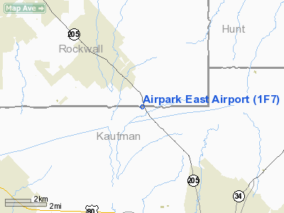
| Airpark East Airport |
| IATA: none – ICAO: none – FAA LID: 1F7 |
| Summary |
| Airport type |
Public |
| Serves |
Dallas, Texas |
| Elevation AMSL |
510 ft / 155 m |
| Coordinates |
32°48′50″N 096°21′08″W / 32.81389°N 96.35222°W / 32.81389; -96.35222 |
| Runways |
| Direction |
Length |
Surface |
| ft |
m |
| 13/31 |
2,630 |
802 |
Asphalt |
| Source: Federal Aviation Administration |
Airpark East Airport (FAA LID: 1F7) is a public airport located 16 nautical miles (30 km) east of the central business district of Dallas, in Dallas County, Texas, United States. The airport is used solely for general aviation purposes.
Facilities
Airpark East Airport has one runway:
- Runway 13/31: 2,630 x 30 ft. (802 x 9 m), Surface: Asphalt
The above content comes from Wikipedia and is published under free licenses – click here to read more.
Location & QuickFacts
| FAA Information Effective: | 2008-09-25 |
| Airport Identifier: | 1F7 |
| Airport Status: | Operational |
| Longitude/Latitude: | 096-21-07.9350W/32-48-50.4550N
-96.352204/32.814015 (Estimated) |
| Elevation: | 510 ft / 155.45 m (Estimated) |
| Land: | 62 acres |
| From nearest city: | 23 nautical miles E of Dallas, TX |
| Location: | Rockwall County, TX |
| Magnetic Variation: | 06E (1985) |
Owner & Manager
| Ownership: | Privately owned |
| Owner: | Jim Parrish |
| Address: | 11230 S. Hwy 205
Terrell, TX 75160 |
| Phone number: | 214-914-5153 |
| Manager: | Jim Parrish |
| Address: | 11230 S. Hwy 205
Terrell, TX 75160 |
| Phone number: | 214-914-5153 |
Airport Operations and Facilities
| Airport Use: | Open to public |
| Wind indicator: | Yes |
| Segmented Circle: | No |
| Control Tower: | No |
| Lighting Schedule: | DUSK-DAWN
ACTVT LIRL RY 13/31 - 122.9. |
| Beacon Color: | Clear-Green (lighted land airport) |
| Sectional chart: | Dallas-ft Worth |
| Region: | ASW - Southwest |
| Boundary ARTCC: | ZFW - Fort Worth |
| Tie-in FSS: | FTW - Fort Worth |
| FSS on Airport: | No |
| FSS Phone: | 817-541-3474 |
| FSS Toll Free: | 1-800-WX-BRIEF
FOR LOCAL CALL TO FSS DIAL 350-3311. |
| NOTAMs Facility: | (NOTAM-d service avaliable) |
Airport Communications
| CTAF: | 122.700 |
| Unicom: | 122.700 |
Airport Services
| Fuel available: | 100LL |
| Airframe Repair: | MAJOR |
| Power Plant Repair: | MAJOR |
Runway Information
Runway 13/31
| Dimension: | 2630 x 30 ft / 801.6 x 9.1 m |
| Surface: | ASPH, Good Condition |
| Edge Lights: | Low |
| |
Runway 13 |
Runway 31 |
| Traffic Pattern: | Right | Left |
| Markings: | Nonstandard, Good Condition | Nonstandard, Good Condition |
| Obstruction: | 20 ft trees, 201.0 ft from runway, 85 ft right of centerline
+4 FT FENCE 90 FT R CNTRLN AT THLD. | 20 ft tree, 240.0 ft from runway, 90 ft left of centerline, 2:1 slope to clear
+20 FT TREE AT THLD 110 FT L CNTRLN; 4 FT FENCE 90 FT L CNTRLN AT THLD. |
|
Radio Navigation Aids
| ID |
Type |
Name |
Ch |
Freq |
Var |
Dist |
| AVZ | NDB | Travis | | 260.00 | 06E | 6.1 nm |
| PQF | NDB | Mesquite | | 248.00 | 06E | 8.9 nm |
| JUG | NDB | Jecca | | 388.00 | 06E | 12.6 nm |
| MII | NDB | Caddo Mills | | 316.00 | 06E | 14.6 nm |
| SYW | NDB | Cash | | 428.00 | 05E | 17.6 nm |
| LNC | NDB | Lancaster | | 239.00 | 06E | 23.5 nm |
| RBD | NDB | Redbird | | 287.00 | 06E | 27.5 nm |
| XQH | NDB | Cedar Hill | | 353.00 | 08E | 34.3 nm |
| CGQ | NDB | Powell | | 344.00 | 06E | 45.2 nm |
| CRS | NDB | Corsicana | | 396.00 | 06E | 47.3 nm |
| AHX | NDB | Athens | | 269.00 | 06E | 47.4 nm |
| HJM | NDB | Rayburn | | 415.00 | 06E | 48.9 nm |
| CSZ | NDB | Crossroads | | 215.00 | 08E | 49.4 nm |
| MJF | TACAN | Arvilla | 033X | | 05E | 21.1 nm |
| CVE | VOR/DME | Cowboy | 109X | 116.20 | 06E | 28.2 nm |
| TTT | VOR/DME | Maverick | 078X | 113.10 | 06E | 34.9 nm |
| SLR | VOR/DME | Sulphur Springs | 027X | 109.00 | 08E | 46.9 nm |
| UIM | VOR/DME | Quitman | 087X | 114.00 | 08E | 49.9 nm |
| CQY | VORTAC | Cedar Creek | 095X | 114.80 | 06E | 38.4 nm |
| FUZ | VORTAC | Ranger | 104X | 115.70 | 06E | 42.0 nm |
| BYP | VORTAC | Bonham | 093X | 114.60 | 06E | 43.9 nm |
| DAL | VOT | Dallas Love Field | | 113.30 | | 25.3 nm |
Remarks
- E111 PRVDD TFC PATS COMPATIBLE WITH PPSD ROCKWELL MUNI ARPT.
Images and information placed above are from
http://www.airport-data.com/airport/1F7/
We thank them for the data!
| General Info
|
| Country |
United States
|
| State |
TEXAS
|
| FAA ID |
1F7
|
| Latitude |
32-48-50.455N
|
| Longitude |
096-21-07.935W
|
| Elevation |
510 feet
|
| Near City |
DALLAS
|
We don't guarantee the information is fresh and accurate. The data may
be wrong or outdated.
For more up-to-date information please refer to other sources.
|
|


