 |
|
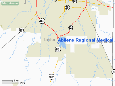
Abilene Rgnl Medical Center Heliport |
Location & QuickFacts
| FAA Information Effective: | 2008-09-25 |
| Airport Identifier: | 4TX1 |
| Airport Status: | Operational |
| Longitude/Latitude: | 099-44-34.3160W/32-22-28.4580N
-99.742866/32.374572 (Estimated) |
| Elevation: | 1800 ft / 548.64 m (Estimated) |
| Land: | 0 acres |
| From nearest city: | 1 nautical miles S of Abilene, TX |
| Location: | Taylor County, TX |
| Magnetic Variation: | 08E (1990) |
Owner & Manager
| Ownership: | Privately owned |
| Owner: | Galen Hospitals Inc |
| Address: | 6250 Hwy 83/84
Abilene, TX 79606 |
| Phone number: | 915-695-9900 |
| Manager: | Dave Collins |
| Address: | 6250 Hwy 83/84
Abilene, TX 79606 |
| Phone number: | 915-695-9900
EXTN 5101. |
Airport Operations and Facilities
| Airport Use: | Private
MEDICAL. |
| Wind indicator: | Yes |
| Segmented Circle: | No |
| Control Tower: | No |
| Lighting Schedule: | PHONE REQ
FOR PERIMETER LGTS CALL 915-695-9900 EXTN 5101. |
| Sectional chart: | Dallas-ft Worth |
| Region: | ASW - Southwest |
| Boundary ARTCC: | ZFW - Fort Worth |
| Tie-in FSS: | FTW - Fort Worth |
| FSS on Airport: | No |
| FSS Phone: | 817-541-3474 |
| FSS Toll Free: | 1-800-WX-BRIEF |
Runway Information
Helipad H1
| Dimension: | 40 x 40 ft / 12.2 x 12.2 m |
| Surface: | CONC, |
| |
Runway H1 |
Runway |
| Traffic Pattern: | Left | Left |
|
Radio Navigation Aids
| ID |
Type |
Name |
Ch |
Freq |
Var |
Dist |
| IEW | NDB | Winters | | 396.00 | 08E | 28.6 nm |
| TMV | NDB | Stamford | | 290.00 | 08E | 29.7 nm |
| COM | NDB | Coleman | | 385.00 | 07E | 36.4 nm |
| SWW | NDB | Sweetwater | | 275.00 | 08E | 37.0 nm |
| UBC | NDB | Ballinger | | 239.00 | 08E | 43.4 nm |
| OIP | NDB | Old Rip | | 410.00 | 07E | 47.4 nm |
| BKD | NDB | Breckenridge | | 245.00 | 07E | 48.6 nm |
| AKL | NDB | Haskell | | 407.00 | 08E | 49.1 nm |
| DYS | TACAN | Dyess | 063X | | 08E | 6.4 nm |
| TQA | VOR/DME | Tuscola | 053X | 111.60 | 10E | 9.2 nm |
| BWD | VOR/DME | Brownwood | 023X | 108.60 | 08E | 49.4 nm |
| ABI | VORTAC | Abilene | 084X | 113.70 | 10E | 8.9 nm |
Images and information placed above are from
http://www.airport-data.com/airport/4TX1/
We thank them for the data!
| General Info
|
| Country |
United States
|
| State |
TEXAS
|
| FAA ID |
4TX1
|
| Latitude |
32-22-28.458N
|
| Longitude |
099-44-34.316W
|
| Elevation |
1800 feet
|
| Near City |
ABILENE
|
We don't guarantee the information is fresh and accurate. The data may
be wrong or outdated.
For more up-to-date information please refer to other sources.
|
|


