 |
|
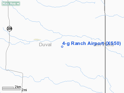
Location & QuickFacts
| FAA Information Effective: | 2008-09-25 |
| Airport Identifier: | XS50 |
| Airport Status: | Operational |
| Longitude/Latitude: | 098-18-36.0290W/27-23-01.1340N
-98.310008/27.383648 (Estimated) |
| Elevation: | 272 ft / 82.91 m (Estimated) |
| Land: | 0 acres |
| From nearest city: | 10 nautical miles W of Premont, TX |
| Location: | Duval County, TX |
| Magnetic Variation: | 07E (1985) |
Owner & Manager
| Ownership: | Privately owned |
| Owner: | C. Gus Glasscock |
| Address: | 14825 St Mary's La, Suite 140
Houston, TX 77079 |
| Phone number: | 713-493-9626 |
| Manager: | C. Gus Glasscock, Jr. |
| Address: | 14825 St Mary's La, Suite 140
Houston, TX 77079 |
| Phone number: | 713-493-9626 |
Airport Operations and Facilities
| Airport Use: | Private |
| Wind indicator: | Yes |
| Segmented Circle: | No |
| Control Tower: | No |
| Landing fee charge: | No |
| Sectional chart: | Brownsville |
| Region: | ASW - Southwest |
| Boundary ARTCC: | ZHU - Houston |
| Tie-in FSS: | SJT - San Angelo |
| FSS on Airport: | No |
| FSS Toll Free: | 1-800-WX-BRIEF |
Airport Services
| Airframe Repair: | NONE |
| Power Plant Repair: | NONE |
Runway Information
Runway 09/27
| Dimension: | 3515 x 100 ft / 1071.4 x 30.5 m |
| Surface: | TURF, |
| |
Runway 09 |
Runway 27 |
| Traffic Pattern: | Left | Left |
|
Runway 13/31
| Dimension: | 3260 x 100 ft / 993.6 x 30.5 m |
| Surface: | TURF, |
| |
Runway 13 |
Runway 31 |
| Traffic Pattern: | Left | Left |
|
Radio Navigation Aids
| ID |
Type |
Name |
Ch |
Freq |
Var |
Dist |
| BKS | NDB | Brooks County | | 353.00 | 06E | 14.6 nm |
| TKB | NDB | Kleberg County | | 347.00 | 06E | 17.9 nm |
| HBV | NDB | Hebbronville | | 266.00 | 06E | 23.2 nm |
| SNE | NDB | Santa Elena | | 260.00 | 07E | 42.4 nm |
| NQI | TACAN | Kingsville | 125X | | 09E | 27.8 nm |
| NOG | TACAN | Orange Grove | 063X | | 09E | 33.9 nm |
| ALI | VOR | Alice | | 114.50 | 06E | 26.4 nm |
Remarks
- CHECK FOR LIVESTOCK ON RWY.
- RUNWAYS ROUGH.
- PRIVATE-LANDING BY PERMISSION ONLY
- MAY BE EXEMPT UNDER GRANDFATHER CLAUSE
Images and information placed above are from
http://www.airport-data.com/airport/XS50/
We thank them for the data!
| General Info
|
| Country |
United States
|
| State |
TEXAS
|
| FAA ID |
XS50
|
| Latitude |
27-23-01.134N
|
| Longitude |
098-18-36.029W
|
| Elevation |
272 feet
|
| Near City |
PREMONT
|
We don't guarantee the information is fresh and accurate. The data may
be wrong or outdated.
For more up-to-date information please refer to other sources.
|
|


