 |
|
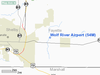
Location & QuickFacts
| FAA Information Effective: | 2008-09-25 |
| Airport Identifier: | 54M |
| Airport Status: | Operational |
| Longitude/Latitude: | 089-34-48.0950W/35-03-14.4850N
-89.580026/35.054024 (Estimated) |
| Elevation: | 310 ft / 94.49 m (Estimated) |
| Land: | 80 acres |
| From nearest city: | 2 nautical miles W of Rossville, TN |
| Location: | Fayette County, TN |
| Magnetic Variation: | 02E (1985) |
Owner & Manager
| Ownership: | Privately owned |
| Owner: | Mary S. Degan |
| Address: | 2799 Scarlet Road
Germantown, TN 38139 |
| Phone number: | 901-853-1558 |
| Manager: | Roy E. Degan Iii |
| Address: | 2799 Scarlet Road
Germantown, TN 38139 |
| Phone number: | 901-853-1558 |
Airport Operations and Facilities
| Airport Use: | Open to public |
| Wind indicator: | Yes |
| Segmented Circle: | Yes |
| Control Tower: | No |
| Landing fee charge: | No |
| Sectional chart: | Memphis |
| Region: | ASO - Southern |
| Boundary ARTCC: | ZME - Memphis |
| Tie-in FSS: | MKL - Jackson |
| FSS on Airport: | No |
| FSS Toll Free: | 1-800-WX-BRIEF |
| NOTAMs Facility: | MKL (NOTAM-d service avaliable) |
Airport Communications
Airport Services
Runway Information
Runway 18/36
| Dimension: | 3106 x 100 ft / 946.7 x 30.5 m |
| Surface: | TURF, Good Condition |
| |
Runway 18 |
Runway 36 |
| Longitude: | 089-34-47.2200W | 089-34-48.9700W |
| Latitude: | 35-03-29.8300N | 35-02-59.1400N |
| Elevation: | 303.00 ft | 305.00 ft |
| Traffic Pattern: | Right | Left |
| Markings: | Nonstandard, Good Condition
RY, THLD, AND DSPLCD THLD MARKED WITH 3 FT WHITE CONE EDGE MARKERS | Nonstandard, Good Condition |
| Displaced threshold: | 1000.00 ft | 0.00 ft |
| Obstruction: | 88 ft trees, 770.0 ft from runway, 20 ft right of centerline, 7:1 slope to clear
APCH RATIO 20:1 FM DSPLCD THLD. | 24 ft trees, 435.0 ft from runway, 13 ft right of centerline, 18:1 slope to clear |
|
Radio Navigation Aids
| ID |
Type |
Name |
Ch |
Freq |
Var |
Dist |
| OLV | NDB | Olive Branch | | 275.00 | 01E | 11.2 nm |
| FYE | NDB | Somerville | | 255.00 | 00E | 13.0 nm |
| MIG | NDB | Millington | | 232.00 | 04E | 22.0 nm |
| ME | NDB | Elvis | | 287.00 | 01E | 24.2 nm |
| SPQ | NDB | Spain | | 414.00 | 04E | 24.8 nm |
| BAV | NDB | Hardeman | | 404.00 | 01E | 28.1 nm |
| COO | NDB | Covington | | 326.00 | 02E | 32.2 nm |
| AWM | NDB | West Memphis | | 362.00 | 01E | 32.5 nm |
| BPW | NDB | Osceola | | 239.00 | 02E | 43.9 nm |
| MKL | VOR/DME | Mc Kellar | 057X | 112.00 | 02E | 46.6 nm |
| GQE | VOR/DME | Gilmore | 077X | 113.00 | 04E | 47.5 nm |
| HLI | VORTAC | Holly Springs | 071X | 112.40 | 03E | 17.5 nm |
| MEM | VORTAC | Memphis | 122X | 117.50 | 01E | 20.0 nm |
| MEM | VOT | Memphis Metropolitn | | 111.00 | | 19.6 nm |
Remarks
Images and information placed above are from
http://www.airport-data.com/airport/54M/
We thank them for the data!
| General Info
|
| Country |
United States
|
| State |
TENNESSEE
|
| FAA ID |
54M
|
| Latitude |
35-03-14.485N
|
| Longitude |
089-34-48.095W
|
| Elevation |
310 feet
|
| Near City |
ROSSVILLE
|
We don't guarantee the information is fresh and accurate. The data may
be wrong or outdated.
For more up-to-date information please refer to other sources.
|
|


