 |
|
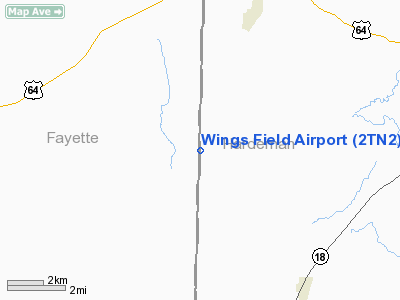
Location & QuickFacts
| FAA Information Effective: | 2008-09-25 |
| Airport Identifier: | 2TN2 |
| Airport Status: | Operational |
| Longitude/Latitude: | 089-11-20.0000W/35-13-25.0000N
-89.188889/35.223611 (Estimated) |
| Elevation: | 540 ft / 164.59 m (Estimated) |
| Land: | 108 acres |
| From nearest city: | 5 nautical miles NW of Hickory Valley, TN |
| Location: | Hardeman County, TN |
| Magnetic Variation: | 01E (1990) |
Owner & Manager
| Ownership: | Privately owned |
| Owner: | Michael Mullins |
| Address: | P.o. Box 381104
Germantown, TN 38183 |
| Phone number: | 901-465-3483 |
| Manager: | Michael Mullins |
| Address: | P.o. Box 381104
Germantown, TN 38183 |
| Phone number: | 901-465-3483 |
Airport Operations and Facilities
| Airport Use: | Private |
| Wind indicator: | Yes |
| Segmented Circle: | No |
| Control Tower: | No |
| Sectional chart: | Memphis |
| Region: | ASO - Southern |
| Boundary ARTCC: | ZME - Memphis |
| Tie-in FSS: | MKL - Jackson |
| FSS on Airport: | No |
| FSS Toll Free: | 1-800-WX-BRIEF |
Runway Information
Runway 18/36
| Dimension: | 2390 x 100 ft / 728.5 x 30.5 m |
| Surface: | TURF,
COND POOR WHEN WET. |
| |
Runway 18 |
Runway 36 |
| Traffic Pattern: | Left | Left |
| Obstruction: | 50 ft trees, 1500.0 ft from runway | 100 ft pline, 3000.0 ft from runway |
|
Radio Navigation Aids
| ID |
Type |
Name |
Ch |
Freq |
Var |
Dist |
| BAV | NDB | Hardeman | | 404.00 | 01E | 7.2 nm |
| FYE | NDB | Somerville | | 255.00 | 00E | 10.1 nm |
| COO | NDB | Covington | | 326.00 | 02E | 29.4 nm |
| OLV | NDB | Olive Branch | | 275.00 | 01E | 32.9 nm |
| SZY | NDB | Sibley | | 386.00 | 01E | 33.0 nm |
| MIG | NDB | Millington | | 232.00 | 04E | 36.7 nm |
| SPQ | NDB | Spain | | 414.00 | 04E | 42.4 nm |
| ME | NDB | Elvis | | 287.00 | 01E | 44.5 nm |
| TGC | NDB | Gibson | | 378.00 | 01E | 45.8 nm |
| DNT | NDB | Nally Dunston | | 343.00 | 01W | 47.6 nm |
| HHY | NDB | Pinhook | | 346.00 | 01W | 48.4 nm |
| BPW | NDB | Osceola | | 239.00 | 02E | 49.2 nm |
| MKL | VOR/DME | Mc Kellar | 057X | 112.00 | 02E | 26.6 nm |
| JKS | VOR/DME | Jacks Creek | 031X | 109.40 | 02E | 46.5 nm |
| HLI | VORTAC | Holly Springs | 071X | 112.40 | 03E | 31.2 nm |
| MEM | VORTAC | Memphis | 122X | 117.50 | 01E | 41.0 nm |
| DYR | VORTAC | Dyersburg | 115X | 116.80 | 03E | 48.2 nm |
| MEM | VOT | Memphis Metropolitn | | 111.00 | | 40.2 nm |
Remarks
Images and information placed above are from
http://www.airport-data.com/airport/2TN2/
We thank them for the data!
| General Info
|
| Country |
United States
|
| State |
TENNESSEE
|
| FAA ID |
2TN2
|
| Latitude |
35-13-25.000N
|
| Longitude |
089-11-20.000W
|
| Elevation |
540 feet
|
| Near City |
HICKORY VALLEY
|
We don't guarantee the information is fresh and accurate. The data may
be wrong or outdated.
For more up-to-date information please refer to other sources.
|
|


