 |
|
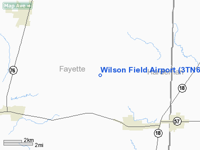
Location & QuickFacts
| FAA Information Effective: | 2008-09-25 |
| Airport Identifier: | 3TN6 |
| Airport Status: | Operational |
| Longitude/Latitude: | 089-16-50.2520W/35-05-48.3180N
-89.280626/35.096755 (Estimated) |
| Elevation: | 435 ft / 132.59 m (Estimated) |
| Land: | 6 acres |
| From nearest city: | 35 nautical miles E of Memphis, TN |
| Location: | Fayette County, TN |
| Magnetic Variation: | 01E (1990) |
Owner & Manager
| Ownership: | Privately owned |
| Owner: | Robert A. Wilson |
| Address: | 8700 Trail Lake Dr West - Suite 300
Memphis, TN 38125 |
| Phone number: | 901-346-8800 |
| Address: |
|
Airport Operations and Facilities
| Airport Use: | Private |
| Wind indicator: | Yes |
| Segmented Circle: | No |
| Control Tower: | No |
| Lighting Schedule: | RDO-CTL
ACTVT MIRL RY 13/31 - CTAF. |
| Sectional chart: | Memphis |
| Region: | ASO - Southern |
| Boundary ARTCC: | ZME - Memphis |
| Tie-in FSS: | MKL - Jackson |
| FSS on Airport: | No |
| FSS Toll Free: | 1-800-WX-BRIEF |
Runway Information
Runway 13/31
| Dimension: | 3000 x 40 ft / 914.4 x 12.2 m |
| Surface: | ASPH-GRVL, |
| Edge Lights: | Medium |
| |
Runway 13 |
Runway 31 |
| Traffic Pattern: | Left | Left |
|
Radio Navigation Aids
| ID |
Type |
Name |
Ch |
Freq |
Var |
Dist |
| FYE | NDB | Somerville | | 255.00 | 00E | 8.6 nm |
| BAV | NDB | Hardeman | | 404.00 | 01E | 13.7 nm |
| OLV | NDB | Olive Branch | | 275.00 | 01E | 26.0 nm |
| COO | NDB | Covington | | 326.00 | 02E | 33.2 nm |
| MIG | NDB | Millington | | 232.00 | 04E | 33.9 nm |
| SPQ | NDB | Spain | | 414.00 | 04E | 38.4 nm |
| SZY | NDB | Sibley | | 386.00 | 01E | 38.5 nm |
| ME | NDB | Elvis | | 287.00 | 01E | 39.0 nm |
| AWM | NDB | West Memphis | | 362.00 | 01E | 46.9 nm |
| MKL | VOR/DME | Mc Kellar | 057X | 112.00 | 02E | 35.5 nm |
| HLI | VORTAC | Holly Springs | 071X | 112.40 | 03E | 22.3 nm |
| MEM | VORTAC | Memphis | 122X | 117.50 | 01E | 34.9 nm |
| MEM | VOT | Memphis Metropolitn | | 111.00 | | 34.5 nm |
Remarks
Images and information placed above are from
http://www.airport-data.com/airport/3TN6/
We thank them for the data!
| General Info
|
| Country |
United States
|
| State |
TENNESSEE
|
| FAA ID |
3TN6
|
| Latitude |
35-05-48.318N
|
| Longitude |
089-16-50.252W
|
| Elevation |
435 feet
|
| Near City |
MEMPHIS
|
We don't guarantee the information is fresh and accurate. The data may
be wrong or outdated.
For more up-to-date information please refer to other sources.
|
|


