 |
|
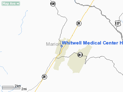
Whitwell Medical Center Heliport |
Location & QuickFacts
| FAA Information Effective: | 2008-09-25 |
| Airport Identifier: | TN42 |
| Airport Status: | Operational |
| Longitude/Latitude: | 085-31-09.8750W/35-12-10.2670N
-85.519410/35.202852 (Estimated) |
| Elevation: | 750 ft / 228.60 m (Estimated) |
| Land: | 0 acres |
| From nearest city: | 1 nautical miles E of Whitwell, TN |
| Location: | Marion County, TN |
| Magnetic Variation: | 01W (1985) |
Owner & Manager
| Ownership: | Privately owned |
| Owner: | Valley View Of Whitwell |
| Address: | 101 North Maple St
Whitwell, TN 37397 |
| Phone number: | 423-837-3242 |
| Manager: | Frank G. Schupp |
| Address: | 101 North Maple St
Whitwell, TN 37397 |
| Phone number: | 423-837-3242 |
Airport Operations and Facilities
| Airport Use: | Private
MEDICAL USE |
| Segmented Circle: | No |
| Control Tower: | No |
| Lighting Schedule: | PHONE REQ
FOR PERIMETER LGTS CALL 615-658-2101. |
| Sectional chart: | Atlanta |
| Region: | ASO - Southern |
| Boundary ARTCC: | ZME - Memphis |
| Tie-in FSS: | BNA - Nashville |
| FSS on Airport: | No |
| FSS Toll Free: | 1-800-WX-BRIEF |
Runway Information
Helipad H1
| Dimension: | 24 x 24 ft / 7.3 x 7.3 m |
| Surface: | CONC, |
| |
Runway H1 |
Runway |
| Traffic Pattern: | Left | Left |
|
Radio Navigation Aids
| ID |
Type |
Name |
Ch |
Freq |
Var |
Dist |
| SYI | FAN MARKER | Bomar | | | 01W | 49.4 nm |
| APT | NDB | Jasper | | 382.00 | 02W | 9.2 nm |
| CQN | NDB | Daisy | | 341.00 | 02W | 17.9 nm |
| UOS | NDB | Sewanee | | 275.00 | 02E | 18.5 nm |
| BGF | NDB | Boiling Fork | | 263.00 | 02W | 27.0 nm |
| HDI | NDB | Hardwick | | 369.00 | 01W | 30.3 nm |
| DTE | NDB | Mark Anton | | 394.00 | 02W | 33.4 nm |
| RN | NDB | Warri | | 209.00 | 02W | 35.1 nm |
| UWI | NDB | Whitfield | | 400.00 | 03W | 37.6 nm |
| ULH | NDB | Burwi | | 332.00 | 03W | 38.7 nm |
| FTP | NDB | Fort Payne | | 426.00 | 01W | 41.7 nm |
| HEM | NDB | Huchn | | 233.00 | 02W | 47.3 nm |
| MMI | NDB | Mc Minn County | | 242.00 | 03W | 48.4 nm |
| SKN | NDB | Hurricane | | 256.00 | 02W | 49.0 nm |
| UXM | VOR | Tullahoma Regional | | 109.65 | 03W | 37.2 nm |
| SYI | VOR/DME | Shelbyville | 027X | 109.00 | 01W | 50.0 nm |
| GQO | VORTAC | Choo Choo | 105X | 115.80 | 01E | 23.1 nm |
| HCH | VORTAC | Hinch Mountain | 123X | 117.60 | 02W | 43.7 nm |
Remarks
- PROVIDING VFR OPS ONLY; APCH RTES 260 OR 110 DEG, DEP RTES 080 OR 290 DEG. EACH RTE 8:1 GRAD. P-LINES & POLES MARKED; TKOF/LNDG MARKED; WIND INDICATOR MAINTAINED.
Images and information placed above are from
http://www.airport-data.com/airport/TN42/
We thank them for the data!
| General Info
|
| Country |
United States
|
| State |
TENNESSEE
|
| FAA ID |
TN42
|
| Latitude |
35-12-10.267N
|
| Longitude |
085-31-09.875W
|
| Elevation |
750 feet
|
| Near City |
WHITWELL
|
We don't guarantee the information is fresh and accurate. The data may
be wrong or outdated.
For more up-to-date information please refer to other sources.
|
|


