 |
|
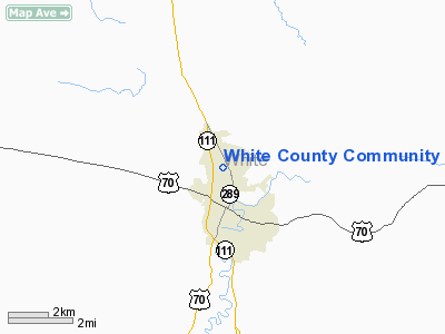
White County Community Hospital Heliport |
Location & QuickFacts
| FAA Information Effective: | 2008-09-25 |
| Airport Identifier: | TN88 |
| Airport Status: | Operational |
| Longitude/Latitude: | 085-28-41.0000W/35-56-58.0000N
-85.478056/35.949444 (Estimated) |
| Elevation: | 1100 ft / 335.28 m (Estimated) |
| Land: | 0 acres |
| From nearest city: | 1 nautical miles N of Sparta, TN |
| Location: | White County, TN |
| Magnetic Variation: | 03W (2000) |
Owner & Manager
| Ownership: | Privately owned |
| Owner: | Community Health Systems, Inc |
| Address: | 155 Franklin Blvd
Brentwood, TN 37027 |
| Phone number: | 615-373-9600 |
| Manager: | Mark Cain |
| Address: | 401 Sewell Road
Sparta, TN 38583 |
| Phone number: | 931-738-4150 |
Airport Operations and Facilities
| Airport Use: | Private |
| Wind indicator: | Yes |
| Segmented Circle: | No |
| Control Tower: | No |
| Sectional chart: | Atlanta |
| Region: | ASO - Southern |
| Boundary ARTCC: | ZME - Memphis |
| Tie-in FSS: | BNA - Nashville |
| FSS Toll Free: | 1-800-WX-BRIEF |
Runway Information
Helipad H1
| Dimension: | 50 x 50 ft / 15.2 x 15.2 m |
| Surface: | CONC, |
| |
Runway H1 |
Runway |
| Traffic Pattern: | Left | Left |
|
Radio Navigation Aids
| ID |
Type |
Name |
Ch |
Freq |
Var |
Dist |
| HEM | NDB | Huchn | | 233.00 | 02W | 5.7 nm |
| SKN | NDB | Hurricane | | 256.00 | 02W | 16.2 nm |
| RN | NDB | Warri | | 209.00 | 02W | 18.3 nm |
| DTE | NDB | Mark Anton | | 394.00 | 02W | 38.8 nm |
| JUE | NDB | Lebanon | | 414.00 | 02W | 43.1 nm |
| FQW | NDB | Walter Hill | | 371.00 | 02W | 43.5 nm |
| LFB | NDB | Lafayette | | 245.00 | 02W | 44.2 nm |
| ULH | NDB | Burwi | | 332.00 | 03W | 47.4 nm |
| SWZ | NDB | Sewart | | 391.00 | 02W | 48.0 nm |
| UOS | NDB | Sewanee | | 275.00 | 02E | 49.2 nm |
| CQN | NDB | Daisy | | 341.00 | 02W | 49.6 nm |
| HCH | VORTAC | Hinch Mountain | 123X | 117.60 | 02W | 26.4 nm |
| LVT | VORTAC | Livingston | 021X | 108.40 | 02W | 41.0 nm |
Remarks
- 160 FT TOWER 750 FT NORTHWEST, 55 FT POWER LINE 300 FT NORTH, 35 FT PARKING LOT LGTS 150 FT NORTHWEST OF HELIPAD.
- PRVDD VFR OPNS, PVT USE, ALL APCH/DEP FROM 030 TO 220 DEGS, AREA IS MKD, WIND INDICATOR IS MAINTAINED.
Images and information placed above are from
http://www.airport-data.com/airport/TN88/
We thank them for the data!
| General Info
|
| Country |
United States
|
| State |
TENNESSEE
|
| FAA ID |
TN88
|
| Latitude |
35-56-58.000N
|
| Longitude |
085-28-41.000W
|
| Elevation |
1100 feet
|
| Near City |
SPARTA
|
We don't guarantee the information is fresh and accurate. The data may
be wrong or outdated.
For more up-to-date information please refer to other sources.
|
|


