 |
|
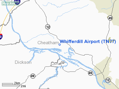
Location & QuickFacts
| FAA Information Effective: | 2008-09-25 |
| Airport Identifier: | TN77 |
| Airport Status: | Operational |
| Longitude/Latitude: | 087-09-02.4000W/36-19-18.6000N
-87.150667/36.321833 (Estimated) |
| Elevation: | 600 ft / 182.88 m (Surveyed) |
| Land: | 0 acres |
| From nearest city: | 1 nautical miles NW of Chapmansboro, TN |
| Location: | Cheatham County, TN |
| Magnetic Variation: | 00W (1985) |
Owner & Manager
| Ownership: | Privately owned |
| Owner: | Whifferdill, Inc. |
| Address: | P.o. Box 167
Chapmansboro, TN 37035 |
| Manager: | Ray Williams |
| Address: | P.o. Box 167
Chapmansboro, TN 37035 |
| Phone number: | 615-792-2762 |
Airport Operations and Facilities
| Airport Use: | Private |
| Wind indicator: | No |
| Segmented Circle: | No |
| Control Tower: | No |
| Landing fee charge: | No |
| Sectional chart: | St Louis |
| Region: | ASO - Southern |
| Boundary ARTCC: | ZME - Memphis |
| Tie-in FSS: | BNA - Nashville |
| FSS on Airport: | No |
| FSS Toll Free: | 1-800-WX-BRIEF |
Runway Information
Runway 02/20
| Dimension: | 3200 x 200 ft / 975.4 x 61.0 m |
| Surface: | TURF, |
| |
Runway 02 |
Runway 20 |
| Traffic Pattern: | Left | Left |
|
Runway 15/33
| Dimension: | 2000 x 100 ft / 609.6 x 30.5 m |
| Surface: | TURF, |
| |
Runway 15 |
Runway 33 |
| Traffic Pattern: | Left | Left |
|
Radio Navigation Aids
| ID |
Type |
Name |
Ch |
Freq |
Var |
Dist |
| ON | NDB | Music | | 279.00 | 03W | 10.8 nm |
| PED | NDB | Needmore | | 221.00 | 01W | 17.1 nm |
| DMZ | NDB | Dickson | | 203.00 | 01W | 18.0 nm |
| VI | NDB | Opery | | 344.00 | 02W | 25.1 nm |
| FK | NDB | Airbe | | 273.00 | 01W | 28.0 nm |
| AEY | NDB | Waverly | | 329.00 | 00E | 31.2 nm |
| HIX | NDB | Honey Grove | | 356.00 | 01W | 34.8 nm |
| SWZ | NDB | Sewart | | 391.00 | 02W | 39.9 nm |
| JUE | NDB | Lebanon | | 414.00 | 02W | 41.3 nm |
| PBC | NDB | Maury County | | 365.00 | 01W | 43.0 nm |
| FQW | NDB | Walter Hill | | 371.00 | 02W | 43.6 nm |
| HXW | TACAN | Screaming Eagle | 096X | | 01W | 27.0 nm |
| CKV | VOR/DME | Clarksville | 043X | 110.60 | 01W | 22.0 nm |
| BNA | VORTAC | Nashville | 088X | 114.10 | 02W | 25.2 nm |
| GHM | VORTAC | Graham | 053X | 111.60 | 03E | 32.8 nm |
| BWG | VORTAC | Bowling Green | 126X | 117.90 | 02E | 49.9 nm |
| BNA | VOT | Nashville Metropoln | | 108.60 | | 25.6 nm |
| MQY | VOT | Smyrna | | 110.20 | | 36.5 nm |
Remarks
- GLIDER ACTIVITY ON & INVOF ARPT DURG DALGT HRS.
- AEROBATIC ACTIVITY 1/2 NM S OF RY.
- VFR USE ONLY.
Images and information placed above are from
http://www.airport-data.com/airport/TN77/
We thank them for the data!
| General Info
|
| Country |
United States
|
| State |
TENNESSEE
|
| FAA ID |
TN77
|
| Latitude |
36-19-18.600N
|
| Longitude |
087-09-02.400W
|
| Elevation |
600 feet
|
| Near City |
CHAPMANSBORO
|
We don't guarantee the information is fresh and accurate. The data may
be wrong or outdated.
For more up-to-date information please refer to other sources.
|
|


