 |
|
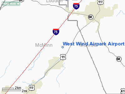
West Wind Airpark Airport |
Location & QuickFacts
| FAA Information Effective: | 2008-09-25 |
| Airport Identifier: | TN64 |
| Airport Status: | Operational |
| Longitude/Latitude: | 084-31-58.0000W/35-32-39.0000N
-84.532778/35.544167 (Estimated) |
| Elevation: | 1000 ft / 304.80 m (Estimated) |
| Land: | 5 acres |
| From nearest city: | 5 nautical miles S of Sweetwater, TN |
| Location: | Monroe County, TN |
| Magnetic Variation: | 03W (1995) |
Owner & Manager
| Ownership: | Privately owned |
| Owner: | Bobby Lewis |
| Address: | 13104 Kingston Pike
Knoxville, TN 37922 |
| Phone number: | 685-675-2103 |
| Manager: | Bobby Lewis |
| Address: | 13104 Kingston Pike
Jnoxville, TN 37922 |
| Phone number: | 685-675-2013 |
Airport Operations and Facilities
| Airport Use: | Private |
| Wind indicator: | Yes |
| Segmented Circle: | No |
| Control Tower: | No |
| Sectional chart: | Atlanta |
| Region: | ASO - Southern |
| Boundary ARTCC: | ZTL - Atlanta |
| Tie-in FSS: | BNA - Nashville |
| FSS Toll Free: | 1-800-WX-BRIEF |
Runway Information
Runway 18/36
| Dimension: | 870 x 50 ft / 265.2 x 15.2 m |
| Surface: | TURF, |
| |
Runway 18 |
Runway 36 |
| Traffic Pattern: | Left | Left |
|
Radio Navigation Aids
| ID |
Type |
Name |
Ch |
Freq |
Var |
Dist |
| MNV | NDB | Madisonville | | 361.00 | 04W | 7.3 nm |
| MMI | NDB | Mc Minn County | | 242.00 | 03W | 9.1 nm |
| DTE | NDB | Mark Anton | | 394.00 | 02W | 19.8 nm |
| HDI | NDB | Hardwick | | 369.00 | 01W | 29.8 nm |
| CQN | NDB | Daisy | | 341.00 | 02W | 38.1 nm |
| TTQ | NDB | Tomotla | | 335.00 | 01W | 38.2 nm |
| UWI | NDB | Whitfield | | 400.00 | 03W | 49.7 nm |
| HCH | VORTAC | Hinch Mountain | 123X | 117.60 | 02W | 26.0 nm |
| VXV | VORTAC | Volunteer | 111X | 116.40 | 03W | 37.9 nm |
| GQO | VORTAC | Choo Choo | 105X | 115.80 | 01E | 46.4 nm |
| HRS | VORTAC | Harris | 035X | 109.80 | 00E | 47.2 nm |
| TYS | VOT | Knoxville | | 112.00 | | 30.9 nm |
Remarks
- PRVDD VFR, PVT USE & BE ALERT FOR MILITARY ACFT INVOF ARPT NEAR CNTRLN VR1052.
Images and information placed above are from
http://www.airport-data.com/airport/TN64/
We thank them for the data!
| General Info
|
| Country |
United States
|
| State |
TENNESSEE
|
| FAA ID |
TN64
|
| Latitude |
35-32-39.000N
|
| Longitude |
084-31-58.000W
|
| Elevation |
1000 feet
|
| Near City |
SWEETWATER
|
We don't guarantee the information is fresh and accurate. The data may
be wrong or outdated.
For more up-to-date information please refer to other sources.
|
|


