 |
|
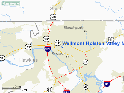
Wellmont Holston Valley Medical Center Heliport |
Location & QuickFacts
| FAA Information Effective: | 2008-09-25 |
| Airport Identifier: | 3TN5 |
| Airport Status: | Operational |
| Longitude/Latitude: | 082-33-12.0000W/36-33-13.0000N
-82.553333/36.553611 (Estimated) |
| Elevation: | 1270 ft / 387.10 m (Surveyed) |
| Land: | 0 acres |
| From nearest city: | 0 nautical miles NE of Kingsport, TN |
| Location: | Sullivan County, TN |
| Magnetic Variation: | 04W (1985) |
Owner & Manager
| Ownership: | Privately owned |
| Owner: | Wellmont Health System |
| Address: | 130 West Ravine Rd
Kingsport, TN 37660 |
| Phone number: | 423-224-5040 |
| Manager: | Jim Moore |
| Address: | 130 West Ravine Rd
Kingsport, TN 37660 |
| Phone number: | 423-224-5040 |
Airport Operations and Facilities
| Airport Use: | Private
MEDICAL USE. |
| Wind indicator: | Yes |
| Segmented Circle: | No |
| Control Tower: | No |
| Lighting Schedule: | PHONE REQ
FOR PERIMETER LIGHTS CALL 423-224-5044. |
| Sectional chart: | Cincinnati |
| Region: | ASO - Southern |
| Boundary ARTCC: | ZTL - Atlanta |
| Tie-in FSS: | BNA - Nashville |
| FSS on Airport: | No |
| FSS Toll Free: | 1-800-WX-BRIEF |
Runway Information
Helipad H1
| Dimension: | 50 x 50 ft / 15.2 x 15.2 m |
| Surface: | CONC, |
| |
Runway H1 |
Runway |
| Traffic Pattern: | Left | Left |
|
Radio Navigation Aids
| ID |
Type |
Name |
Ch |
Freq |
Var |
Dist |
| BO | NDB | Booie | | 221.00 | 04W | 9.7 nm |
| RVN | NDB | Rogersville | | 329.00 | 04W | 17.0 nm |
| EZT | NDB | Elizabethton | | 275.00 | 02W | 19.8 nm |
| LQV | NDB | Long Hollow | | 252.00 | 03W | 26.8 nm |
| DYQ | NDB | Dulaney | | 263.00 | 04W | 29.9 nm |
| VJ | NDB | Whine | | 236.00 | 05W | 31.1 nm |
| JJO | NDB | Mountain City | | 396.00 | 04W | 36.2 nm |
| BAR | NDB | Hemlock | | 320.00 | 02W | 40.5 nm |
| GZG | VOR/DME | Glade Spring | 039X | 110.20 | 02W | 28.1 nm |
| HMV | VORTAC | Holston Mountain | 093X | 114.60 | 04W | 21.6 nm |
Remarks
- PRVDD VFR PVT USE;APCH/DEP OPS 010-085 & 130-180. TKOF/LNDG AREA APROPLY MKD & NON-OBSTRUCTED. WIND INDICATOR MNTND.
Images and information placed above are from
http://www.airport-data.com/airport/3TN5/
We thank them for the data!
| General Info
|
| Country |
United States
|
| State |
TENNESSEE
|
| FAA ID |
3TN5
|
| Latitude |
36-33-13.000N
|
| Longitude |
082-33-12.000W
|
| Elevation |
1270 feet
|
| Near City |
KINGSPORT
|
We don't guarantee the information is fresh and accurate. The data may
be wrong or outdated.
For more up-to-date information please refer to other sources.
|
|


