 |
|
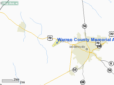
Warren County Memorial Airport |
Location & QuickFacts
| FAA Information Effective: | 2008-09-25 |
| Airport Identifier: | RNC |
| Airport Status: | Operational |
| Longitude/Latitude: | 085-50-37.7420W/35-41-55.3540N
-85.843817/35.698709 (Estimated) |
| Elevation: | 1032 ft / 314.55 m (Surveyed) |
| Land: | 353 acres |
| From nearest city: | 3 nautical miles W of Mc Minnville, TN |
| Location: | Warren County, TN |
| Magnetic Variation: | 02W (1995) |
Owner & Manager
| Ownership: | Publicly owned |
| Owner: | Warren County |
| Address: | Warren County Courthouse, 201 Locust Street
Mcminnville, TN 37110 |
| Phone number: | 931-473-2505 |
| Manager: | James D. Stephens |
| Address: | 4187 Nashville Hwy
Mc Minnville, TN 37110 |
| Phone number: | 931-668-7050 |
Airport Operations and Facilities
| Airport Use: | Open to public |
| Wind indicator: | Yes |
| Segmented Circle: | Yes |
| Control Tower: | No |
| Lighting Schedule: | DUSK-DAWN
MIRL RY 05/23 PRESET ON LOW INTST; TO INCR INTST ACTVT - CTAF. |
| Beacon Color: | Clear-Green (lighted land airport) |
| Landing fee charge: | No |
| Sectional chart: | Atlanta |
| Region: | ASO - Southern |
| Boundary ARTCC: | ZME - Memphis |
| Tie-in FSS: | BNA - Nashville |
| FSS on Airport: | No |
| FSS Toll Free: | 1-800-WX-BRIEF |
| NOTAMs Facility: | BNA (NOTAM-d service avaliable) |
| Federal Agreements: | NGY |
Airport Communications
| CTAF: | 122.800 |
| Unicom: | 122.800 |
Airport Services
| Fuel available: | 100LLA+ |
| Airframe Repair: | MAJOR |
| Power Plant Repair: | MAJOR |
| Bottled Oxygen: | NONE |
| Bulk Oxygen: | NONE |
Runway Information
Runway 05/23
| Dimension: | 5000 x 100 ft / 1524.0 x 30.5 m |
| Surface: | ASPH, Good Condition |
| Weight Limit: | Single wheel: 29000 lbs.
Dual wheel: 48000 lbs. |
| Edge Lights: | Medium |
| |
Runway 05 |
Runway 23 |
| Longitude: | 085-51-01.1640W | 085-50-14.3450W |
| Latitude: | 35-41-39.6170N | 35-42-11.0220N |
| Elevation: | 1032.00 ft | 1027.00 ft |
| Alignment: | 51 | 127 |
| ILS Type: | | LOCALIZER
|
| Traffic Pattern: | Left | Left |
| Markings: | Non-precision instrument, Good Condition | Non-precision instrument, Good Condition |
| Displaced threshold: | 0.00 ft | 290.00 ft |
| VASI: | 4-light PAPI on left side | 4-light PAPI on left side |
| Runway End Identifier: | Yes | Yes |
| Obstruction: | 95 ft trees, 2038.0 ft from runway, 100 ft right of centerline, 19:1 slope to clear | 44 ft trees, 959.0 ft from runway, 228 ft right of centerline, 17:1 slope to clear
RWY 23 RY 23 OBSTN CLNC SLOPE 28:1 AT DSPLCD THLD. |
|
Radio Navigation Aids
| ID |
Type |
Name |
Ch |
Freq |
Var |
Dist |
| SYI | FAN MARKER | Bomar | | | 01W | 33.0 nm |
| RN | NDB | Warri | | 209.00 | 02W | 5.1 nm |
| SKN | NDB | Hurricane | | 256.00 | 02W | 17.2 nm |
| HEM | NDB | Huchn | | 233.00 | 02W | 21.4 nm |
| ULH | NDB | Burwi | | 332.00 | 03W | 24.1 nm |
| UOS | NDB | Sewanee | | 275.00 | 02E | 29.8 nm |
| FQW | NDB | Walter Hill | | 371.00 | 02W | 30.1 nm |
| BGF | NDB | Boiling Fork | | 263.00 | 02W | 33.2 nm |
| SWZ | NDB | Sewart | | 391.00 | 02W | 34.0 nm |
| JUE | NDB | Lebanon | | 414.00 | 02W | 37.5 nm |
| APT | NDB | Jasper | | 382.00 | 02W | 40.5 nm |
| CQN | NDB | Daisy | | 341.00 | 02W | 46.4 nm |
| DTE | NDB | Mark Anton | | 394.00 | 02W | 46.5 nm |
| TNY | NDB | Kelso | | 358.00 | 01W | 48.2 nm |
| LUG | NDB | Verona | | 251.00 | 00W | 48.7 nm |
| VI | NDB | Opery | | 344.00 | 02W | 49.7 nm |
| UXM | VOR | Tullahoma Regional | | 109.65 | 03W | 27.4 nm |
| SYI | VOR/DME | Shelbyville | 027X | 109.00 | 01W | 30.2 nm |
| HCH | VORTAC | Hinch Mountain | 123X | 117.60 | 02W | 42.5 nm |
| BNA | VORTAC | Nashville | 088X | 114.10 | 02W | 48.7 nm |
| MQY | VOT | Smyrna | | 110.20 | | 37.3 nm |
| BNA | VOT | Nashville Metropoln | | 108.60 | | 48.2 nm |
Remarks
- ARPT UNATTENDED CHRISTMAS DAY.
- GCO AVBL ON 121.725 THRU FLIGHT SERVICES.
Images and information placed above are from
http://www.airport-data.com/airport/RNC/
We thank them for the data!
| General Info
|
| Country |
United States
|
| State |
TENNESSEE
|
| FAA ID |
RNC
|
| Latitude |
35-41-55.354N
|
| Longitude |
085-50-37.742W
|
| Elevation |
1032 feet
|
| Near City |
MC MINNVILLE
|
We don't guarantee the information is fresh and accurate. The data may
be wrong or outdated.
For more up-to-date information please refer to other sources.
|
|


