 |
|
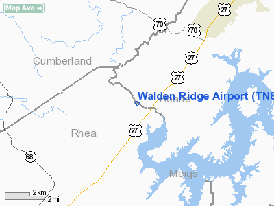
Location & QuickFacts
| FAA Information Effective: | 2008-09-25 |
| Airport Identifier: | TN86 |
| Airport Status: | Operational |
| Longitude/Latitude: | 084-45-47.7930W/35-47-55.2580N
-84.763276/35.798683 (Estimated) |
| Elevation: | 820 ft / 249.94 m (Estimated) |
| Land: | 48 acres |
| From nearest city: | 5 nautical miles SW of Rockwood, TN |
| Location: | Roane County, TN |
| Magnetic Variation: | 02W (1990) |
Owner & Manager
| Ownership: | Privately owned |
| Owner: | Calvin Monroe |
| Address: | 215 Black Cree Rd.
Rockwood, TN 37854 |
| Phone number: | 865-558-6875 |
| Manager: | Calvin Monroe |
| Address: | 215 Black Cree Rd
Rockwood, TN 37854
GUTTERY LN. |
| Phone number: | 865-558-6875 |
Airport Operations and Facilities
| Airport Use: | Private |
| Wind indicator: | No |
| Segmented Circle: | Yes |
| Control Tower: | No |
| Sectional chart: | Atlanta |
| Region: | ASO - Southern |
| Boundary ARTCC: | ZTL - Atlanta |
| Tie-in FSS: | BNA - Nashville |
| FSS on Airport: | No |
| FSS Toll Free: | 1-800-WX-BRIEF |
Airport Communications
Runway Information
Runway 05/23
| Dimension: | 2200 x 50 ft / 670.6 x 15.2 m |
| Surface: | TURF, |
| |
Runway 05 |
Runway 23 |
| Traffic Pattern: | Right | Left |
| Displaced threshold: | 0.00 ft | 50.00 ft |
| Obstruction: | | 10 ft trees, 50.0 ft from runway |
|
Radio Navigation Aids
| ID |
Type |
Name |
Ch |
Freq |
Var |
Dist |
| DTE | NDB | Mark Anton | | 394.00 | 02W | 20.7 nm |
| MNV | NDB | Madisonville | | 361.00 | 04W | 24.0 nm |
| MMI | NDB | Mc Minn County | | 242.00 | 03W | 26.2 nm |
| HDI | NDB | Hardwick | | 369.00 | 01W | 39.4 nm |
| HEM | NDB | Huchn | | 233.00 | 02W | 41.7 nm |
| CQN | NDB | Daisy | | 341.00 | 02W | 42.6 nm |
| JAU | NDB | Jacksboro | | 204.00 | 03W | 43.7 nm |
| BPO | NDB | Piney Grove | | 403.00 | 05W | 46.7 nm |
| RN | NDB | Warri | | 209.00 | 02W | 48.9 nm |
| HCH | VORTAC | Hinch Mountain | 123X | 117.60 | 02W | 10.5 nm |
| VXV | VORTAC | Volunteer | 111X | 116.40 | 03W | 42.8 nm |
| TYS | VOT | Knoxville | | 112.00 | | 37.6 nm |
Remarks
- PRVDD ALL OPNS BE CONDUCTED IN VFR WEATHER CONDITIONS AND LNDG AREA LIMITED TO PVT USE ONLY.
Images and information placed above are from
http://www.airport-data.com/airport/TN86/
We thank them for the data!
| General Info
|
| Country |
United States
|
| State |
TENNESSEE
|
| FAA ID |
TN86
|
| Latitude |
35-47-55.258N
|
| Longitude |
084-45-47.793W
|
| Elevation |
820 feet
|
| Near City |
ROCKWOOD
|
We don't guarantee the information is fresh and accurate. The data may
be wrong or outdated.
For more up-to-date information please refer to other sources.
|
|


