 |
|
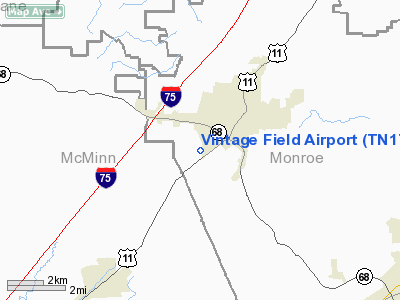
Location & QuickFacts
| FAA Information Effective: | 2008-09-25 |
| Airport Identifier: | TN17 |
| Airport Status: | Operational |
| Longitude/Latitude: | 084-29-16.7460W/35-34-56.2670N
-84.487985/35.582296 (Estimated) |
| Elevation: | 990 ft / 301.75 m (Estimated) |
| Land: | 0 acres |
| From nearest city: | 2 nautical miles SW of Sweetwater, TN |
| Location: | Monroe County, TN |
| Magnetic Variation: | 02W (1985) |
Owner & Manager
| Ownership: | Privately owned |
| Owner: | Charles R Cleveland |
| Address: | 506 Old Athens Pike
Sweetwater, TN 37874 |
| Phone number: | 423-337-7002 |
| Manager: | Charles R Cleveland |
| Address: | 506 Old Athens Pike
Sweetwater, TN 37874 |
| Phone number: | 423-337-7002 |
Airport Operations and Facilities
| Airport Use: | Private |
| Wind indicator: | Yes |
| Segmented Circle: | No |
| Control Tower: | No |
| Sectional chart: | Atlanta |
| Region: | ASO - Southern |
| Boundary ARTCC: | ZTL - Atlanta |
| Tie-in FSS: | BNA - Nashville |
| FSS Toll Free: | 1-800-WX-BRIEF |
Runway Information
Runway 18/36
| Dimension: | 1000 x 75 ft / 304.8 x 22.9 m |
| Surface: | TURF, |
| |
Runway 18 |
Runway 36 |
| Traffic Pattern: | Left | Left |
|
Radio Navigation Aids
| ID |
Type |
Name |
Ch |
Freq |
Var |
Dist |
| MNV | NDB | Madisonville | | 361.00 | 04W | 5.6 nm |
| MMI | NDB | Mc Minn County | | 242.00 | 03W | 11.8 nm |
| DTE | NDB | Mark Anton | | 394.00 | 02W | 22.5 nm |
| HDI | NDB | Hardwick | | 369.00 | 01W | 32.9 nm |
| TTQ | NDB | Tomotla | | 335.00 | 01W | 38.2 nm |
| CQN | NDB | Daisy | | 341.00 | 02W | 41.2 nm |
| JAU | NDB | Jacksboro | | 204.00 | 03W | 48.1 nm |
| HCH | VORTAC | Hinch Mountain | 123X | 117.60 | 02W | 26.8 nm |
| VXV | VORTAC | Volunteer | 111X | 116.40 | 03W | 34.8 nm |
| HRS | VORTAC | Harris | 035X | 109.80 | 00E | 47.6 nm |
| GQO | VORTAC | Choo Choo | 105X | 115.80 | 01E | 49.6 nm |
| TYS | VOT | Knoxville | | 112.00 | | 27.9 nm |
Remarks
- PRVDD ALL OPNS ARE CONDUCTED IN VFR WX CONDITION; LNDG AREA LIMITED TO PRIVATE USE.
Images and information placed above are from
http://www.airport-data.com/airport/TN17/
We thank them for the data!
| General Info
|
| Country |
United States
|
| State |
TENNESSEE
|
| FAA ID |
TN17
|
| Latitude |
35-34-56.267N
|
| Longitude |
084-29-16.746W
|
| Elevation |
990 feet
|
| Near City |
SWEETWATER
|
We don't guarantee the information is fresh and accurate. The data may
be wrong or outdated.
For more up-to-date information please refer to other sources.
|
|


