 |
|
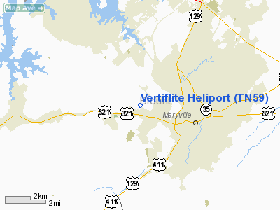
Location & QuickFacts
| FAA Information Effective: | 2008-09-25 |
| Airport Identifier: | TN59 |
| Airport Status: | Operational |
| Longitude/Latitude: | 084-01-29.6620W/35-45-45.2940N
-84.024906/35.762582 (Estimated) |
| Elevation: | 920 ft / 280.42 m (Estimated) |
| Land: | 6 acres |
| From nearest city: | 0 nautical miles N of Maryville, TN |
| Location: | Blount County, TN |
| Magnetic Variation: | 03W (1985) |
Owner & Manager
| Ownership: | Privately owned |
| Owner: | Vertiflite, Inc. |
| Address: | 1503 Old Mount Tabor Rd
Maryville, TN 37801 |
| Phone number: | 615-982-3960 |
| Manager: | Dan Tussey, General Manager |
| Address: | 1503 Old Mount Tabor Rd.
Maryville, TN 37801 |
| Phone number: | 615-982-3960 |
Airport Operations and Facilities
| Airport Use: | Private |
| Wind indicator: | Yes |
| Segmented Circle: | Yes |
| Control Tower: | No |
| Landing fee charge: | No |
| Sectional chart: | Atlanta |
| Region: | ASO - Southern |
| Boundary ARTCC: | ZTL - Atlanta |
| Tie-in FSS: | BNA - Nashville |
| FSS on Airport: | No |
| FSS Toll Free: | 1-800-WX-BRIEF |
Airport Communications
Runway Information
Helipad H1
| Dimension: | 12 x 12 ft / 3.7 x 3.7 m |
| Surface: | CONC, |
| |
Runway H1 |
Runway |
| Traffic Pattern: | Left | Left |
|
Helipad H2
| Dimension: | 12 x 12 ft / 3.7 x 3.7 m |
| Surface: | CONC, |
| |
Runway H2 |
Runway |
| Traffic Pattern: | Left | Left |
|
Helipad H3
| Dimension: | 12 x 12 ft / 3.7 x 3.7 m |
| Surface: | CONC, |
| |
Runway H3 |
Runway |
| Traffic Pattern: | Left | Left |
|
Helipad H4
| Dimension: | 12 x 12 ft / 3.7 x 3.7 m |
| Surface: | CONC, |
| |
Runway H4 |
Runway |
| Traffic Pattern: | Left | Left |
|
Helipad H5
| Dimension: | 12 x 12 ft / 3.7 x 3.7 m |
| Surface: | CONC, |
| |
Runway H5 |
Runway |
| Traffic Pattern: | Left | Left |
|
Helipad H6
| Dimension: | 12 x 12 ft / 3.7 x 3.7 m |
| Surface: | CONC, |
| |
Runway H6 |
Runway |
| Traffic Pattern: | Left | Left |
|
Helipad H7
| Dimension: | 12 x 12 ft / 3.7 x 3.7 m |
| Surface: | CONC, |
| |
Runway H7 |
Runway |
| Traffic Pattern: | Left | Left |
|
Radio Navigation Aids
| ID |
Type |
Name |
Ch |
Freq |
Var |
Dist |
| MNV | NDB | Madisonville | | 361.00 | 04W | 21.8 nm |
| JXT | NDB | Jefferson | | 346.00 | 04W | 33.9 nm |
| MMI | NDB | Mc Minn County | | 242.00 | 03W | 34.3 nm |
| JAU | NDB | Jacksboro | | 204.00 | 03W | 35.2 nm |
| TTQ | NDB | Tomotla | | 335.00 | 01W | 39.0 nm |
| DTE | NDB | Mark Anton | | 394.00 | 02W | 47.4 nm |
| VXV | VORTAC | Volunteer | 111X | 116.40 | 03W | 10.6 nm |
| HCH | VORTAC | Hinch Mountain | 123X | 117.60 | 02W | 46.5 nm |
| SOT | VORTAC | Snowbird | 025X | 108.80 | 04W | 47.5 nm |
| HRS | VORTAC | Harris | 035X | 109.80 | 00E | 49.6 nm |
| TYS | VOT | Knoxville | | 112.00 | | 3.4 nm |
Remarks
- VFR PVT USE COORD USE OF HELI WITH NASHVILLE FSDO COM PROCS & OPNL PATS & PROCS ARE COORD WITH MC GHEE TYSON ATCT.
Images and information placed above are from
http://www.airport-data.com/airport/TN59/
We thank them for the data!
| General Info
|
| Country |
United States
|
| State |
TENNESSEE
|
| FAA ID |
TN59
|
| Latitude |
35-45-45.294N
|
| Longitude |
084-01-29.662W
|
| Elevation |
920 feet
|
| Near City |
MARYVILLE
|
We don't guarantee the information is fresh and accurate. The data may
be wrong or outdated.
For more up-to-date information please refer to other sources.
|
|


