 |
|
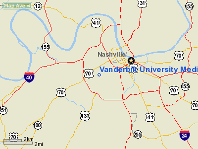
Vanderbilt University Medical Center Heliport |
Location & QuickFacts
| FAA Information Effective: | 2008-09-25 |
| Airport Identifier: | TN35 |
| Airport Status: | Operational |
| Longitude/Latitude: | 086-48-09.9970W/36-08-29.2060N
-86.802777/36.141446 (Estimated) |
| Elevation: | 602 ft / 183.49 m (Estimated) |
| Land: | 0 acres |
| From nearest city: | 2 nautical miles N of Nashville, TN |
| Location: | Davidson County, TN |
| Magnetic Variation: | 02W (2000) |
Owner & Manager
| Ownership: | Privately owned |
| Owner: | Vanderbilt Univ Medical Center |
| Address: | 1211 Med Center Drive, Ste 13200
Nashville, TN 37232-7430 |
| Phone number: | 615-322-3211 |
| Manager: | Jeanne Yeatman |
| Address: | 1211 Med Center Drive
Nashville, TN 37232-7430 |
| Phone number: | 615-936-0770 |
Airport Operations and Facilities
| Airport Use: | Private
MEDICAL. |
| Wind indicator: | Yes |
| Segmented Circle: | No |
| Control Tower: | No |
| Lighting Schedule: | 24 HRS
PERIMETER LGTS OPR SS-SR. |
| Beacon Color: | Clear-Green-Yellow (heliport) |
| Sectional chart: | Atlanta |
| Region: | ASO - Southern |
| Boundary ARTCC: | ZME - Memphis |
| Tie-in FSS: | BNA - Nashville |
| FSS Toll Free: | 1-800-WX-BRIEF |
Airport Communications
Runway Information
Helipad H1
| Dimension: | 85 x 44 ft / 25.9 x 13.4 m |
| Surface: | CONC, Good Condition |
| |
Runway H1 |
Runway |
| Traffic Pattern: | Left | Left |
|
Radio Navigation Aids
| ID |
Type |
Name |
Ch |
Freq |
Var |
Dist |
| SYI | FAN MARKER | Bomar | | | 01W | 42.8 nm |
| VI | NDB | Opery | | 344.00 | 02W | 8.2 nm |
| SWZ | NDB | Sewart | | 391.00 | 02W | 19.9 nm |
| ON | NDB | Music | | 279.00 | 03W | 20.7 nm |
| FQW | NDB | Walter Hill | | 371.00 | 02W | 23.6 nm |
| JUE | NDB | Lebanon | | 414.00 | 02W | 23.9 nm |
| PED | NDB | Needmore | | 221.00 | 01W | 24.4 nm |
| DMZ | NDB | Dickson | | 203.00 | 01W | 30.6 nm |
| PBC | NDB | Maury County | | 365.00 | 01W | 35.0 nm |
| LUG | NDB | Verona | | 251.00 | 00W | 38.5 nm |
| LFB | NDB | Lafayette | | 245.00 | 02W | 42.4 nm |
| AEY | NDB | Waverly | | 329.00 | 00E | 45.6 nm |
| FK | NDB | Airbe | | 273.00 | 01W | 46.4 nm |
| ULH | NDB | Burwi | | 332.00 | 03W | 49.2 nm |
| SKN | NDB | Hurricane | | 256.00 | 02W | 49.2 nm |
| HXW | TACAN | Screaming Eagle | 096X | | 01W | 46.4 nm |
| SYI | VOR/DME | Shelbyville | 027X | 109.00 | 01W | 39.1 nm |
| CKV | VOR/DME | Clarksville | 043X | 110.60 | 01W | 41.3 nm |
| BNA | VORTAC | Nashville | 088X | 114.10 | 02W | 5.7 nm |
| GHM | VORTAC | Graham | 053X | 111.60 | 03E | 36.6 nm |
| BNA | VOT | Nashville Metropoln | | 108.60 | | 5.9 nm |
| MQY | VOT | Smyrna | | 110.20 | | 16.4 nm |
Remarks
- PROVIDING ALL OPS VFR, PVT USE, APP/DEP ROUTES FM 070-170 DEGREES; AREA APPROPRIATELY MARKED; NON-OBSTRUCTING WIND INDICATOR.
Images and information placed above are from
http://www.airport-data.com/airport/TN35/
We thank them for the data!
| General Info
|
| Country |
United States
|
| State |
TENNESSEE
|
| FAA ID |
TN35
|
| Latitude |
36-08-29.206N
|
| Longitude |
086-48-09.997W
|
| Elevation |
602 feet
|
| Near City |
NASHVILLE
|
We don't guarantee the information is fresh and accurate. The data may
be wrong or outdated.
For more up-to-date information please refer to other sources.
|
|


