 |
|
Location & QuickFacts
| FAA Information Effective: | 2008-09-25 |
| Airport Identifier: | 6TN8 |
| Airport Status: | Operational |
| Longitude/Latitude: | 088-06-24.1350W/36-03-17.2150N
-88.106704/36.054782 (Estimated) |
| Elevation: | 438 ft / 133.50 m (Estimated) |
| Land: | 11 acres |
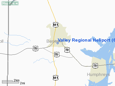
| From nearest city: | 1 nautical miles W of Camden, TN |
| Location: | Benton County, TN |
| Magnetic Variation: | 01W (2000) |
Owner & Manager
| Ownership: | Privately owned |
| Owner: | Camden General Hospital |
| Address: | 175 Hospital Dr
Camden, TN 38320 |
| Phone number: | 731-584-6135 |
| Address: |
|
Airport Operations and Facilities
| Airport Use: | Private
MEDICAL USE. |
| Wind indicator: | Yes |
| Segmented Circle: | No |
| Control Tower: | No |
| Sectional chart: | St Louis |
| Region: | ASO - Southern |
| Boundary ARTCC: | ZME - Memphis |
| Tie-in FSS: | MKL - Jackson |
| FSS Toll Free: | 1-800-WX-BRIEF |
Runway Information
Helipad H1
| Dimension: | 40 x 40 ft / 12.2 x 12.2 m |
| Surface: | TURF, |
| |
Runway H1 |
Runway |
| Traffic Pattern: | Left | Left |
|
Radio Navigation Aids
| ID |
Type |
Name |
Ch |
Freq |
Var |
Dist |
| HZD | NDB | Huntingdon | | 217.00 | 00E | 17.6 nm |
| AEY | NDB | Waverly | | 329.00 | 00E | 18.1 nm |
| TIQ | NDB | Trainer | | 410.00 | 00E | 19.0 nm |
| DMZ | NDB | Dickson | | 203.00 | 01W | 33.0 nm |
| TGC | NDB | Gibson | | 378.00 | 01E | 36.9 nm |
| JHG | NDB | Hohenwald | | 257.00 | 01W | 42.5 nm |
| GGK | NDB | Mayfield | | 401.00 | 00E | 44.9 nm |
| UC | NDB | Obion | | 212.00 | 00E | 45.5 nm |
| HHY | NDB | Pinhook | | 346.00 | 01W | 48.4 nm |
| HXW | TACAN | Screaming Eagle | 096X | | 01W | 47.6 nm |
| JKS | VOR/DME | Jacks Creek | 031X | 109.40 | 02E | 30.0 nm |
| MKL | VOR/DME | Mc Kellar | 057X | 112.00 | 02E | 47.6 nm |
| CKV | VOR/DME | Clarksville | 043X | 110.60 | 01W | 47.9 nm |
| GHM | VORTAC | Graham | 053X | 111.60 | 03E | 34.5 nm |
Remarks
- VFR, PRIVATE USE; OPERATIONS ARE FROM 185 TO 215; AREA IS MARKED; WIND INDICATOR IS MAINTAINED.
Images and information placed above are from
http://www.airport-data.com/airport/6TN8/
We thank them for the data!
| General Info
|
| Country |
United States
|
| State |
TENNESSEE
|
| FAA ID |
6TN8
|
| Latitude |
36-03-17.215N
|
| Longitude |
088-06-24.135W
|
| Elevation |
438 feet
|
| Near City |
CAMDEN
|
We don't guarantee the information is fresh and accurate. The data may
be wrong or outdated.
For more up-to-date information please refer to other sources.
|
|


