 |
|
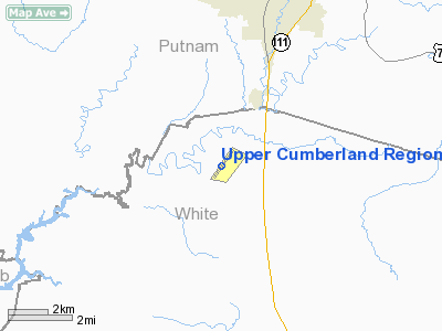
Upper Cumberland Rgnl Airport |
Location & QuickFacts
| FAA Information Effective: | 2008-09-25 |
| Airport Identifier: | SRB |
| Airport Status: | Operational |
| Longitude/Latitude: | 085-31-50.6910W/36-03-21.3580N
-85.530748/36.055933 (Estimated) |
| Elevation: | 1025 ft / 312.42 m (Surveyed) |
| Land: | 343 acres |
| From nearest city: | 9 nautical miles NW of Sparta, TN |
| Location: | White County, TN |
| Magnetic Variation: | 03W (2000) |
Owner & Manager
| Ownership: | Publicly owned |
| Owner: | Upper Cumberland Arpt Auth |
| Address: | 750 Airport Rd
Sparta, TN 38583
ATT HOYTE JONES, CHAIRMAN ARPT AUTHORITY. |
| Phone number: | 931-739-7000 |
| Manager: | Mike Douglas |
| Address: | 750 Airport Rd
Sparta, TN 38583 |
| Phone number: | 931-739-7000
FAX NUMBER FOR MANAGER 931-738-4498 |
Airport Operations and Facilities
| Airport Use: | Open to public |
| Wind indicator: | Yes |
| Segmented Circle: | Yes |
| Control Tower: | No |
| Lighting Schedule: | DUSK-DAWN
ACTVT ODALS RY 04 - CTAF. |
| Beacon Color: | Clear-Green (lighted land airport) |
| Landing fee charge: | No |
| Sectional chart: | St Louis |
| Region: | ASO - Southern |
| Boundary ARTCC: | ZME - Memphis |
| Tie-in FSS: | BNA - Nashville |
| FSS on Airport: | No |
| FSS Toll Free: | 1-800-WX-BRIEF |
| NOTAMs Facility: | BNA (NOTAM-d service avaliable) |
| Federal Agreements: | NGY |
Airport Communications
| CTAF: | 122.800 |
| Unicom: | 122.800 |
Airport Services
| Fuel available: | 100LLA+ |
| Airframe Repair: | MAJOR |
| Power Plant Repair: | MAJOR |
| Bottled Oxygen: | NONE |
| Bulk Oxygen: | NONE |
Runway Information
Runway 04/22
| Dimension: | 6005 x 100 ft / 1830.3 x 30.5 m |
| Surface: | ASPH, Good Condition |
| Weight Limit: | Single wheel: 25000 lbs.
Dual wheel: 37000 lbs. |
| Edge Lights: | High |
| |
Runway 04 |
Runway 22 |
| Longitude: | 085-32-11.5790W | 085-31-29.8030W |
| Latitude: | 36-02-57.0180N | 36-03-45.6990N |
| Elevation: | 1016.00 ft | 1023.00 ft |
| Alignment: | 35 | 127 |
| ILS Type: | ILS/DME
| |
| Traffic Pattern: | Left | Left |
| Markings: | Precision instrument, Good Condition | Precision instrument, Good Condition |
| VASI: | 4-light PAPI on left side | 4-light PAPI on left side |
| Approach lights: | ODALS | |
| Runway End Identifier: | Yes | Yes |
| Obstruction: | 68 ft trees, 2839.0 ft from runway, 326 ft left of centerline, 38:1 slope to clear | , 50:1 slope to clear |
|
Radio Navigation Aids
| ID |
Type |
Name |
Ch |
Freq |
Var |
Dist |
| HEM | NDB | Huchn | | 233.00 | 02W | 4.9 nm |
| SKN | NDB | Hurricane | | 256.00 | 02W | 14.2 nm |
| RN | NDB | Warri | | 209.00 | 02W | 21.5 nm |
| LFB | NDB | Lafayette | | 245.00 | 02W | 37.7 nm |
| JUE | NDB | Lebanon | | 414.00 | 02W | 38.9 nm |
| FQW | NDB | Walter Hill | | 371.00 | 02W | 41.3 nm |
| DTE | NDB | Mark Anton | | 394.00 | 02W | 45.2 nm |
| SWZ | NDB | Sewart | | 391.00 | 02W | 45.8 nm |
| ULH | NDB | Burwi | | 332.00 | 03W | 49.8 nm |
| HCH | VORTAC | Hinch Mountain | 123X | 117.60 | 02W | 31.6 nm |
| LVT | VORTAC | Livingston | 021X | 108.40 | 02W | 36.3 nm |
| MQY | VOT | Smyrna | | 110.20 | | 47.6 nm |
Remarks
- GCO AVBL ON FREQ 121.725 THRU FLIGHT SERVICES.
Images and information placed above are from
http://www.airport-data.com/airport/SRB/
We thank them for the data!
| General Info
|
| Country |
United States
|
| State |
TENNESSEE
|
| FAA ID |
SRB
|
| Latitude |
36-03-21.358N
|
| Longitude |
085-31-50.691W
|
| Elevation |
1025 feet
|
| Near City |
SPARTA
|
We don't guarantee the information is fresh and accurate. The data may
be wrong or outdated.
For more up-to-date information please refer to other sources.
|
|


