 |
|
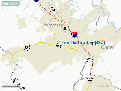
Location & QuickFacts
| FAA Information Effective: | 2008-09-25 |
| Airport Identifier: | TN95 |
| Airport Status: | Operational |
| Longitude/Latitude: | 082-22-59.5070W/36-18-30.3820N
-82.383196/36.308439 (Estimated) |
| Elevation: | 1500 ft / 457.20 m (Estimated) |
| Land: | 1 acres |
| From nearest city: | 0 nautical miles W of Johnson City, TN |
| Location: | Washington County, TN |
| Magnetic Variation: | 04W (1985) |
Owner & Manager
| Ownership: | Publicly owned |
| Owner: | Tennessee Valley Authority |
| Address: | 106 Tri-cities Business Park Dr
Gray, TN 37615 |
| Phone number: | 423-467-3827 |
| Manager: | John G. Hitchcock |
| Address: | 106 Tri-cities Business Park Dr
Gray, TN 37615 |
| Phone number: | 423-467-3827 |
Airport Operations and Facilities
| Airport Use: | Private |
| Wind indicator: | Yes |
| Segmented Circle: | No |
| Control Tower: | No |
| Landing fee charge: | No |
| Sectional chart: | Cincinnati |
| Region: | ASO - Southern |
| Boundary ARTCC: | ZTL - Atlanta |
| Tie-in FSS: | BNA - Nashville |
| FSS on Airport: | No |
| FSS Toll Free: | 1-800-WX-BRIEF |
Runway Information
Helipad H1
| Dimension: | 240 x 100 ft / 73.2 x 30.5 m |
| Surface: | GRAVEL, |
| |
Runway H1 |
Runway |
| Traffic Pattern: | Left | Left |
|
Radio Navigation Aids
| ID |
Type |
Name |
Ch |
Freq |
Var |
Dist |
| MRN | FAN MARKER | Lenoir | | | 03W | 48.0 nm |
| EZT | NDB | Elizabethton | | 275.00 | 02W | 5.5 nm |
| BO | NDB | Booie | | 221.00 | 04W | 7.7 nm |
| RVN | NDB | Rogersville | | 329.00 | 04W | 25.8 nm |
| BAR | NDB | Hemlock | | 320.00 | 02W | 26.1 nm |
| DYQ | NDB | Dulaney | | 263.00 | 04W | 26.7 nm |
| JJO | NDB | Mountain City | | 396.00 | 04W | 27.8 nm |
| VJ | NDB | Whine | | 236.00 | 05W | 33.1 nm |
| LQV | NDB | Long Hollow | | 252.00 | 03W | 41.1 nm |
| FIQ | NDB | Fiddlers | | 391.00 | 07W | 49.9 nm |
| GZG | VOR/DME | Glade Spring | 039X | 110.20 | 02W | 34.4 nm |
| HMV | VORTAC | Holston Mountain | 093X | 114.60 | 04W | 14.5 nm |
| SOT | VORTAC | Snowbird | 025X | 108.80 | 04W | 45.0 nm |
Remarks
Images and information placed above are from
http://www.airport-data.com/airport/TN95/
We thank them for the data!
| General Info
|
| Country |
United States
|
| State |
TENNESSEE
|
| FAA ID |
TN95
|
| Latitude |
36-18-30.382N
|
| Longitude |
082-22-59.507W
|
| Elevation |
1500 feet
|
| Near City |
JOHNSON CITY
|
We don't guarantee the information is fresh and accurate. The data may
be wrong or outdated.
For more up-to-date information please refer to other sources.
|
|


