 |
|
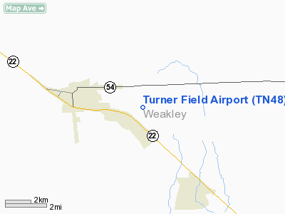
Location & QuickFacts
| FAA Information Effective: | 2008-09-25 |
| Airport Identifier: | TN48 |
| Airport Status: | Operational |
| Longitude/Latitude: | 088-39-13.1970W/36-16-39.2220N
-88.653666/36.277562 (Estimated) |
| Elevation: | 401 ft / 122.22 m (Surveyed) |
| Land: | 8 acres |
| From nearest city: | 3 nautical miles SE of Dresden, TN |
| Location: | Weakley County, TN |
| Magnetic Variation: | 01E (1990) |
Owner & Manager
| Ownership: | Privately owned |
| Owner: | David E Turner |
| Address: | 329 W Main St
Dresden, TN 38225 |
| Phone number: | 901-364-3279 |
| Manager: | David E Turner |
| Address: | 329 W Main St
Dresden, TN 38225 |
| Phone number: | 901-364-3279 |
Airport Operations and Facilities
| Airport Use: | Private |
| Wind indicator: | Yes |
| Segmented Circle: | No |
| Control Tower: | No |
| Sectional chart: | St Louis |
| Region: | ASO - Southern |
| Boundary ARTCC: | ZME - Memphis |
| Tie-in FSS: | MKL - Jackson |
| FSS Toll Free: | 1-800-WX-BRIEF |
Airport Services
Runway Information
Runway 07/25
| Dimension: | 1923 x 40 ft / 586.1 x 12.2 m |
| Surface: | TURF, |
| |
Runway 07 |
Runway 25 |
| Traffic Pattern: | Left | Left |
|
Radio Navigation Aids
| ID |
Type |
Name |
Ch |
Freq |
Var |
Dist |
| TIQ | NDB | Trainer | | 410.00 | 00E | 11.7 nm |
| HZD | NDB | Huntingdon | | 217.00 | 00E | 14.5 nm |
| UC | NDB | Obion | | 212.00 | 00E | 16.6 nm |
| TGC | NDB | Gibson | | 378.00 | 01E | 22.8 nm |
| GGK | NDB | Mayfield | | 401.00 | 00E | 25.0 nm |
| DNT | NDB | Nally Dunston | | 343.00 | 01W | 40.3 nm |
| AEY | NDB | Waverly | | 329.00 | 00E | 45.3 nm |
| CHQ | NDB | Charleston | | 208.00 | 01E | 48.1 nm |
| MKL | VOR/DME | Mc Kellar | 057X | 112.00 | 02E | 42.4 nm |
| JKS | VOR/DME | Jacks Creek | 031X | 109.40 | 02E | 43.2 nm |
| DYR | VORTAC | Dyersburg | 115X | 116.80 | 03E | 35.8 nm |
| CNG | VORTAC | Cunningham | 078X | 113.10 | 03E | 44.8 nm |
Remarks
- PRVDD ALL OPNS ARE CONDUCTED IN VFR WX CONDITIONS AND LNDG ARE LIMITED TO PRIVATE USE.
Images and information placed above are from
http://www.airport-data.com/airport/TN48/
We thank them for the data!
| General Info
|
| Country |
United States
|
| State |
TENNESSEE
|
| FAA ID |
TN48
|
| Latitude |
36-16-39.222N
|
| Longitude |
088-39-13.197W
|
| Elevation |
401 feet
|
| Near City |
DRESDEN
|
We don't guarantee the information is fresh and accurate. The data may
be wrong or outdated.
For more up-to-date information please refer to other sources.
|
|


