 |
|
Tullahoma Rgnl Arpt/wm Northern Field Airport |
| Tullahoma Regional Airport |
| IATA: THA – ICAO: KTHA – FAA LID: THA |
| Summary |
| Airport type |
Public |
| Operator |
City of Tullahoma |
| Location |
Tullahoma, Tennessee |
| Elevation AMSL |
1082 ft / 329.8 m |
| Coordinates |
35°22′48″N 86°14′47″W / 35.38°N 86.24639°W / 35.38; -86.24639Coordinates: 35°22′48″N 86°14′47″W / 35.38°N 86.24639°W / 35.38; -86.24639 |
| Runways |
| Direction |
Length |
Surface |
| ft |
m |
| 18/36 |
5,002 |
1,525 |
Asphalt |
| 6/24 |
5,000 |
1,524 |
Asphalt |
| 9/27 |
2,693 |
821 |
Turf |
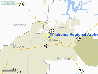
Tullahoma Regional Airport (IATA: THA, ICAO: KTHA) aka William Northern Field is an airport located 2 miles (3.2 km) northwest of the central business district (CBD) of Tullahoma, Tennessee.
The above content comes from Wikipedia and is published under free licenses – click here to read more.
Location & QuickFacts
| FAA Information Effective: | 2008-09-25 |
| Airport Identifier: | THA |
| Airport Status: | Operational |
| Longitude/Latitude: | 086-14-46.8960W/35-22-48.3270N
-86.246360/35.380091 (Estimated) |
| Elevation: | 1082 ft / 329.79 m (Surveyed) |
| Land: | 594 acres |
| From nearest city: | 2 nautical miles NW of Tullahoma, TN |
| Location: | Coffee County, TN |
| Magnetic Variation: | 03W (2005) |
Owner & Manager
| Ownership: | Publicly owned |
| Owner: | City Of Tullahoma |
| Address: | Box 1584
Tullahoma, TN 37388 |
| Manager: | Jon Glass |
| Address: | P.o. Box 1584
Tullahoma, TN 37388
AIRPORT PHYSICAL ADDRESS: 807 WILLIAM NORTHERN BLVD., TULLAHOMA, TN 37388 |
| Phone number: | 931-581-5111 |
Airport Operations and Facilities
| Airport Use: | Open to public |
| Wind indicator: | Yes |
| Segmented Circle: | Yes |
| Control Tower: | No |
| Lighting Schedule: | DUSK-DAWN
ACTVT ODALS RY 18 - CTAF. |
| Beacon Color: | Clear-Green (lighted land airport) |
| Landing fee charge: | No |
| Sectional chart: | Atlanta |
| Region: | ASO - Southern |
| Boundary ARTCC: | ZME - Memphis |
| Tie-in FSS: | BNA - Nashville |
| FSS on Airport: | No |
| FSS Toll Free: | 1-800-WX-BRIEF |
| NOTAMs Facility: | BNA (NOTAM-d service avaliable) |
| Federal Agreements: | N |
Airport Communications
| CTAF: | 123.000 |
| Unicom: | 123.000 |
Airport Services
| Fuel available: | 100 A |
| Airframe Repair: | MAJOR |
| Power Plant Repair: | MAJOR |
| Bottled Oxygen: | NONE |
| Bulk Oxygen: | NONE |
Runway Information
Runway 06/24
| Dimension: | 5000 x 150 ft / 1524.0 x 45.7 m |
| Surface: | ASPH-CONC, Fair Condition |
| |
Runway 06 |
Runway 24 |
| Longitude: | 086-15-15.5600W | 086-14-24.4600W |
| Latitude: | 35-22-42.4700N | 35-23-08.8100N |
| Elevation: | 1082.00 ft | 1077.00 ft |
| Alignment: | 58 | 127 |
| Traffic Pattern: | Left | Left |
| Markings: | Basic, Fair Condition | Basic, Fair Condition |
| Displaced threshold: | 0.00 ft | 502.00 ft |
| Obstruction: | 88 ft tree, 1074.0 ft from runway, 320 ft left of centerline, 9:1 slope to clear | 45 ft tree, 850.0 ft from runway, 139 ft right of centerline, 14:1 slope to clear
OBSTN CLNC SLOPE 30:1 AT DSPLCD THLD. |
|
Runway 09/27
| Dimension: | 2693 x 100 ft / 820.8 x 30.5 m |
| Surface: | TURF, |
| |
Runway 09 |
Runway 27 |
| Longitude: | 086-15-16.2100W | 086-14-43.6900W |
| Latitude: | 35-22-27.0400N | 35-22-27.3900N |
| Elevation: | 1078.00 ft | 1075.00 ft |
| Alignment: | 89 | 127 |
| Traffic Pattern: | Left | Left |
| Obstruction: | 55 ft trees, 1593.0 ft from runway, 36 ft left of centerline, 28:1 slope to clear | 73 ft trees, 1389.0 ft from runway, 86 ft right of centerline, 19:1 slope to clear |
|
Runway 18/36
| Dimension: | 5002 x 100 ft / 1524.6 x 30.5 m |
| Surface: | ASPH-CONC, Good Condition |
| Weight Limit: | Single wheel: 37000 lbs. |
| Edge Lights: | Medium |
| |
Runway 18 |
Runway 36 |
| Longitude: | 086-14-36.8440W | 086-14-36.6700W |
| Latitude: | 35-23-17.1200N | 35-22-27.6500N |
| Elevation: | 1077.00 ft | 1081.00 ft |
| Alignment: | 127 | 0 |
| ILS Type: | SDF
| |
| Traffic Pattern: | Left | Left |
| Markings: | Non-precision instrument, Poor Condition | Non-precision instrument, Poor Condition |
| Crossing Height: | 0.00 ft | 48.00 ft |
| VASI: | 2-light PAPI on left side | 2-light PAPI on left side |
| Visual Glide Angle: | 0.00° | 2.75° |
| Approach lights: | ODALS | |
| Runway End Identifier: | Yes | Yes |
| Obstruction: | 84 ft trees, 1092.0 ft from runway, 281 ft right of centerline, 10:1 slope to clear | 53 ft tree, 1053.0 ft from runway, 45 ft right of centerline, 16:1 slope to clear |
|
Radio Navigation Aids
| ID |
Type |
Name |
Ch |
Freq |
Var |
Dist |
| SYI | FAN MARKER | Bomar | | | 01W | 12.4 nm |
| ULH | NDB | Burwi | | 332.00 | 03W | 4.9 nm |
| BGF | NDB | Boiling Fork | | 263.00 | 02W | 15.0 nm |
| UOS | NDB | Sewanee | | 275.00 | 02E | 20.2 nm |
| TNY | NDB | Kelso | | 358.00 | 01W | 20.7 nm |
| LUG | NDB | Verona | | 251.00 | 00W | 28.5 nm |
| RN | NDB | Warri | | 209.00 | 02W | 32.5 nm |
| FQW | NDB | Walter Hill | | 371.00 | 02W | 35.4 nm |
| SWZ | NDB | Sewart | | 391.00 | 02W | 36.3 nm |
| APT | NDB | Jasper | | 382.00 | 02W | 37.8 nm |
| SKN | NDB | Hurricane | | 256.00 | 02W | 42.1 nm |
| GZS | NDB | Giles/dcmsnd | | 375.00 | 00E | 42.1 nm |
| PBC | NDB | Maury County | | 365.00 | 01W | 43.6 nm |
| CWH | NDB | Capshaw | | 350.00 | 01W | 44.9 nm |
| HUA | NDB | Redstone | | 287.00 | 00W | 46.4 nm |
| HEM | NDB | Huchn | | 233.00 | 02W | 48.7 nm |
| JUE | NDB | Lebanon | | 414.00 | 02W | 48.9 nm |
| SYI | VOR/DME | Shelbyville | 027X | 109.00 | 01W | 14.4 nm |
| RQZ | VORTAC | Rocket | 059X | 112.20 | 02E | 39.9 nm |
| HSV | VOT | Huntsville | | 111.00 | | 35.2 nm |
| MQY | VOT | Smyrna | | 110.20 | | 39.8 nm |
| BNA | VOT | Nashville Metropoln | | 108.60 | | 49.7 nm |
Remarks
- DEER ON & INVOF ARPT.
- EXISTED PRIOR TO 1959
Images and information placed above are from
http://www.airport-data.com/airport/THA/
We thank them for the data!
| General Info
|
| Country |
United States
|
| State |
TENNESSEE
|
| FAA ID |
THA
|
| Latitude |
35-22-48.565N
|
| Longitude |
086-14-45.684W
|
| Elevation |
1082 feet
|
| Near City |
TULLAHOMA
|
We don't guarantee the information is fresh and accurate. The data may
be wrong or outdated.
For more up-to-date information please refer to other sources.
|
|


