 |
|
Location & QuickFacts
| FAA Information Effective: | 2008-09-25 |
| Airport Identifier: | 9TN9 |
| Airport Status: | Operational |
| Longitude/Latitude: | 086-17-17.0000W/36-01-10.0000N
-86.288056/36.019444 (Estimated) |
| Elevation: | 630 ft / 192.02 m (Estimated) |
| Land: | 76 acres |
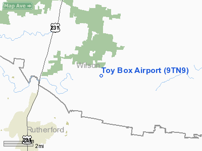
| From nearest city: | 11 nautical miles S of Lebanon, TN |
| Location: | Wilson County, TN |
| Magnetic Variation: | 02W (1995) |
Owner & Manager
| Ownership: | Privately owned |
| Owner: | Ernest Betancourt |
| Address: | 544 Barlow Lane
Lascassas, TN 37085 |
| Phone number: | 615-286-2303 |
| Manager: | Ernest Betancourt |
| Address: | 544 Barlow Lane
Lascassas, TN 37085 |
| Phone number: | 615-286-2303 |
Airport Operations and Facilities
| Airport Use: | Private |
| Wind indicator: | Yes |
| Segmented Circle: | No |
| Control Tower: | No |
| Sectional chart: | St Louis |
| Region: | ASO - Southern |
| Boundary ARTCC: | ZME - Memphis |
| Tie-in FSS: | BNA - Nashville |
| FSS Toll Free: | 1-800-WX-BRIEF |
Runway Information
Runway 06/24
| Dimension: | 1500 x 50 ft / 457.2 x 15.2 m |
| Surface: | TURF, |
| |
Runway 06 |
Runway 24 |
| Traffic Pattern: | Left | Left |
| Markings: | Nonstandard,
RY 06/24 THLDS MKD WITH PANELS. | Nonstandard, |
| Displaced threshold: | 0.00 ft | 300.00 ft
RY 24 DSPLCD THLD MKD WITH PANELS. |
| Obstruction: | 15 ft road, 5.0 ft from runway | |
|
Radio Navigation Aids
| ID |
Type |
Name |
Ch |
Freq |
Var |
Dist |
| SYI | FAN MARKER | Bomar | | | 01W | 33.3 nm |
| FQW | NDB | Walter Hill | | 371.00 | 02W | 5.3 nm |
| SWZ | NDB | Sewart | | 391.00 | 02W | 9.3 nm |
| JUE | NDB | Lebanon | | 414.00 | 02W | 10.5 nm |
| VI | NDB | Opery | | 344.00 | 02W | 20.9 nm |
| SKN | NDB | Hurricane | | 256.00 | 02W | 23.4 nm |
| RN | NDB | Warri | | 209.00 | 02W | 30.1 nm |
| LFB | NDB | Lafayette | | 245.00 | 02W | 31.8 nm |
| ULH | NDB | Burwi | | 332.00 | 03W | 33.6 nm |
| HEM | NDB | Huchn | | 233.00 | 02W | 34.2 nm |
| LUG | NDB | Verona | | 251.00 | 00W | 40.3 nm |
| ON | NDB | Music | | 279.00 | 03W | 42.9 nm |
| PED | NDB | Needmore | | 221.00 | 01W | 43.5 nm |
| PBC | NDB | Maury County | | 365.00 | 01W | 46.3 nm |
| UXM | VOR | Tullahoma Regional | | 109.65 | 03W | 38.5 nm |
| SYI | VOR/DME | Shelbyville | 027X | 109.00 | 01W | 28.5 nm |
| BNA | VORTAC | Nashville | 088X | 114.10 | 02W | 20.5 nm |
| MQY | VOT | Smyrna | | 110.20 | | 10.7 nm |
| BNA | VOT | Nashville Metropoln | | 108.60 | | 20.2 nm |
Remarks
Images and information placed above are from
http://www.airport-data.com/airport/9TN9/
We thank them for the data!
| General Info
|
| Country |
United States
|
| State |
TENNESSEE
|
| FAA ID |
9TN9
|
| Latitude |
36-01-10.000N
|
| Longitude |
086-17-17.000W
|
| Elevation |
630 feet
|
| Near City |
LEBANON
|
We don't guarantee the information is fresh and accurate. The data may
be wrong or outdated.
For more up-to-date information please refer to other sources.
|
|


