 |
|
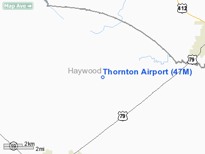
Location & QuickFacts
| FAA Information Effective: | 2008-09-25 |
| Airport Identifier: | 47M |
| Airport Status: | Operational |
| Longitude/Latitude: | 089-12-16.2430W/35-41-07.2720N
-89.204512/35.685353 (Estimated) |
| Elevation: | 351 ft / 106.98 m (Surveyed) |
| Land: | 25 acres |
| From nearest city: | 6 nautical miles NE of Brownsville, TN |
| Location: | Haywood County, TN |
| Magnetic Variation: | 02E (1985) |
Owner & Manager
| Ownership: | Privately owned |
| Owner: | Nick P. Thornton, Iii |
| Address: | 1234 Tabernacle Road
Brownsville, TN 38012 |
| Phone number: | 731-772-2211 |
| Manager: | Nick Thornton |
| Address: | 1234 Tabernacle Road
Brownsville, TN 38012 |
| Phone number: | 731-772-2211 |
Airport Operations and Facilities
| Airport Use: | Open to public |
| Segmented Circle: | No |
| Control Tower: | No |
| Landing fee charge: | No |
| Sectional chart: | Memphis |
| Region: | ASO - Southern |
| Boundary ARTCC: | ZME - Memphis |
| Tie-in FSS: | MKL - Jackson |
| FSS on Airport: | No |
| FSS Toll Free: | 1-800-WX-BRIEF |
| NOTAMs Facility: | MKL (NOTAM-d service avaliable) |
Airport Communications
Airport Services
| Airframe Repair: | NONE |
| Power Plant Repair: | NONE |
Runway Information
Runway 17/35
| Dimension: | 2000 x 150 ft / 609.6 x 45.7 m |
| Surface: | TURF, Poor Condition
NEEDS MOWING & SFC UNEVEN. |
| |
Runway 17 |
Runway 35 |
| Traffic Pattern: | Left | Left |
| Touchdown Lights: | No | No |
| Obstruction: | 68 ft trees, 2875.0 ft from runway, 318 ft left of centerline, 42:1 slope to clear | 53 ft trees, 1249.0 ft from runway, 56 ft left of centerline, 23:1 slope to clear |
|
Radio Navigation Aids
| ID |
Type |
Name |
Ch |
Freq |
Var |
Dist |
| COO | NDB | Covington | | 326.00 | 02E | 19.6 nm |
| DNT | NDB | Nally Dunston | | 343.00 | 01W | 21.0 nm |
| TGC | NDB | Gibson | | 378.00 | 01E | 22.8 nm |
| BAV | NDB | Hardeman | | 404.00 | 01E | 29.4 nm |
| FYE | NDB | Somerville | | 255.00 | 00E | 30.3 nm |
| IUI | NDB | Hicks | | 350.00 | 01E | 34.2 nm |
| UC | NDB | Obion | | 212.00 | 00E | 38.2 nm |
| BPW | NDB | Osceola | | 239.00 | 02E | 39.5 nm |
| SZY | NDB | Sibley | | 386.00 | 01E | 43.2 nm |
| MIG | NDB | Millington | | 232.00 | 04E | 43.2 nm |
| HZD | NDB | Huntingdon | | 217.00 | 00E | 43.3 nm |
| MXA | NDB | Manila | | 282.00 | 01E | 48.1 nm |
| GOJ | VOR | Gosnell | | 111.80 | 01E | 39.3 nm |
| MKL | VOR/DME | Mc Kellar | 057X | 112.00 | 02E | 15.2 nm |
| JKS | VOR/DME | Jacks Creek | 031X | 109.40 | 02E | 41.6 nm |
| DYR | VORTAC | Dyersburg | 115X | 116.80 | 03E | 20.8 nm |
Remarks
- LARGE TREE WEST SIDE OF RWY.
- EXISTED PRIOR TO 1959.
Images and information placed above are from
http://www.airport-data.com/airport/47M/
We thank them for the data!
| General Info
|
| Country |
United States
|
| State |
TENNESSEE
|
| FAA ID |
47M
|
| Latitude |
35-41-07.272N
|
| Longitude |
089-12-16.243W
|
| Elevation |
351 feet
|
| Near City |
BROWNSVILLE
|
We don't guarantee the information is fresh and accurate. The data may
be wrong or outdated.
For more up-to-date information please refer to other sources.
|
|


