 |
|
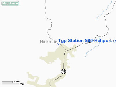
Location & QuickFacts
| FAA Information Effective: | 2008-09-25 |
| Airport Identifier: | 4TN5 |
| Airport Status: | Operational |
| Longitude/Latitude: | 087-26-58.0510W/35-50-52.2380N
-87.449459/35.847844 (Estimated) |
| Elevation: | 760 ft / 231.65 m (Estimated) |
| Land: | 0 acres |
| From nearest city: | 1 nautical miles NW of Fairfield, TN |
| Location: | Hickman County, TN |
| Magnetic Variation: | 00W (1990) |
Owner & Manager
| Ownership: | Privately owned |
| Owner: | Tennessee Gas Pipeline Co |
| Address: | 2775 Hwy 48 N
Nunnelly, TN 37137 |
| Phone number: | 931-729-2817 |
| Manager: | Everett Moss |
| Address: | 2775 Hwy 48 N
Nunnelly, TN 37137 |
| Phone number: | 931-729-2817 |
Airport Operations and Facilities
| Airport Use: | Private |
| Segmented Circle: | No |
| Control Tower: | No |
| Sectional chart: | Atlanta |
| Region: | ASO - Southern |
| Boundary ARTCC: | ZME - Memphis |
| Tie-in FSS: | MKL - Jackson |
| FSS Toll Free: | 1-800-WX-BRIEF |
Runway Information
Helipad H1
| Dimension: | 20 x 20 ft / 6.1 x 6.1 m |
| Surface: | ASPH, |
| |
Runway H1 |
Runway |
| Traffic Pattern: | Left | Left |
|
Radio Navigation Aids
| ID |
Type |
Name |
Ch |
Freq |
Var |
Dist |
| DMZ | NDB | Dickson | | 203.00 | 01W | 16.8 nm |
| AEY | NDB | Waverly | | 329.00 | 00E | 21.5 nm |
| PBC | NDB | Maury County | | 365.00 | 01W | 22.6 nm |
| JHG | NDB | Hohenwald | | 257.00 | 01W | 24.8 nm |
| LUG | NDB | Verona | | 251.00 | 00W | 37.6 nm |
| LRT | NDB | Lawrenceburg | | 269.00 | 00E | 37.9 nm |
| ON | NDB | Music | | 279.00 | 03W | 42.4 nm |
| VI | NDB | Opery | | 344.00 | 02W | 44.2 nm |
| GZS | NDB | Giles/dcmsnd | | 375.00 | 00E | 46.0 nm |
| SWZ | NDB | Sewart | | 391.00 | 02W | 48.4 nm |
| PED | NDB | Needmore | | 221.00 | 01W | 48.8 nm |
| HXW | TACAN | Screaming Eagle | 096X | | 01W | 49.8 nm |
| CKV | VOR/DME | Clarksville | 043X | 110.60 | 01W | 46.6 nm |
| JKS | VOR/DME | Jacks Creek | 031X | 109.40 | 02E | 46.8 nm |
| GHM | VORTAC | Graham | 053X | 111.60 | 03E | 0.8 nm |
| BNA | VORTAC | Nashville | 088X | 114.10 | 02W | 41.0 nm |
| BNA | VOT | Nashville Metropoln | | 108.60 | | 40.9 nm |
| MQY | VOT | Smyrna | | 110.20 | | 46.8 nm |
Remarks
- (E111-1) TKOF/LDG AREA MARKED; WIND IND IS MAINTAINED; & USE 122.8 UNICOM FREQ.
- PRVDD RESTRICTED TO TGP; VFR; PVT USE; APCH ARE 120 DEG, OR R TURN TOWARD HELIPAD ON DESCENT PRIOR TO LOSS OF TRANSITIONAL LIFT. REVERSAL OF THIS INGRESS PROCEDURE APPEARS TO BE THE SAFEST EGRESS WITH CONSIDERATION OF SURFACE WIND EFFECT ON HELICOPTER DURING TKOF & LOW LEVEL OPS.
Images and information placed above are from
http://www.airport-data.com/airport/4TN5/
We thank them for the data!
| General Info
|
| Country |
United States
|
| State |
TENNESSEE
|
| FAA ID |
4TN5
|
| Latitude |
35-50-52.238N
|
| Longitude |
087-26-58.051W
|
| Elevation |
760 feet
|
| Near City |
FAIRFIELD
|
We don't guarantee the information is fresh and accurate. The data may
be wrong or outdated.
For more up-to-date information please refer to other sources.
|
|


