 |
|
Location & QuickFacts
| FAA Information Effective: | 2008-09-25 |
| Airport Identifier: | 5TN0 |
| Airport Status: | Operational |
| Longitude/Latitude: | 087-47-07.0870W/35-46-41.2370N
-87.785302/35.778121 (Estimated) |
| Elevation: | 500 ft / 152.40 m (Estimated) |
| Land: | 0 acres |
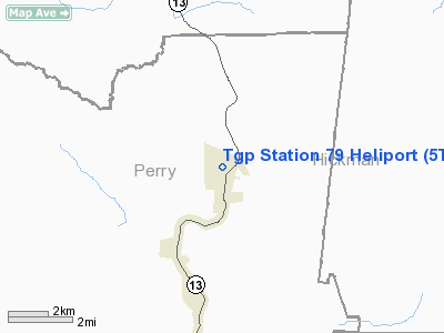
| From nearest city: | 0 nautical miles N of Lobelville, TN |
| Location: | Perry County, TN |
| Magnetic Variation: | 00W (1990) |
Owner & Manager
| Ownership: | Privately owned |
| Owner: | Tennessee Gas Pipeline Co |
| Address: | 434 Tennessee Gas Dr
Lobelville, TN 37097 |
| Phone number: | 901-376-8449 |
| Manager: | James Graves |
| Address: | 434 Tennessee Gas Dr
Lobelville, TN 37097 |
| Phone number: | 901-376-8449 |
Airport Operations and Facilities
| Airport Use: | Private |
| Segmented Circle: | No |
| Control Tower: | No |
| Sectional chart: | Atlanta |
| Region: | ASO - Southern |
| Boundary ARTCC: | ZME - Memphis |
| Tie-in FSS: | MKL - Jackson |
| FSS Toll Free: | 1-800-WX-BRIEF |
Runway Information
Helipad H1
| Dimension: | 150 x 150 ft / 45.7 x 45.7 m |
| Surface: | TURF, |
| |
Runway H1 |
Runway |
| Traffic Pattern: | Left | Left |
|
Radio Navigation Aids
| ID |
Type |
Name |
Ch |
Freq |
Var |
Dist |
| JHG | NDB | Hohenwald | | 257.00 | 01W | 20.4 nm |
| AEY | NDB | Waverly | | 329.00 | 00E | 20.4 nm |
| DMZ | NDB | Dickson | | 203.00 | 01W | 27.1 nm |
| PBC | NDB | Maury County | | 365.00 | 01W | 35.4 nm |
| HHY | NDB | Pinhook | | 346.00 | 01W | 37.6 nm |
| HZD | NDB | Huntingdon | | 217.00 | 00E | 38.1 nm |
| LRT | NDB | Lawrenceburg | | 269.00 | 00E | 41.5 nm |
| TIQ | NDB | Trainer | | 410.00 | 00E | 41.7 nm |
| SZY | NDB | Sibley | | 386.00 | 01E | 48.3 nm |
| JKS | VOR/DME | Jacks Creek | 031X | 109.40 | 02E | 30.0 nm |
| GHM | VORTAC | Graham | 053X | 111.60 | 03E | 16.6 nm |
Remarks
- PRRVDD VFR; PVT USE; TKF/LDG AREA MKD; WIND IND IS MAINTAINED; & OPS RESTRICTED TO TGP HELICOPTERS.
Images and information placed above are from
http://www.airport-data.com/airport/5TN0/
We thank them for the data!
| General Info
|
| Country |
United States
|
| State |
TENNESSEE
|
| FAA ID |
5TN0
|
| Latitude |
35-46-41.237N
|
| Longitude |
087-47-07.087W
|
| Elevation |
500 feet
|
| Near City |
LOBELVILLE
|
We don't guarantee the information is fresh and accurate. The data may
be wrong or outdated.
For more up-to-date information please refer to other sources.
|
|


