 |
|
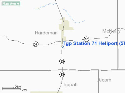
Location & QuickFacts
| FAA Information Effective: | 2008-09-25 |
| Airport Identifier: | 5TN2 |
| Airport Status: | Operational |
| Longitude/Latitude: | 088-53-35.2110W/35-02-00.3180N
-88.893114/35.033422 (Estimated) |
| Elevation: | 440 ft / 134.11 m (Estimated) |
| Land: | 0 acres |
| From nearest city: | 1 nautical miles S of Middleton, TN |
| Location: | Hardeman County, TN |
| Magnetic Variation: | 01E (1990) |
Owner & Manager
| Ownership: | Privately owned |
| Owner: | Tennessee Gas Pipeline Co |
| Address: | 2560 Hwy 125 South
Middleton, TN 38052 |
| Phone number: | 731-376-8449 |
| Manager: | George Weir |
| Address: | 2560 Hwy 125 South
Middleton, TN 38052 |
| Phone number: | 731-376-8449 |
Airport Operations and Facilities
| Airport Use: | Private |
| Segmented Circle: | No |
| Control Tower: | No |
| Sectional chart: | Memphis |
| Region: | ASO - Southern |
| Boundary ARTCC: | ZME - Memphis |
| Tie-in FSS: | MKL - Jackson |
| FSS Toll Free: | 1-800-WX-BRIEF |
Runway Information
Helipad H1
| Dimension: | 40 x 40 ft / 12.2 x 12.2 m |
| Surface: | CONC,
40 FT CIRCLE. |
| |
Runway H1 |
Runway |
| Traffic Pattern: | Left | Left |
|
Radio Navigation Aids
| ID |
Type |
Name |
Ch |
Freq |
Var |
Dist |
| BAV | NDB | Hardeman | | 404.00 | 01E | 13.1 nm |
| SZY | NDB | Sibley | | 386.00 | 01E | 22.2 nm |
| FYE | NDB | Somerville | | 255.00 | 00E | 26.6 nm |
| HHY | NDB | Pinhook | | 346.00 | 01W | 36.4 nm |
| OLV | NDB | Olive Branch | | 275.00 | 01E | 44.2 nm |
| COO | NDB | Covington | | 326.00 | 02E | 47.7 nm |
| MKL | VOR/DME | Mc Kellar | 057X | 112.00 | 02E | 34.3 nm |
| JKS | VOR/DME | Jacks Creek | 031X | 109.40 | 02E | 42.9 nm |
| OTB | VOR/DME | Tupelo | 035X | 109.80 | 04E | 48.9 nm |
| HLI | VORTAC | Holly Springs | 071X | 112.40 | 03E | 33.7 nm |
Remarks
- PRVDD VFR; PVT USE; TKF/LDG AREA MKD; WIND IND IS MAINTAINED; & APCH/DEP RTE OPS FM 350 DEG TO 010 DEG & FM 210 DEG TO 240 DEG.
Images and information placed above are from
http://www.airport-data.com/airport/5TN2/
We thank them for the data!
| General Info
|
| Country |
United States
|
| State |
TENNESSEE
|
| FAA ID |
5TN2
|
| Latitude |
35-02-00.318N
|
| Longitude |
088-53-35.211W
|
| Elevation |
440 feet
|
| Near City |
MIDDLETON
|
We don't guarantee the information is fresh and accurate. The data may
be wrong or outdated.
For more up-to-date information please refer to other sources.
|
|


