 |
|
Location & QuickFacts
| FAA Information Effective: | 2008-09-25 |
| Airport Identifier: | 4TN1 |
| Airport Status: | Operational |
| Longitude/Latitude: | 087-45-28.0980W/35-01-30.3010N
-87.757805/35.025084 (Estimated) |
| Elevation: | 874 ft / 266.40 m (Estimated) |
| Land: | 0 acres |
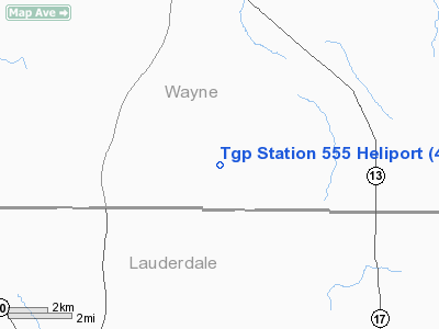
| From nearest city: | 11 nautical miles SW of Collinwood, TN |
| Location: | Wayne County, TN |
| Magnetic Variation: | 00E (1990) |
Owner & Manager
| Ownership: | Privately owned |
| Owner: | Tennessee Gas Pipeline Co. |
| Address: | Box 2160 Hwy 227 W.
Cypress Inn, TN 38452 |
| Phone number: | 901-376-8449 |
| Manager: | James Graves |
| Address: | Box 2160 Hwy 227 W.
Cypress Inn, TN 38452 |
| Phone number: | 901-376-8449 |
Airport Operations and Facilities
| Airport Use: | Private |
| Segmented Circle: | No |
| Control Tower: | No |
| Sectional chart: | Atlanta |
| Region: | ASO - Southern |
| Boundary ARTCC: | ZME - Memphis |
| Tie-in FSS: | MKL - Jackson |
| FSS Toll Free: | 1-800-WX-BRIEF |
Runway Information
Helipad H1
| Dimension: | 30 x 30 ft / 9.1 x 9.1 m |
| Surface: | CONC, |
| |
Runway H1 |
Runway |
| Traffic Pattern: | Left | Left |
|
Radio Navigation Aids
| ID |
Type |
Name |
Ch |
Freq |
Var |
Dist |
| HHY | NDB | Pinhook | | 346.00 | 01W | 25.9 nm |
| JHG | NDB | Hohenwald | | 257.00 | 01W | 27.0 nm |
| LRT | NDB | Lawrenceburg | | 269.00 | 00E | 27.5 nm |
| GZS | NDB | Giles/dcmsnd | | 375.00 | 00E | 35.2 nm |
| SZY | NDB | Sibley | | 386.00 | 01E | 39.4 nm |
| PBC | NDB | Maury County | | 365.00 | 01W | 47.9 nm |
| JKS | VOR/DME | Jacks Creek | 031X | 109.40 | 02E | 45.4 nm |
| DCU | VOR/DME | Decatur | 075X | 112.80 | 01W | 46.3 nm |
| MSL | VORTAC | Muscle Shoals | 112X | 116.50 | 01E | 23.2 nm |
| HSV | VOT | Huntsville | | 111.00 | | 48.6 nm |
Remarks
- PRVDD VFR; PVT USE; APCH/DEP RTE OPS ARE CONDUCTED USING EITHER THE 120 DEG OR 270 DEG RADIAL; TKF/LDG AREA MARKED & WIND INDICATOR IS MAINTAINED.
Images and information placed above are from
http://www.airport-data.com/airport/4TN1/
We thank them for the data!
| General Info
|
| Country |
United States
|
| State |
TENNESSEE
|
| FAA ID |
4TN1
|
| Latitude |
35-01-30.301N
|
| Longitude |
087-45-28.098W
|
| Elevation |
874 feet
|
| Near City |
COLLINWOOD
|
We don't guarantee the information is fresh and accurate. The data may
be wrong or outdated.
For more up-to-date information please refer to other sources.
|
|


