 |
|
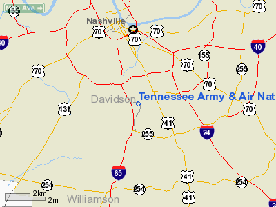
Tennessee Army & Air National Guard Heliport |
Location & QuickFacts
| FAA Information Effective: | 2008-09-25 |
| Airport Identifier: | TN33 |
| Airport Status: | Operational |
| Longitude/Latitude: | 086-45-30.0000W/36-06-06.0000N
-86.758333/36.101667 (Estimated) |
| Elevation: | 590 ft / 179.83 m (Estimated) |
| Land: | 0 acres |
| From nearest city: | 3 nautical miles SW of Nashville, TN |
| Location: | Davidson County, TN |
| Magnetic Variation: | 01W (1985) |
Owner & Manager
| Ownership: | Publicly owned |
| Owner: | Tennessee Army & Air National Guard |
| Address: | 3041 Sidco Drive
Nashville, TN 37204-1502 |
| Phone number: | 615-741-0001 |
| Manager: | Ltc Terry Ethridge
ERIC KEISER 615-355-3965 |
| Address: | Tennessee Army & Air Natl Guard, Saao Bldg 680
Smyrna, TN 37167-2091 |
| Phone number: | 615-355-3735 |
Airport Operations and Facilities
| Airport Use: | Private |
| Wind indicator: | No |
| Segmented Circle: | No |
| Control Tower: | No |
| Landing fee charge: | No |
| Sectional chart: | St Louis |
| Region: | ASO - Southern |
| Boundary ARTCC: | ZME - Memphis |
| Tie-in FSS: | BNA - Nashville |
| FSS on Airport: | No |
| FSS Toll Free: | 1-800-WX-BRIEF |
Airport Services
| Airframe Repair: | NONE |
| Power Plant Repair: | NONE |
Runway Information
Helipad H1
| Dimension: | 300 x 300 ft / 91.4 x 91.4 m |
| Surface: | CONC, |
| Edge Lights: | Low |
| |
Runway H1 |
Runway |
| Traffic Pattern: | Right | Left |
|
Radio Navigation Aids
| ID |
Type |
Name |
Ch |
Freq |
Var |
Dist |
| SYI | FAN MARKER | Bomar | | | 01W | 39.8 nm |
| VI | NDB | Opery | | 344.00 | 02W | 8.0 nm |
| SWZ | NDB | Sewart | | 391.00 | 02W | 16.8 nm |
| FQW | NDB | Walter Hill | | 371.00 | 02W | 20.6 nm |
| JUE | NDB | Lebanon | | 414.00 | 02W | 22.3 nm |
| ON | NDB | Music | | 279.00 | 03W | 23.8 nm |
| PED | NDB | Needmore | | 221.00 | 01W | 27.2 nm |
| DMZ | NDB | Dickson | | 203.00 | 01W | 32.8 nm |
| PBC | NDB | Maury County | | 365.00 | 01W | 33.8 nm |
| LUG | NDB | Verona | | 251.00 | 00W | 36.2 nm |
| LFB | NDB | Lafayette | | 245.00 | 02W | 41.9 nm |
| ULH | NDB | Burwi | | 332.00 | 03W | 46.0 nm |
| SKN | NDB | Hurricane | | 256.00 | 02W | 46.7 nm |
| AEY | NDB | Waverly | | 329.00 | 00E | 47.7 nm |
| FK | NDB | Airbe | | 273.00 | 01W | 49.6 nm |
| HXW | TACAN | Screaming Eagle | 096X | | 01W | 49.6 nm |
| SYI | VOR/DME | Shelbyville | 027X | 109.00 | 01W | 36.0 nm |
| CKV | VOR/DME | Clarksville | 043X | 110.60 | 01W | 44.5 nm |
| BNA | VORTAC | Nashville | 088X | 114.10 | 02W | 4.2 nm |
| GHM | VORTAC | Graham | 053X | 111.60 | 03E | 37.4 nm |
| BNA | VOT | Nashville Metropoln | | 108.60 | | 4.0 nm |
| MQY | VOT | Smyrna | | 110.20 | | 13.4 nm |
Remarks
Images and information placed above are from
http://www.airport-data.com/airport/TN33/
We thank them for the data!
| General Info
|
| Country |
United States
|
| State |
TENNESSEE
|
| FAA ID |
TN33
|
| Latitude |
36-06-06.000N
|
| Longitude |
086-45-30.000W
|
| Elevation |
590 feet
|
| Near City |
NASHVILLE
|
We don't guarantee the information is fresh and accurate. The data may
be wrong or outdated.
For more up-to-date information please refer to other sources.
|
|


