 |
|
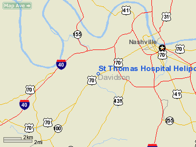
St Thomas Hospital Heliport |
Location & QuickFacts
| FAA Information Effective: | 2008-09-25 |
| Airport Identifier: | TN34 |
| Airport Status: | Operational |
| Longitude/Latitude: | 086-50-37.0000W/36-07-45.2080N
-86.843611/36.129224 (Estimated) |
| Elevation: | 497 ft / 151.49 m (Surveyed) |
| Land: | 0 acres |
| From nearest city: | 0 nautical miles W of Nashville, TN |
| Location: | Davidson County, TN |
| Magnetic Variation: | 00W (1985) |
Owner & Manager
| Ownership: | Privately owned |
| Owner: | St Thomas Hospital |
| Address: | 4220 Harding Road
Nashville, TN 37202 |
| Manager: | David Wheeler |
| Address: | Po Box 380
Nashville, TN 37202 |
| Phone number: | 615-222-2111 |
Airport Operations and Facilities
| Airport Use: | Private
MEDICAL. |
| Wind indicator: | Yes |
| Segmented Circle: | No |
| Control Tower: | No |
| Lighting Schedule: | PHONE REQ
FOR LGTS CALL 618-386-2111. |
| Landing fee charge: | No |
| Sectional chart: | Atlanta |
| Region: | ASO - Southern |
| Boundary ARTCC: | ZME - Memphis |
| Tie-in FSS: | BNA - Nashville |
| FSS on Airport: | No |
| FSS Toll Free: | 1-800-WX-BRIEF |
Runway Information
Helipad H1
| Dimension: | 90 x 75 ft / 27.4 x 22.9 m |
| Surface: | CONC, Good Condition |
| |
Runway H1 |
Runway |
| Traffic Pattern: | Left | Left |
| Markings: | Basic, | , |
|
Radio Navigation Aids
| ID |
Type |
Name |
Ch |
Freq |
Var |
Dist |
| SYI | FAN MARKER | Bomar | | | 01W | 42.9 nm |
| VI | NDB | Opery | | 344.00 | 02W | 10.3 nm |
| ON | NDB | Music | | 279.00 | 03W | 20.6 nm |
| SWZ | NDB | Sewart | | 391.00 | 02W | 21.2 nm |
| PED | NDB | Needmore | | 221.00 | 01W | 24.7 nm |
| FQW | NDB | Walter Hill | | 371.00 | 02W | 25.1 nm |
| JUE | NDB | Lebanon | | 414.00 | 02W | 26.0 nm |
| DMZ | NDB | Dickson | | 203.00 | 01W | 28.6 nm |
| PBC | NDB | Maury County | | 365.00 | 01W | 33.6 nm |
| LUG | NDB | Verona | | 251.00 | 00W | 37.8 nm |
| AEY | NDB | Waverly | | 329.00 | 00E | 43.6 nm |
| LFB | NDB | Lafayette | | 245.00 | 02W | 44.4 nm |
| FK | NDB | Airbe | | 273.00 | 01W | 45.8 nm |
| ULH | NDB | Burwi | | 332.00 | 03W | 49.7 nm |
| HXW | TACAN | Screaming Eagle | 096X | | 01W | 45.5 nm |
| SYI | VOR/DME | Shelbyville | 027X | 109.00 | 01W | 39.4 nm |
| CKV | VOR/DME | Clarksville | 043X | 110.60 | 01W | 40.4 nm |
| BNA | VORTAC | Nashville | 088X | 114.10 | 02W | 7.7 nm |
| GHM | VORTAC | Graham | 053X | 111.60 | 03E | 34.5 nm |
| BNA | VOT | Nashville Metropoln | | 108.60 | | 7.9 nm |
| MQY | VOT | Smyrna | | 110.20 | | 17.9 nm |
Remarks
- VFR ONLY; PVT USE. USE COORD WITH NASHVILLE GADO. CTC METRO BERRY FLD OR MEDCOM HDQTRS ON FREQ 340 FM TO OBTAIN APRVL.
Images and information placed above are from
http://www.airport-data.com/airport/TN34/
We thank them for the data!
| General Info
|
| Country |
United States
|
| State |
TENNESSEE
|
| FAA ID |
TN34
|
| Latitude |
36-07-45.208N
|
| Longitude |
086-50-37.000W
|
| Elevation |
497 feet
|
| Near City |
NASHVILLE
|
We don't guarantee the information is fresh and accurate. The data may
be wrong or outdated.
For more up-to-date information please refer to other sources.
|
|


