 |
|
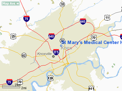
St Mary's Medical Center Heliport |
Location & QuickFacts
| FAA Information Effective: | 2008-09-25 |
| Airport Identifier: | 0TN4 |
| Airport Status: | Operational |
| Longitude/Latitude: | 083-55-39.6640W/35-59-30.2970N
-83.927684/35.991749 (Estimated) |
| Elevation: | 790 ft / 240.79 m (Estimated) |
| Land: | 0 acres |
| From nearest city: | 1 nautical miles N of Knoxville, TN |
| Location: | Knox County, TN |
| Magnetic Variation: | 03W (1985) |
Owner & Manager
| Ownership: | Privately owned |
| Owner: | St Mary's Medical Center |
| Address: | 900 E. Oak Hill Ave
Knoxville, TN 37917 |
| Phone number: | 865-545-7954 |
| Manager: | Dr. Bruce Irwin |
| Address: | St Mary's Medical Center, 900 E. Oak Hill Dr
Knoxville, TN 37917 |
| Phone number: | 865-545-7954 |
Airport Operations and Facilities
| Airport Use: | Private
MEDICAL. |
| Wind indicator: | Yes |
| Segmented Circle: | No |
| Control Tower: | No |
| Lighting Schedule: | PHONE REQ
FOR PERIMETER LGTS CALL 615-545-7896. |
| Sectional chart: | Charlotte |
| Region: | ASO - Southern |
| Boundary ARTCC: | ZTL - Atlanta |
| Tie-in FSS: | BNA - Nashville |
| FSS on Airport: | No |
| FSS Toll Free: | 1-800-WX-BRIEF |
Airport Communications
Runway Information
Helipad H1
| Dimension: | 50 x 50 ft / 15.2 x 15.2 m |
| Surface: | CONC, |
| |
Runway H1 |
Runway |
| Traffic Pattern: | Left | Left |
|
Radio Navigation Aids
| ID |
Type |
Name |
Ch |
Freq |
Var |
Dist |
| JXT | NDB | Jefferson | | 346.00 | 04W | 23.1 nm |
| JAU | NDB | Jacksboro | | 204.00 | 03W | 23.7 nm |
| MNV | NDB | Madisonville | | 361.00 | 04W | 34.8 nm |
| BPO | NDB | Piney Grove | | 403.00 | 05W | 42.3 nm |
| MMI | NDB | Mc Minn County | | 242.00 | 03W | 47.4 nm |
| VXV | VORTAC | Volunteer | 111X | 116.40 | 03W | 5.5 nm |
| SOT | VORTAC | Snowbird | 025X | 108.80 | 04W | 44.3 nm |
| TYS | VOT | Knoxville | | 112.00 | | 11.2 nm |
Remarks
Images and information placed above are from
http://www.airport-data.com/airport/0TN4/
We thank them for the data!
| General Info
|
| Country |
United States
|
| State |
TENNESSEE
|
| FAA ID |
0TN4
|
| Latitude |
35-59-30.297N
|
| Longitude |
083-55-39.664W
|
| Elevation |
790 feet
|
| Near City |
KNOXVILLE
|
We don't guarantee the information is fresh and accurate. The data may
be wrong or outdated.
For more up-to-date information please refer to other sources.
|
|


