 |
|
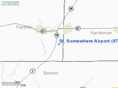
Location & QuickFacts
| FAA Information Effective: | 2008-09-25 |
| Airport Identifier: | 6TN7 |
| Airport Status: | Operational |
| Longitude/Latitude: | 089-12-18.0000W/35-01-26.0000N
-89.205000/35.023889 (Estimated) |
| Elevation: | 550 ft / 167.64 m (Estimated) |
| Land: | 100 acres |
| From nearest city: | 2 nautical miles SW of Grand Junction, TN |
| Location: | Fayette County, TN |
| Magnetic Variation: | 01E (1990) |
Owner & Manager
| Ownership: | Privately owned |
| Owner: | Gordon Harris & Eleanor Morgan |
| Address: | 1120 Smith Dr
Grand Junction, TN 38039 |
| Phone number: | 901-878-1711 |
| Manager: | Gordon Harris & Eleanor Morgan |
| Address: | 1120 Smith Dr
Grand Junction, TN 38039 |
| Phone number: | 901-878-1711 |
Airport Operations and Facilities
| Airport Use: | Private |
| Wind indicator: | Yes |
| Segmented Circle: | No |
| Control Tower: | No |
| Sectional chart: | Memphis |
| Region: | ASO - Southern |
| Boundary ARTCC: | ZME - Memphis |
| Tie-in FSS: | MKL - Jackson |
| FSS on Airport: | No |
| FSS Toll Free: | 1-800-WX-BRIEF |
Runway Information
Runway 08/26
| Dimension: | 3000 x 200 ft / 914.4 x 61.0 m |
| Surface: | TURF, |
| |
Runway 08 |
Runway 26 |
| Traffic Pattern: | Left | Left |
|
Radio Navigation Aids
| ID |
Type |
Name |
Ch |
Freq |
Var |
Dist |
| BAV | NDB | Hardeman | | 404.00 | 01E | 14.0 nm |
| FYE | NDB | Somerville | | 255.00 | 00E | 14.3 nm |
| OLV | NDB | Olive Branch | | 275.00 | 01E | 28.9 nm |
| SZY | NDB | Sibley | | 386.00 | 01E | 36.2 nm |
| COO | NDB | Covington | | 326.00 | 02E | 38.8 nm |
| MIG | NDB | Millington | | 232.00 | 04E | 38.9 nm |
| ME | NDB | Elvis | | 287.00 | 01E | 42.7 nm |
| SPQ | NDB | Spain | | 414.00 | 04E | 43.0 nm |
| MKL | VOR/DME | Mc Kellar | 057X | 112.00 | 02E | 37.7 nm |
| HLI | VORTAC | Holly Springs | 071X | 112.40 | 03E | 21.0 nm |
| MEM | VORTAC | Memphis | 122X | 117.50 | 01E | 38.3 nm |
| MEM | VOT | Memphis Metropolitn | | 111.00 | | 38.1 nm |
Remarks
Images and information placed above are from
http://www.airport-data.com/airport/6TN7/
We thank them for the data!
| General Info
|
| Country |
United States
|
| State |
TENNESSEE
|
| FAA ID |
6TN7
|
| Latitude |
35-01-26.000N
|
| Longitude |
089-12-18.000W
|
| Elevation |
550 feet
|
| Near City |
GRAND JUNCTION
|
We don't guarantee the information is fresh and accurate. The data may
be wrong or outdated.
For more up-to-date information please refer to other sources.
|
|


