 |
|
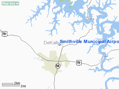
Location & QuickFacts
| FAA Information Effective: | 2008-09-25 |
| Airport Identifier: | 0A3 |
| Airport Status: | Operational |
| Longitude/Latitude: | 085-48-33.5450W/35-59-07.1230N
-85.809318/35.985312 (Estimated) |
| Elevation: | 1084 ft / 330.40 m (Surveyed) |
| Land: | 87 acres |
| From nearest city: | 3 nautical miles NE of Smithville, TN |
| Location: | De Kalb County, TN |
| Magnetic Variation: | 04W (2010) |
Owner & Manager
| Ownership: | Publicly owned |
| Owner: | City Of Smithville |
| Address: | City Hall
Smithville, TN 37166 |
| Phone number: | 615-597-4745 |
| Manager: | Wes Nokes |
| Address: | 338 Airport Lane
Smithville, TN 37166 |
| Phone number: | 615-597-4940 |
Airport Operations and Facilities
| Airport Use: | Open to public |
| Wind indicator: | Yes |
| Segmented Circle: | Yes |
| Control Tower: | No |
| Lighting Schedule: | DUSK-DAWN |
| Beacon Color: | Clear-Green (lighted land airport) |
| Landing fee charge: | No |
| Sectional chart: | Atlanta |
| Region: | ASO - Southern |
| Boundary ARTCC: | ZME - Memphis |
| Tie-in FSS: | BNA - Nashville |
| FSS on Airport: | No |
| FSS Toll Free: | 1-800-WX-BRIEF |
| NOTAMs Facility: | BNA (NOTAM-d service avaliable) |
| Federal Agreements: | NGY |
Airport Communications
| CTAF: | 122.800 |
| Unicom: | 122.800 |
Airport Services
| Airframe Repair: | MAJOR |
| Power Plant Repair: | MAJOR |
| Bottled Oxygen: | NONE |
| Bulk Oxygen: | NONE |
Runway Information
Runway 06/24
| Dimension: | 4107 x 75 ft / 1251.8 x 22.9 m |
| Surface: | ASPH, Good Condition |
| Weight Limit: | Single wheel: 25000 lbs.
Dual wheel: 37000 lbs. |
| Edge Lights: | Medium |
| |
Runway 06 |
Runway 24 |
| Longitude: | 085-48-54.6710W | 085-48-12.4570W |
| Latitude: | 35-58-56.2970N | 35-59-18.0270N |
| Elevation: | 1080.00 ft | 1084.00 ft |
| Alignment: | 58 | 127 |
| Traffic Pattern: | Left | Left |
| Markings: | Basic, Good Condition | Basic, Good Condition |
| Displaced threshold: | 150.00 ft | 0.00 ft |
| VASI: | 2-light PAPI on left side | 2-light PAPI on left side |
| Runway End Identifier: | Yes | Yes |
| Obstruction: | 35 ft trees, 834.0 ft from runway, 167 ft right of centerline, 18:1 slope to clear | 68 ft trees, 2000.0 ft from runway, 100 ft right of centerline, 26:1 slope to clear |
|
Radio Navigation Aids
| ID |
Type |
Name |
Ch |
Freq |
Var |
Dist |
| SYI | FAN MARKER | Bomar | | | 01W | 44.0 nm |
| HEM | NDB | Huchn | | 233.00 | 02W | 10.9 nm |
| RN | NDB | Warri | | 209.00 | 02W | 14.2 nm |
| FQW | NDB | Walter Hill | | 371.00 | 02W | 27.4 nm |
| JUE | NDB | Lebanon | | 414.00 | 02W | 27.5 nm |
| SWZ | NDB | Sewart | | 391.00 | 02W | 31.9 nm |
| LFB | NDB | Lafayette | | 245.00 | 02W | 34.1 nm |
| ULH | NDB | Burwi | | 332.00 | 03W | 37.9 nm |
| VI | NDB | Opery | | 344.00 | 02W | 43.0 nm |
| UOS | NDB | Sewanee | | 275.00 | 02E | 47.1 nm |
| UXM | VOR | Tullahoma Regional | | 109.65 | 03W | 42.1 nm |
| SYI | VOR/DME | Shelbyville | 027X | 109.00 | 01W | 39.9 nm |
| HCH | VORTAC | Hinch Mountain | 123X | 117.60 | 02W | 42.3 nm |
| BNA | VORTAC | Nashville | 088X | 114.10 | 02W | 43.5 nm |
| LVT | VORTAC | Livingston | 021X | 108.40 | 02W | 47.6 nm |
| MQY | VOT | Smyrna | | 110.20 | | 34.0 nm |
| BNA | VOT | Nashville Metropoln | | 108.60 | | 43.2 nm |
Images and information placed above are from
http://www.airport-data.com/airport/0A3/
We thank them for the data!
| General Info
|
| Country |
United States
|
| State |
TENNESSEE
|
| FAA ID |
0A3
|
| Latitude |
35-59-07.123N
|
| Longitude |
085-48-33.545W
|
| Elevation |
1084 feet
|
| Near City |
SMITHVILLE
|
We don't guarantee the information is fresh and accurate. The data may
be wrong or outdated.
For more up-to-date information please refer to other sources.
|
|


