 |
|
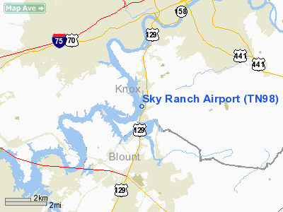
Location & QuickFacts
| FAA Information Effective: | 2008-09-25 |
| Airport Identifier: | TN98 |
| Airport Status: | Operational |
| Longitude/Latitude: | 083-57-27.6610W/35-53-08.2970N
-83.957684/35.885638 (Estimated) |
| Elevation: | 830 ft / 252.98 m (Estimated) |
| Land: | 10 acres |
| From nearest city: | 5 nautical miles S of Knoxville, TN |
| Location: | Knox County, TN |
| Magnetic Variation: | 03W (1985) |
Owner & Manager
| Ownership: | Privately owned |
| Owner: | East Tennessee Pilots Association |
| Address: | 3535 Alcoa Hwy
Knoxville, TN 37920 |
| Phone number: | 615-577-9353 |
| Manager: | East Tennessee Pilots Association |
| Address: | 3535 Alcoa Hwy
Knoxville, TN 37920 |
| Phone number: | 865-577-4466 |
Airport Operations and Facilities
| Airport Use: | Private |
| Wind indicator: | Yes |
| Segmented Circle: | No |
| Control Tower: | No |
| Landing fee charge: | No |
| Sectional chart: | Atlanta |
| Region: | ASO - Southern |
| Boundary ARTCC: | ZTL - Atlanta |
| Tie-in FSS: | BNA - Nashville |
| FSS on Airport: | No |
| FSS Toll Free: | 1-800-WX-BRIEF |
Runway Information
Runway 01/19
| Dimension: | 2100 x 150 ft / 640.1 x 45.7 m |
| Surface: | TURF, |
| Edge Lights: | Low |
| |
Runway 01 |
Runway 19 |
| Traffic Pattern: | Left | Right |
| Obstruction: | 40 ft tree, 1000.0 ft from runway | 20 ft tree, 1000.0 ft from runway |
|
Radio Navigation Aids
| ID |
Type |
Name |
Ch |
Freq |
Var |
Dist |
| JXT | NDB | Jefferson | | 346.00 | 04W | 27.1 nm |
| JAU | NDB | Jacksboro | | 204.00 | 03W | 28.9 nm |
| MNV | NDB | Madisonville | | 361.00 | 04W | 29.2 nm |
| MMI | NDB | Mc Minn County | | 242.00 | 03W | 41.7 nm |
| TTQ | NDB | Tomotla | | 335.00 | 01W | 46.2 nm |
| BPO | NDB | Piney Grove | | 403.00 | 05W | 46.7 nm |
| VXV | VORTAC | Volunteer | 111X | 116.40 | 03W | 3.3 nm |
| SOT | VORTAC | Snowbird | 025X | 108.80 | 04W | 44.5 nm |
| TYS | VOT | Knoxville | | 112.00 | | 4.7 nm |
Remarks
Images and information placed above are from
http://www.airport-data.com/airport/TN98/
We thank them for the data!
| General Info
|
| Country |
United States
|
| State |
TENNESSEE
|
| FAA ID |
TN98
|
| Latitude |
35-53-08.297N
|
| Longitude |
083-57-27.661W
|
| Elevation |
830 feet
|
| Near City |
KNOXVILLE
|
We don't guarantee the information is fresh and accurate. The data may
be wrong or outdated.
For more up-to-date information please refer to other sources.
|
|


