 |
|
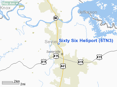
Location & QuickFacts
| FAA Information Effective: | 2008-09-25 |
| Airport Identifier: | 6TN3 |
| Airport Status: | Operational |
| Longitude/Latitude: | 083-34-41.0000W/35-53-45.3210N
-83.578056/35.895922 (Estimated) |
| Elevation: | 1010 ft / 307.85 m (Estimated) |
| Land: | 8 acres |
| From nearest city: | 2 nautical miles N of Sevierville, TN |
| Location: | Sevier County, TN |
| Magnetic Variation: | 03W (1990) |
Owner & Manager
| Ownership: | Privately owned |
| Owner: | Rock A & Bobby W Riggs |
| Address: | 245 Mt Vista Drive
Pigeon Forge, TN 32863 |
| Phone number: | 615-493-2997 |
| Manager: | Rock Riggs |
| Address: | 245 Mt Vista Drive
Pigeon Forge, TN 32863 |
| Phone number: | 615-493-2997 |
Airport Operations and Facilities
| Airport Use: | Private |
| Wind indicator: | Yes |
| Segmented Circle: | No |
| Control Tower: | No |
| Sectional chart: | Atlanta |
| Region: | ASO - Southern |
| Boundary ARTCC: | ZTL - Atlanta |
| Tie-in FSS: | BNA - Nashville |
| FSS on Airport: | No |
| FSS Toll Free: | 1-800-WX-BRIEF |
Runway Information
Helipad H1
| Dimension: | 200 x 200 ft / 61.0 x 61.0 m |
| Surface: | TURF, |
| |
Runway H1 |
Runway |
| Traffic Pattern: | Left | Left |
|
Radio Navigation Aids
| ID |
Type |
Name |
Ch |
Freq |
Var |
Dist |
| JXT | NDB | Jefferson | | 346.00 | 04W | 13.8 nm |
| DYQ | NDB | Dulaney | | 263.00 | 04W | 36.4 nm |
| JAU | NDB | Jacksboro | | 204.00 | 03W | 38.8 nm |
| MNV | NDB | Madisonville | | 361.00 | 04W | 44.6 nm |
| RVN | NDB | Rogersville | | 329.00 | 04W | 47.6 nm |
| VXV | VORTAC | Volunteer | 111X | 116.40 | 03W | 15.4 nm |
| SOT | VORTAC | Snowbird | 025X | 108.80 | 04W | 26.4 nm |
| TYS | VOT | Knoxville | | 112.00 | | 20.8 nm |
Remarks
- VFR; PRIVATE USE ONLY; OPERATIONS CONDUCTED FROM 200 DEGREES TO 340 DEGREES; AREA IS MKD; WIND INDICATOR IS MAINTAINED.
Images and information placed above are from
http://www.airport-data.com/airport/6TN3/
We thank them for the data!
| General Info
|
| Country |
United States
|
| State |
TENNESSEE
|
| FAA ID |
6TN3
|
| Latitude |
35-53-45.321N
|
| Longitude |
083-34-41.000W
|
| Elevation |
1010 feet
|
| Near City |
SEVIERVILLE
|
We don't guarantee the information is fresh and accurate. The data may
be wrong or outdated.
For more up-to-date information please refer to other sources.
|
|


