 |
|
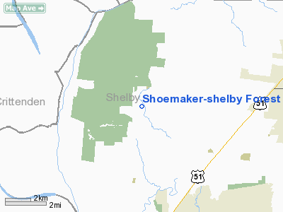
Shoemaker-shelby Forest Airport |
Location & QuickFacts
| FAA Information Effective: | 2008-09-25 |
| Airport Identifier: | 2TN4 |
| Airport Status: | Operational |
| Longitude/Latitude: | 090-02-07.0000W/35-19-05.0000N
-90.035278/35.318056 (Estimated) |
| Elevation: | 335 ft / 102.11 m (Estimated) |
| Land: | 25 acres |
| From nearest city: | 8 nautical miles SW of Millington, TN |
| Location: | Shelby County, TN |
| Magnetic Variation: | 01E (1995) |
Owner & Manager
| Ownership: | Privately owned |
| Owner: | James O'farrell Shoemaker |
| Address: | 847 Chaser Drive
Millington, TN 38053 |
| Phone number: | 901-357-6151 |
| Manager: | James O'farrell Shoemaker |
| Address: | 847 Chaser Drive
Millington, TN 38053 |
| Phone number: | 901-357-6151 |
Airport Operations and Facilities
| Airport Use: | Private |
| Wind indicator: | Yes |
| Segmented Circle: | No |
| Control Tower: | No |
| Sectional chart: | Memphis |
| Region: | ASO - Southern |
| Boundary ARTCC: | ZME - Memphis |
| Tie-in FSS: | MKL - Jackson |
| FSS Toll Free: | 1-800-WX-BRIEF |
Runway Information
Runway 16/34
| Dimension: | 2785 x 40 ft / 848.9 x 12.2 m |
| Surface: | CONC, |
| |
Runway 16 |
Runway 34 |
| Traffic Pattern: | Left | Left |
| Obstruction: | 50 ft trees, 2600.0 ft from runway | 50 ft trees, 2600.0 ft from runway |
|
Radio Navigation Aids
| ID |
Type |
Name |
Ch |
Freq |
Var |
Dist |
| MIG | NDB | Millington | | 232.00 | 04E | 5.5 nm |
| SPQ | NDB | Spain | | 414.00 | 04E | 7.1 nm |
| AWM | NDB | West Memphis | | 362.00 | 01E | 14.5 nm |
| ME | NDB | Elvis | | 287.00 | 01E | 15.5 nm |
| BPW | NDB | Osceola | | 239.00 | 02E | 22.5 nm |
| OLV | NDB | Olive Branch | | 275.00 | 01E | 23.7 nm |
| COO | NDB | Covington | | 326.00 | 02E | 27.3 nm |
| FYE | NDB | Somerville | | 255.00 | 00E | 32.3 nm |
| MXA | NDB | Manila | | 282.00 | 01E | 35.0 nm |
| IUI | NDB | Hicks | | 350.00 | 01E | 38.5 nm |
| FCY | NDB | Forrest City | | 332.00 | 01E | 42.8 nm |
| BAV | NDB | Hardeman | | 404.00 | 01E | 49.1 nm |
| GOJ | VOR | Gosnell | | 111.80 | 01E | 38.3 nm |
| GQE | VOR/DME | Gilmore | 077X | 113.00 | 04E | 21.8 nm |
| JBR | VOR/DME | Jonesboro | 023X | 108.60 | 02E | 43.0 nm |
| MEM | VORTAC | Memphis | 122X | 117.50 | 01E | 18.4 nm |
| HLI | VORTAC | Holly Springs | 071X | 112.40 | 03E | 42.3 nm |
| MEM | VOT | Memphis Metropolitn | | 111.00 | | 16.4 nm |
Remarks
Images and information placed above are from
http://www.airport-data.com/airport/2TN4/
We thank them for the data!
| General Info
|
| Country |
United States
|
| State |
TENNESSEE
|
| FAA ID |
2TN4
|
| Latitude |
35-19-05.000N
|
| Longitude |
090-02-07.000W
|
| Elevation |
335 feet
|
| Near City |
MILLINGTON
|
We don't guarantee the information is fresh and accurate. The data may
be wrong or outdated.
For more up-to-date information please refer to other sources.
|
|


