 |
|
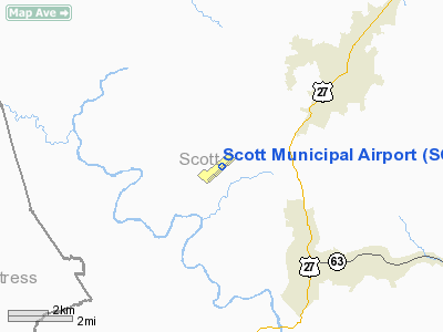
| Scott Municipal Airport |
| IATA: none – ICAO: KSCX – FAA LID: SCX |
| Summary |
| Airport type |
Public |
| Owner |
Scott County |
| Serves |
Oneida, Tennessee |
| Location |
Big South Fork Airpark |
| Elevation AMSL |
1,545 ft / 471 m |
| Coordinates |
36°27′20″N 084°35′08″W / 36.45556°N 84.58556°W / 36.45556; -84.58556 |
| Runways |
| Direction |
Length |
Surface |
| ft |
m |
| 5/23 |
5,502 |
1,677 |
Asphalt |
| Statistics (2004) |
| Aircraft operations |
11,000 |
| Based aircraft |
23 |
| Source: Federal Aviation Administration |
Scott Municipal Airport (ICAO: KSCX, FAA LID: SCX) is a public-use airport located four nautical miles (7 km) southwest of the central business district of Oneida, a city in Scott County, Tennessee, United States. The airport is owned by Scott County. It located adjacent to the Big South Fork Airpark, a gated community and residential airpark.
Although most U.S. airports use the same three-letter location identifier for the FAA and IATA, this airport is assigned SCX by the FAA but has no designation from the IATA (which assigned SCX to Salina Cruz, Oaxaca, Mexico).
Facilities and aircraft
Scott Municipal Airport covers an area of 144 acres (58 ha) at an elevation of 1,545 feet (471 m) above mean sea level. It has one asphalt paved runway designated 5/23 which measures 5,502 by 75 feet (1,677 x 23 m).
For the 12-month period ending October 6, 2004, the airport had 11,000 aircraft operations, an average of 30 per day: 91% general aviation, 5% air taxi and 5% military. At that time there were 23 aircraft based at this airport: 57% single-engine, 39% multi-engine and 4% ultralight.
The above content comes from Wikipedia and is published under free licenses – click here to read more.
Location & QuickFacts
| FAA Information Effective: | 2008-09-25 |
| Airport Identifier: | SCX |
| Airport Status: | Operational |
| Longitude/Latitude: | 084-35-08.7000W/36-27-20.5000N
-84.585750/36.455694 (Estimated) |
| Elevation: | 1545 ft / 470.92 m (Surveyed) |
| Land: | 144 acres |
| From nearest city: | 4 nautical miles SW of Oneida, TN |
| Location: | Scott County, TN |
| Magnetic Variation: | 05W (2005) |
Owner & Manager
| Ownership: | Publicly owned |
| Owner: | Scott County |
| Address: | County Courthouse
Huntsville, TN 37756 |
| Manager: | Mike Douglas |
| Address: | 2263 Airport Rd
Oneida, TN 37841 |
| Phone number: | 423-569-8270 |
Airport Operations and Facilities
| Airport Use: | Open to public |
| Wind indicator: | Yes |
| Segmented Circle: | Yes |
| Control Tower: | No |
| Lighting Schedule: | DUSK-DAWN
MIRL RY 05/23 PRESET MED INTST ONLY. |
| Beacon Color: | Clear-Green (lighted land airport) |
| Landing fee charge: | No |
| Sectional chart: | Cincinnati |
| Region: | ASO - Southern |
| Boundary ARTCC: | ZID - Indianapolis |
| Tie-in FSS: | BNA - Nashville |
| FSS on Airport: | No |
| FSS Toll Free: | 1-800-WX-BRIEF |
| NOTAMs Facility: | BNA (NOTAM-d service avaliable) |
| Federal Agreements: | NGY |
Airport Communications
| CTAF: | 122.800 |
| Unicom: | 122.800 |
Airport Services
| Fuel available: | 100LLA |
| Airframe Repair: | MAJOR |
| Power Plant Repair: | MAJOR |
| Bottled Oxygen: | NONE |
| Bulk Oxygen: | NONE |
Runway Information
Runway 05/23
| Dimension: | 5502 x 75 ft / 1677.0 x 22.9 m |
| Surface: | ASPH, Good Condition |
| Weight Limit: | Single wheel: 28000 lbs.
Dual wheel: 40000 lbs. |
| Edge Lights: | Medium |
| |
Runway 05 |
Runway 23 |
| Longitude: | 084-35-33.1430W | 084-34-44.3360W |
| Latitude: | 36-27-01.7960N | 36-27-39.2850N |
| Elevation: | 1545.00 ft | 1522.00 ft |
| Alignment: | 46 | 127 |
| ILS Type: | | SDF
|
| Traffic Pattern: | Left | Left |
| Markings: | Non-precision instrument, Good Condition | Non-precision instrument, Good Condition |
| Crossing Height: | 0.00 ft | 26.00 ft |
| VASI: | 4-light PAPI on left side | 4-light PAPI on left side |
| Visual Glide Angle: | 0.00° | 3.00° |
| Approach lights: | | ODALS |
| Runway End Identifier: | Yes | Yes |
| Obstruction: | 102 ft trees, 2325.0 ft from runway, 128 ft left of centerline, 21:1 slope to clear | 50 ft trees, 1600.0 ft from runway, 23 ft right of centerline, 28:1 slope to clear |
|
Radio Navigation Aids
| ID |
Type |
Name |
Ch |
Freq |
Var |
Dist |
| BPO | NDB | Piney Grove | | 403.00 | 05W | 7.3 nm |
| JAU | NDB | Jacksboro | | 204.00 | 03W | 21.7 nm |
| EKQ | NDB | Elk Spring | | 290.00 | 03W | 27.3 nm |
| CDX | NDB | Cumberland River | | 388.00 | 05E | 32.8 nm |
| LVT | VORTAC | Livingston | 021X | 108.40 | 02W | 29.1 nm |
| LOZ | VORTAC | London | 108X | 116.10 | 03W | 41.6 nm |
| HCH | VORTAC | Hinch Mountain | 123X | 117.60 | 02W | 44.8 nm |
| VXV | VORTAC | Volunteer | 111X | 116.40 | 03W | 47.1 nm |
| TYS | VOT | Knoxville | | 112.00 | | 48.2 nm |
Images and information placed above are from
http://www.airport-data.com/airport/SCX/
We thank them for the data!
| General Info
|
| Country |
United States
|
| State |
TENNESSEE
|
| FAA ID |
SCX
|
| Latitude |
36-27-20.500N
|
| Longitude |
084-35-08.700W
|
| Elevation |
1545 feet
|
| Near City |
ONEIDA
|
We don't guarantee the information is fresh and accurate. The data may
be wrong or outdated.
For more up-to-date information please refer to other sources.
|
|


