 |
|
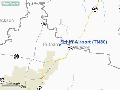
Location & QuickFacts
| FAA Information Effective: | 2008-09-25 |
| Airport Identifier: | TN80 |
| Airport Status: | Operational |
| Longitude/Latitude: | 085-25-34.9020W/36-14-00.2190N
-85.426362/36.233394 (Estimated) |
| Elevation: | 1260 ft / 384.05 m (Surveyed) |
| Land: | 0 acres |
| From nearest city: | 6 nautical miles NE of Cookeville, TN |
| Location: | Putnam County, TN |
| Magnetic Variation: | 02W (1985) |
Owner & Manager
| Ownership: | Privately owned |
| Owner: | Peter Schiff |
| Address: | 4900 Forrest Hill Rd
Cookeville, TN 38501 |
| Phone number: | 615-537-6505 |
| Manager: | Peter Schiff |
| Address: | 4900 Forrest Hill Rd
Cookeville, TN 38501 |
| Phone number: | 615-537-6505 |
Airport Operations and Facilities
| Airport Use: | Private |
| Wind indicator: | Yes |
| Segmented Circle: | No |
| Control Tower: | No |
| Lighting Schedule: | PHONE REQ
FOR LIRL RWY 10/28 CALL 615-537-6505. |
| Landing fee charge: | No |
| Sectional chart: | St Louis |
| Region: | ASO - Southern |
| Boundary ARTCC: | ZME - Memphis |
| Tie-in FSS: | BNA - Nashville |
| FSS on Airport: | No |
| FSS Toll Free: | 1-800-WX-BRIEF |
Airport Communications
Runway Information
Runway 10/28
| Dimension: | 2000 x 32 ft / 609.6 x 9.8 m |
| Surface: | CONC, |
| Edge Lights: | Low |
| |
Runway 10 |
Runway 28 |
| Traffic Pattern: | Left | Left |
| Obstruction: | 50 ft tree, 200.0 ft from runway | |
|
Radio Navigation Aids
| ID |
Type |
Name |
Ch |
Freq |
Var |
Dist |
| HEM | NDB | Huchn | | 233.00 | 02W | 16.7 nm |
| SKN | NDB | Hurricane | | 256.00 | 02W | 23.8 nm |
| RN | NDB | Warri | | 209.00 | 02W | 33.3 nm |
| LFB | NDB | Lafayette | | 245.00 | 02W | 35.1 nm |
| JUE | NDB | Lebanon | | 414.00 | 02W | 43.1 nm |
| EKQ | NDB | Elk Spring | | 290.00 | 03W | 46.6 nm |
| FQW | NDB | Walter Hill | | 371.00 | 02W | 48.7 nm |
| BPO | NDB | Piney Grove | | 403.00 | 05W | 49.5 nm |
| LVT | VORTAC | Livingston | 021X | 108.40 | 02W | 24.6 nm |
| HCH | VORTAC | Hinch Mountain | 123X | 117.60 | 02W | 34.8 nm |
Remarks
Images and information placed above are from
http://www.airport-data.com/airport/TN80/
We thank them for the data!
| General Info
|
| Country |
United States
|
| State |
TENNESSEE
|
| FAA ID |
TN80
|
| Latitude |
36-14-00.219N
|
| Longitude |
085-25-34.902W
|
| Elevation |
1260 feet
|
| Near City |
COOKEVILLE
|
We don't guarantee the information is fresh and accurate. The data may
be wrong or outdated.
For more up-to-date information please refer to other sources.
|
|


