 |
|
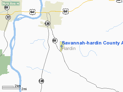
Savannah-hardin County Airport |
Location & QuickFacts
| FAA Information Effective: | 2008-09-25 |
| Airport Identifier: | SNH |
| Airport Status: | Operational |
| Longitude/Latitude: | 088-13-00.2000W/35-10-12.9000N
-88.216722/35.170250 (Estimated) |
| Elevation: | 473 ft / 144.17 m (Surveyed) |
| Land: | 294 acres |
| From nearest city: | 3 nautical miles SE of Savannah, TN |
| Location: | Hardin County, TN |
| Magnetic Variation: | 01W (2000) |
Owner & Manager
| Ownership: | Publicly owned |
| Owner: | City Of Savannah & Hardin Co |
| Address: | City Hall--1020 Main St.
Savannah, TN 38372 |
| Phone number: | 731-925-3300 |
| Manager: | Montille Warren |
| Address: | Route 7 Box 274
Savannah, TN 38372 |
| Phone number: | 731-925-6380 |
Airport Operations and Facilities
| Airport Use: | Open to public |
| Wind indicator: | Yes |
| Segmented Circle: | Yes |
| Control Tower: | No |
| Lighting Schedule: | DUSK-DAWN |
| Beacon Color: | Clear-Green (lighted land airport) |
| Landing fee charge: | No |
| Sectional chart: | Memphis |
| Region: | ASO - Southern |
| Boundary ARTCC: | ZME - Memphis |
| Tie-in FSS: | MKL - Jackson |
| FSS on Airport: | No |
| FSS Toll Free: | 1-800-WX-BRIEF |
| NOTAMs Facility: | MKL (NOTAM-d service avaliable) |
| Federal Agreements: | NGY |
Airport Communications
| CTAF: | 122.800 |
| Unicom: | 122.800 |
Airport Services
| Fuel available: | 100LLA |
| Bottled Oxygen: | NONE |
| Bulk Oxygen: | NONE |
Runway Information
Runway 01/19
| Dimension: | 5000 x 100 ft / 1524.0 x 30.5 m |
| Surface: | CONC, Good Condition |
| Weight Limit: | Single wheel: 45000 lbs.
Dual wheel: 60000 lbs. |
| Edge Lights: | Medium |
| |
Runway 01 |
Runway 19 |
| Longitude: | 088-13-04.1500W | 088-12-56.2800W |
| Latitude: | 35-09-48.4000N | 35-10-37.4200N |
| Elevation: | 472.00 ft | 454.00 ft |
| Alignment: | 8 | 127 |
| ILS Type: | | SDF
|
| Traffic Pattern: | Left | Left |
| Markings: | Non-precision instrument, Good Condition | Non-precision instrument, Good Condition |
| VASI: | 2-box on left side | 2-box on left side |
| Obstruction: | 100 ft tree, 2757.0 ft from runway, 33 ft right of centerline, 25:1 slope to clear | 110 ft trees, 3208.0 ft from runway, 228 ft left of centerline, 27:1 slope to clear
HWY CROSSES CNTRLN EXTENDED. |
|
Radio Navigation Aids
| ID |
Type |
Name |
Ch |
Freq |
Var |
Dist |
| HHY | NDB | Pinhook | | 346.00 | 01W | 5.1 nm |
| SZY | NDB | Sibley | | 386.00 | 01E | 15.2 nm |
| JHG | NDB | Hohenwald | | 257.00 | 01W | 33.7 nm |
| BAV | NDB | Hardeman | | 404.00 | 01E | 40.6 nm |
| LRT | NDB | Lawrenceburg | | 269.00 | 00E | 47.1 nm |
| JKS | VOR/DME | Jacks Creek | 031X | 109.40 | 02E | 26.7 nm |
| MKL | VOR/DME | Mc Kellar | 057X | 112.00 | 02E | 42.8 nm |
| MSL | VORTAC | Muscle Shoals | 112X | 116.50 | 01E | 45.3 nm |
Remarks
Images and information placed above are from
http://www.airport-data.com/airport/SNH/
We thank them for the data!
| General Info
|
| Country |
United States
|
| State |
TENNESSEE
|
| FAA ID |
SNH
|
| Latitude |
35-10-13.296N
|
| Longitude |
088-12-57.132W
|
| Elevation |
473 feet
|
| Near City |
SAVANNAH
|
We don't guarantee the information is fresh and accurate. The data may
be wrong or outdated.
For more up-to-date information please refer to other sources.
|
|


