 |
|
Location & QuickFacts
| FAA Information Effective: | 2008-09-25 |
| Airport Identifier: | 1TN9 |
| Airport Status: | Operational |
| Longitude/Latitude: | 086-08-14.9580W/35-24-45.2800N
-86.137488/35.412578 (Estimated) |
| Elevation: | 1082 ft / 329.79 m (Estimated) |
| Land: | 0 acres |
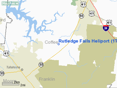
| From nearest city: | 6 nautical miles S of Manchester, TN |
| Location: | Coffee County, TN |
| Magnetic Variation: | 01W (1985) |
Owner & Manager
| Ownership: | Privately owned |
| Owner: | Jerald L. Ritchey |
| Address: | P.o. Box 485/321 Marbeth Lane
Tullahoma, TN 37388 |
| Phone number: | 615-455-0494 |
| Address: |
|
Airport Operations and Facilities
| Airport Use: | Private |
| Segmented Circle: | No |
| Control Tower: | No |
| Sectional chart: | Atlanta |
| Region: | ASO - Southern |
| Boundary ARTCC: | ZME - Memphis |
| Tie-in FSS: | BNA - Nashville |
| FSS Toll Free: | 1-800-WX-BRIEF |
Runway Information
Helipad H1
| Dimension: | 100 x 100 ft / 30.5 x 30.5 m |
| Surface: | TURF, |
| |
Runway H1 |
Runway |
| Traffic Pattern: | Left | Left |
|
Radio Navigation Aids
| ID |
Type |
Name |
Ch |
Freq |
Var |
Dist |
| SYI | FAN MARKER | Bomar | | | 01W | 16.6 nm |
| ULH | NDB | Burwi | | 332.00 | 03W | 5.9 nm |
| BGF | NDB | Boiling Fork | | 263.00 | 02W | 14.5 nm |
| UOS | NDB | Sewanee | | 275.00 | 02E | 17.2 nm |
| TNY | NDB | Kelso | | 358.00 | 01W | 26.0 nm |
| RN | NDB | Warri | | 209.00 | 02W | 27.4 nm |
| LUG | NDB | Verona | | 251.00 | 00W | 33.3 nm |
| APT | NDB | Jasper | | 382.00 | 02W | 34.5 nm |
| FQW | NDB | Walter Hill | | 371.00 | 02W | 34.9 nm |
| SWZ | NDB | Sewart | | 391.00 | 02W | 36.4 nm |
| SKN | NDB | Hurricane | | 256.00 | 02W | 37.9 nm |
| HEM | NDB | Huchn | | 233.00 | 02W | 43.8 nm |
| JUE | NDB | Lebanon | | 414.00 | 02W | 47.6 nm |
| GZS | NDB | Giles/dcmsnd | | 375.00 | 00E | 47.8 nm |
| PBC | NDB | Maury County | | 365.00 | 01W | 48.1 nm |
| CWH | NDB | Capshaw | | 350.00 | 01W | 49.7 nm |
| UXM | VOR | Tullahoma Regional | | 109.65 | 03W | 5.6 nm |
| SYI | VOR/DME | Shelbyville | 027X | 109.00 | 01W | 17.3 nm |
| RQZ | VORTAC | Rocket | 059X | 112.20 | 02E | 44.3 nm |
| MQY | VOT | Smyrna | | 110.20 | | 40.0 nm |
| HSV | VOT | Huntsville | | 111.00 | | 40.5 nm |
Remarks
Images and information placed above are from
http://www.airport-data.com/airport/1TN9/
We thank them for the data!
| General Info
|
| Country |
United States
|
| State |
TENNESSEE
|
| FAA ID |
1TN9
|
| Latitude |
35-24-45.280N
|
| Longitude |
086-08-14.958W
|
| Elevation |
1082 feet
|
| Near City |
MANCHESTER
|
We don't guarantee the information is fresh and accurate. The data may
be wrong or outdated.
For more up-to-date information please refer to other sources.
|
|


